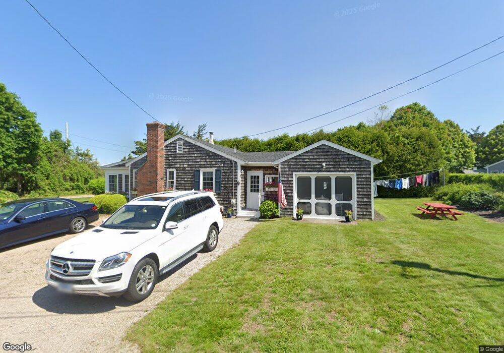
47 Cove Rd Westerly, RI 02891
Estimated Value: $651,920 - $1,894,000
3
Beds
1
Bath
1,227
Sq Ft
$833/Sq Ft
Est. Value
About This Home
This home is located at 47 Cove Rd, Westerly, RI 02891 and is currently estimated at $1,022,480, approximately $833 per square foot. 47 Cove Rd is a home with nearby schools including Westerly High School.
Create a Home Valuation Report for This Property
The Home Valuation Report is an in-depth analysis detailing your home's value as well as a comparison with similar homes in the area
Home Values in the Area
Average Home Value in this Area
Tax History
| Year | Tax Paid | Tax Assessment Tax Assessment Total Assessment is a certain percentage of the fair market value that is determined by local assessors to be the total taxable value of land and additions on the property. | Land | Improvement |
|---|---|---|---|---|
| 2025 | $3,570 | $502,100 | $350,100 | $152,000 |
| 2024 | $3,706 | $377,800 | $250,100 | $127,700 |
| 2023 | $3,634 | $377,800 | $250,100 | $127,700 |
| 2022 | $3,612 | $377,800 | $250,100 | $127,700 |
| 2021 | $3,208 | $278,500 | $184,900 | $93,600 |
| 2020 | $3,150 | $278,500 | $184,900 | $93,600 |
| 2019 | $3,119 | $278,500 | $184,900 | $93,600 |
| 2018 | $3,091 | $260,200 | $184,900 | $75,300 |
| 2017 | $3,016 | $260,200 | $184,900 | $75,300 |
| 2016 | $3,039 | $260,200 | $184,900 | $75,300 |
| 2015 | $3,039 | $280,900 | $188,600 | $92,300 |
| 2014 | $2,989 | $280,900 | $188,600 | $92,300 |
Source: Public Records
Map
Nearby Homes
- 46 Salt Pond Way
- 20 Snowberry Ln
- 30 Clifford Dr
- 22 Breach Dr
- 15 Breach Dr
- 597 Atlantic Ave
- 37 Urso Dr
- 13 Plateau Rd
- 11 Bucks Trail
- 446 Atlantic Ave
- 432 Atlantic Ave
- 43 Noyes Neck Rd
- 7 Fenway Rd
- 19 Wicklow Rd
- 54 Sherwood Dr
- 112 Noyes Neck Rd
- 8 Kettle Close
- 5 Robin Hollow Ln
- 1 Compass Way Unit A103
- 9 Compass Way Unit 201
Your Personal Tour Guide
Ask me questions while you tour the home.