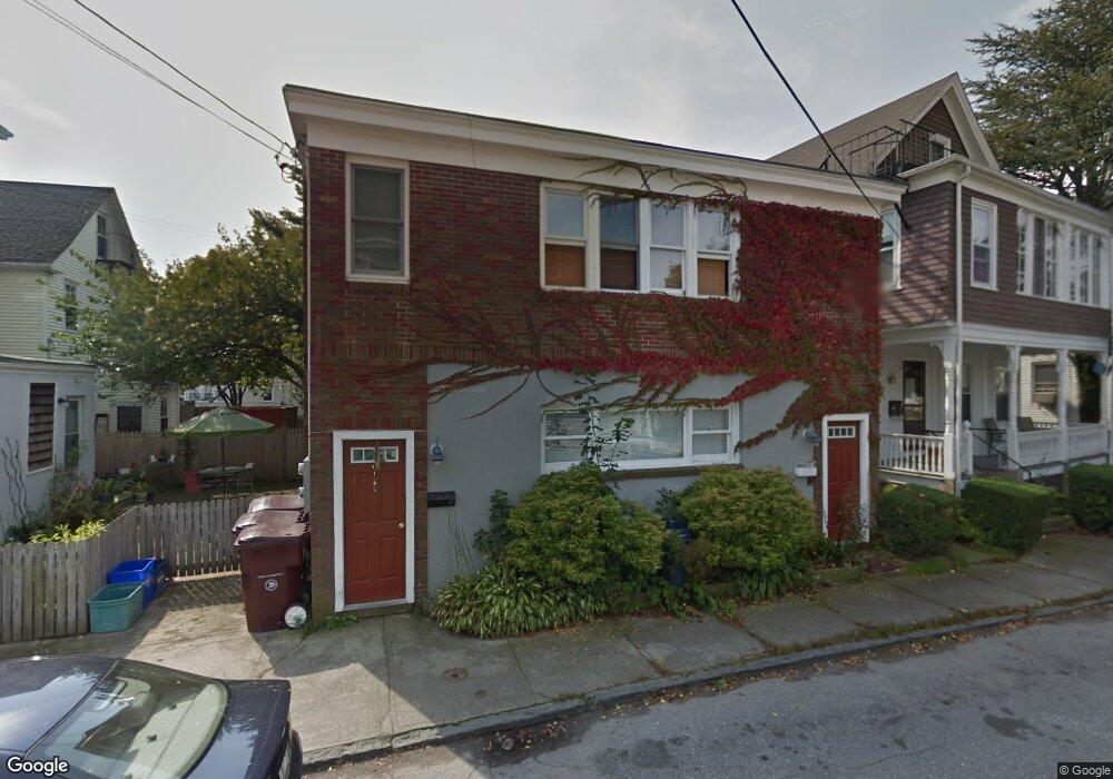
47 E Bowery St Newport, RI 02840
Memorial Boulevard NeighborhoodEstimated Value: $685,451 - $1,128,000
4
Beds
2
Baths
1,704
Sq Ft
$531/Sq Ft
Est. Value
About This Home
This home is located at 47 E Bowery St, Newport, RI 02840 and is currently estimated at $905,613, approximately $531 per square foot. 47 E Bowery St is a home located in Newport County with nearby schools including Rogers High School, St Michael's Country Day School, and St George's School.
Ownership History
Date
Name
Owned For
Owner Type
Purchase Details
Closed on
Jun 18, 1996
Sold by
Maher Stephen T and Manchester Carol
Bought by
Kilroy Gary J and Kilroy Pamela
Current Estimated Value
Home Financials for this Owner
Home Financials are based on the most recent Mortgage that was taken out on this home.
Original Mortgage
$50,000
Outstanding Balance
$3,186
Interest Rate
7.97%
Mortgage Type
Purchase Money Mortgage
Estimated Equity
$902,427
Create a Home Valuation Report for This Property
The Home Valuation Report is an in-depth analysis detailing your home's value as well as a comparison with similar homes in the area
Home Values in the Area
Average Home Value in this Area
Purchase History
| Date | Buyer | Sale Price | Title Company |
|---|---|---|---|
| Kilroy Gary J | $71,500 | -- |
Source: Public Records
Mortgage History
| Date | Status | Borrower | Loan Amount |
|---|---|---|---|
| Open | Kilroy Gary J | $50,000 |
Source: Public Records
Tax History
| Year | Tax Paid | Tax Assessment Tax Assessment Total Assessment is a certain percentage of the fair market value that is determined by local assessors to be the total taxable value of land and additions on the property. | Land | Improvement |
|---|---|---|---|---|
| 2025 | $4,328 | $602,800 | $318,900 | $283,900 |
| 2024 | $4,202 | $602,800 | $318,900 | $283,900 |
| 2023 | $3,883 | $391,400 | $208,500 | $182,900 |
| 2022 | $3,761 | $391,400 | $208,500 | $182,900 |
| 2021 | $3,652 | $391,400 | $208,500 | $182,900 |
| 2020 | $3,783 | $368,000 | $215,300 | $152,700 |
| 2019 | $3,783 | $368,000 | $215,300 | $152,700 |
| 2018 | $3,676 | $368,000 | $215,300 | $152,700 |
| 2017 | $3,353 | $299,100 | $154,100 | $145,000 |
| 2016 | $3,269 | $299,100 | $154,100 | $145,000 |
| 2015 | $3,191 | $299,100 | $154,100 | $145,000 |
| 2014 | $3,166 | $262,500 | $131,000 | $131,500 |
Source: Public Records
Map
Nearby Homes
- 21 Slocum St
- 28 Weaver Ave
- 20 Berkeley Ave Unit 2
- 5 Lowndes St
- 26 Freebody St
- 401 Bellevue Ave Unit 112
- 20 East St Unit 2A
- 71 Pope St
- 2 Perry St
- 7 Red Cross Ave
- 1 Oakwood Terrace Unit 7
- 14 Leroy Ave
- 30 S Baptist St
- 17 Old Beach Rd
- 28 John St Unit 30
- 15 Narragansett Ave Unit 2
- 12 Catherine St Unit 2
- 6 Sharon Ct
- 75 Pelham St Unit B
- 20 Fair St
- 45 E Bowery St
- 45 E Bowery St Unit A
- 41 E Bowery St Unit One
- 41 E Bowery St Unit 3
- 41 E Bowery St
- 43 E Bowery St Unit 45
- 48 E Bowery St
- 48 E Bowery St Unit 1
- 48 E Bowery St Unit 2
- 33 Middleton Ave Unit 3
- 33 Middleton Ave Unit 1
- 33 Middleton Ave Unit 2
- 33 Middleton Ave
- 49 E Bowery St Unit 4
- 49 E Bowery St Unit 2
- 49 E Bowery St Unit 1
- 49 E Bowery St
- 57 Middleton Ave
- 52 E Bowery St
- 41 1/2 E Bowery St
Your Personal Tour Guide
Ask me questions while you tour the home.