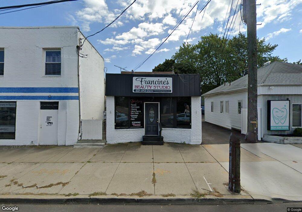
47 E Montauk Hwy Lindenhurst, NY 11757
Estimated Value: $473,870
--
Bed
--
Bath
300
Sq Ft
$1,580/Sq Ft
Est. Value
About This Home
This home is located at 47 E Montauk Hwy, Lindenhurst, NY 11757 and is currently estimated at $473,870, approximately $1,579 per square foot. 47 E Montauk Hwy is a home located in Suffolk County with nearby schools including Harding Avenue Elementary School, Lindenhurst Middle School, and Lindenhurst Senior High School.
Ownership History
Date
Name
Owned For
Owner Type
Purchase Details
Closed on
Apr 13, 2017
Sold by
Bruno John N
Bought by
47 E Montauk Llc
Current Estimated Value
Home Financials for this Owner
Home Financials are based on the most recent Mortgage that was taken out on this home.
Original Mortgage
$150,000
Interest Rate
4.3%
Mortgage Type
Commercial
Purchase Details
Closed on
Jun 18, 2008
Sold by
Baker Laurence
Bought by
Bruno John N
Home Financials for this Owner
Home Financials are based on the most recent Mortgage that was taken out on this home.
Original Mortgage
$137,500
Interest Rate
6.01%
Mortgage Type
Commercial
Purchase Details
Closed on
Sep 28, 2000
Sold by
Imperiale John and Imperiale Elaine P H
Bought by
Baker Laurence and Baker Eileen
Create a Home Valuation Report for This Property
The Home Valuation Report is an in-depth analysis detailing your home's value as well as a comparison with similar homes in the area
Home Values in the Area
Average Home Value in this Area
Purchase History
| Date | Buyer | Sale Price | Title Company |
|---|---|---|---|
| 47 E Montauk Llc | $10,000 | None Available | |
| 47 E Montauk Llc | $10,000 | None Available | |
| Bruno John N | $275,000 | Mark R Garabrant | |
| Bruno John N | $275,000 | Mark R Garabrant | |
| Baker Laurence | $83,000 | Chicago Title Insurance Co | |
| Baker Laurence | $83,000 | Chicago Title Insurance Co |
Source: Public Records
Mortgage History
| Date | Status | Borrower | Loan Amount |
|---|---|---|---|
| Previous Owner | 47 E Montauk Llc | $150,000 | |
| Previous Owner | Bruno John N | $137,500 |
Source: Public Records
Tax History Compared to Growth
Tax History
| Year | Tax Paid | Tax Assessment Tax Assessment Total Assessment is a certain percentage of the fair market value that is determined by local assessors to be the total taxable value of land and additions on the property. | Land | Improvement |
|---|---|---|---|---|
| 2024 | $9,745 | $2,130 | $510 | $1,620 |
| 2023 | $9,110 | $2,130 | $510 | $1,620 |
| 2022 | $6,314 | $2,130 | $510 | $1,620 |
| 2021 | $6,314 | $2,130 | $510 | $1,620 |
| 2020 | $6,522 | $2,130 | $510 | $1,620 |
| 2019 | $7,069 | $0 | $0 | $0 |
| 2018 | -- | $2,130 | $510 | $1,620 |
| 2017 | $6,380 | $2,130 | $510 | $1,620 |
| 2016 | $6,290 | $2,130 | $510 | $1,620 |
| 2015 | -- | $2,130 | $510 | $1,620 |
| 2014 | -- | $2,130 | $510 | $1,620 |
Source: Public Records
Map
Nearby Homes
- 624 Adams Ave
- 634 Adams Ave
- 651 Madison Ave
- 635 S Wellwood Ave
- 502 S Wellwood Ave
- 666 S Wellwood Ave
- 30 Rose Ct
- 696 Madison Ave
- 15 Palm St
- 38 Palm St
- 472 S 3rd St
- 630 Shore Rd
- 248 E Shore Rd
- 768 S Hickory St
- 3 Garfield Place
- 733 Shore Walk
- 769 S Hickory St
- 705 Narragansett Villas Dr
- 513 Narragansett Villas Dr Unit 513
- 738 Shore Walk
- 47 Montauk Hwy
- 51 E Montauk Hwy
- 39 E Montauk Hwy
- 611 Madison Ave
- 612 Adams Ave
- 613 Madison Ave
- 619 Madison Ave
- 610 Madison Ave
- 609 Adams Ave
- 614 Madison Ave
- 616 Madison Ave
- 625 Madison Ave
- 598 Washington Ave Unit 21
- 598 Washington Ave Unit 12
- 598 Washington Ave Unit 7
- 598 Washington Ave
- 621 Adams Ave
- 630 Adams Ave
- 20 Dominick Ct
- 24 Montauk Hwy