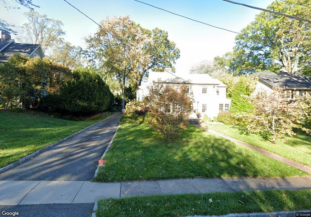
47 Euclid Ave Maplewood, NJ 07040
Estimated Value: $1,443,000 - $1,638,000
--
Bed
--
Bath
3,269
Sq Ft
$473/Sq Ft
Est. Value
About This Home
This home is located at 47 Euclid Ave, Maplewood, NJ 07040 and is currently estimated at $1,545,188, approximately $472 per square foot. 47 Euclid Ave is a home located in Essex County with nearby schools including Delia Bolden Elementary School, Maplewood Middle School, and Columbia Senior High School.
Ownership History
Date
Name
Owned For
Owner Type
Purchase Details
Closed on
Sep 26, 2005
Sold by
Ciarrocca Henrietta
Bought by
Butkas Sean and Butkas Elaine
Current Estimated Value
Home Financials for this Owner
Home Financials are based on the most recent Mortgage that was taken out on this home.
Original Mortgage
$425,000
Outstanding Balance
$228,625
Interest Rate
5.84%
Mortgage Type
New Conventional
Estimated Equity
$1,316,563
Create a Home Valuation Report for This Property
The Home Valuation Report is an in-depth analysis detailing your home's value as well as a comparison with similar homes in the area
Home Values in the Area
Average Home Value in this Area
Purchase History
| Date | Buyer | Sale Price | Title Company |
|---|---|---|---|
| Butkas Sean | $805,000 | -- |
Source: Public Records
Mortgage History
| Date | Status | Borrower | Loan Amount |
|---|---|---|---|
| Open | Butkas Sean | $425,000 |
Source: Public Records
Tax History Compared to Growth
Tax History
| Year | Tax Paid | Tax Assessment Tax Assessment Total Assessment is a certain percentage of the fair market value that is determined by local assessors to be the total taxable value of land and additions on the property. | Land | Improvement |
|---|---|---|---|---|
| 2025 | $36,232 | $1,326,000 | $621,700 | $704,300 |
| 2024 | $36,232 | $1,326,000 | $621,700 | $704,300 |
| 2022 | $35,331 | $1,002,000 | $438,300 | $563,700 |
| 2021 | $34,258 | $1,002,000 | $438,300 | $563,700 |
| 2020 | $33,286 | $1,002,000 | $438,300 | $563,700 |
| 2019 | $32,325 | $1,002,000 | $438,300 | $563,700 |
| 2018 | $31,493 | $1,002,000 | $438,300 | $563,700 |
| 2017 | $30,551 | $1,002,000 | $438,300 | $563,700 |
| 2016 | $27,619 | $749,500 | $408,300 | $341,200 |
| 2015 | $26,982 | $749,500 | $408,300 | $341,200 |
| 2014 | $26,412 | $749,500 | $408,300 | $341,200 |
Source: Public Records
Map
Nearby Homes
- 66 Claremont Ave
- 95 Collinwood Rd S
- 76 Durand Rd
- 13 Collinwood Rd Unit 15
- 168 Wyoming Ave
- 73 Jefferson Ave
- 24 St Lawrence Ave
- 24 Saint Lawrence Ave
- 616 S Orange Ave Unit 5J
- 432 Walton Rd
- 609 So Orange Ave West5q Unit 5Q
- 8 Kendal Ave
- 609 W South Orange Ave
- 311 Lenox Ave
- 2 Maplewood Ave
- 630 Ridgewood Rd
- 376 Wyoming Ave
- 616 S Orange Ave Sh4 Unit SH4
- 23 Kensington Terrace
- 658 Ridgewood Rd Unit 2
- 45 Euclid Ave
- 51 Euclid Ave
- 39 Euclid Ave
- 55 Euclid Ave
- 46 Claremont Ave
- 48 Claremont Ave
- 42 Claremont Ave
- 54 Claremont Ave
- 48 Euclid Ave
- 50 Euclid Ave
- 57 Euclid Ave
- 37 Euclid Ave
- 54 Euclid Ave
- 46 Euclid Ave
- 40 Claremont Ave
- 220 Wyoming Ave
- 58 Euclid Ave Unit 60
- 42 Euclid Ave
- 49 Claremont Dr
- 35 Euclid Ave