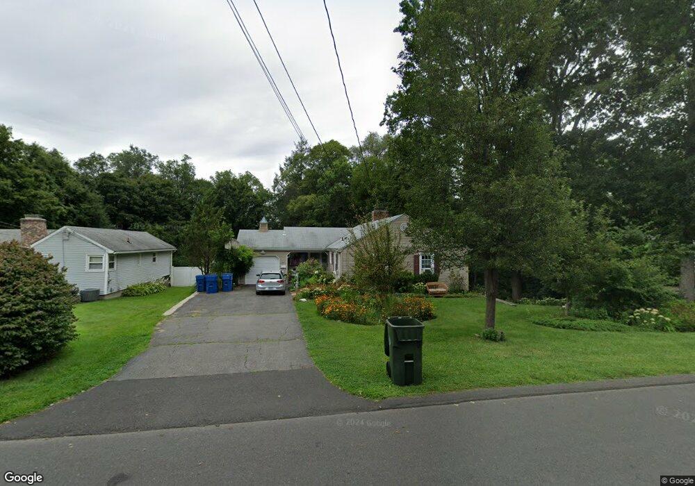
47 Fernstead Ln Berlin, CT 06037
Estimated Value: $348,000 - $439,000
4
Beds
2
Baths
1,421
Sq Ft
$275/Sq Ft
Est. Value
About This Home
This home is located at 47 Fernstead Ln, Berlin, CT 06037 and is currently estimated at $390,149, approximately $274 per square foot. 47 Fernstead Ln is a home located in Hartford County with nearby schools including Richard D. Hubbard School, Catherine M. Mcgee Middle School, and Berlin High School.
Ownership History
Date
Name
Owned For
Owner Type
Purchase Details
Closed on
May 1, 2000
Sold by
Telke Emma
Bought by
Telke Bruce C
Current Estimated Value
Home Financials for this Owner
Home Financials are based on the most recent Mortgage that was taken out on this home.
Original Mortgage
$100,000
Interest Rate
7.08%
Create a Home Valuation Report for This Property
The Home Valuation Report is an in-depth analysis detailing your home's value as well as a comparison with similar homes in the area
Home Values in the Area
Average Home Value in this Area
Purchase History
| Date | Buyer | Sale Price | Title Company |
|---|---|---|---|
| Telke Bruce C | $125,000 | -- | |
| Telke Bruce C | $125,000 | -- |
Source: Public Records
Mortgage History
| Date | Status | Borrower | Loan Amount |
|---|---|---|---|
| Open | Telke Bruce C | $144,000 | |
| Closed | Telke Bruce C | $113,000 | |
| Closed | Telke Bruce C | $100,000 | |
| Closed | Telke Bruce C | $100,000 |
Source: Public Records
Tax History
| Year | Tax Paid | Tax Assessment Tax Assessment Total Assessment is a certain percentage of the fair market value that is determined by local assessors to be the total taxable value of land and additions on the property. | Land | Improvement |
|---|---|---|---|---|
| 2025 | $5,974 | $194,900 | $98,900 | $96,000 |
| 2024 | $5,888 | $194,900 | $98,900 | $96,000 |
| 2023 | $5,761 | $194,900 | $98,900 | $96,000 |
| 2022 | $5,232 | $152,500 | $78,400 | $74,100 |
| 2021 | $5,174 | $152,500 | $78,400 | $74,100 |
| 2020 | $5,174 | $152,500 | $78,400 | $74,100 |
| 2019 | $5,174 | $152,500 | $78,400 | $74,100 |
| 2018 | $4,956 | $152,500 | $78,400 | $74,100 |
| 2017 | $4,685 | $148,200 | $77,700 | $70,500 |
| 2016 | $4,631 | $150,300 | $77,700 | $72,600 |
| 2015 | $4,562 | $150,300 | $77,700 | $72,600 |
| 2014 | $4,347 | $150,300 | $77,700 | $72,600 |
Source: Public Records
Map
Nearby Homes
- 1152 Worthington Ridge
- 1175 Worthington Ridge
- 825 Worthington Ridge
- 68 Tree Hill Rd
- 44 Briar Patch Dr
- 51 Towne Dr
- 5 Burnham St
- 70 Lawndale St
- 10 Main St Unit 107
- 0 Middle St
- 28 Glendale Ave
- 33 Langdon Ct Unit D104
- 953 High Rd
- 963 High Rd
- 975 High Rd
- 1240 High Rd
- 303 New Britain Rd
- 0 Country Ct Unit 137 24077628
- 0 Country Ct Unit 134 24089873
- 95 S Ridge Ln Unit CG2
- 41 Fernstead Ln
- 63 Fernstead Ln
- 33 Fernstead Ln
- 27 Fernstead Ln
- 56 Earl St
- 66 Earl St
- 84 Westview Terrace
- 78 Westview Terrace
- 46 Earl St
- 50 Fernstead Ln
- 36 Earl St
- 70 Westview Terrace
- 58 Fernstead Ln
- 42 Fernstead Ln
- 26 Earl St
- 76 Earl St
- 21 Fernstead Ln
- 96 Westview Terrace
- 30 Fernstead Ln
- 60 Westview Terrace
Your Personal Tour Guide
Ask me questions while you tour the home.