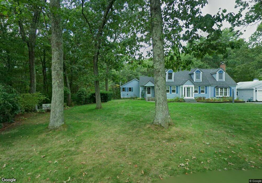
47 Forest St Dunstable, MA 01827
Estimated Value: $710,000 - $931,000
5
Beds
4
Baths
3,775
Sq Ft
$220/Sq Ft
Est. Value
About This Home
This home is located at 47 Forest St, Dunstable, MA 01827 and is currently estimated at $830,062, approximately $219 per square foot. 47 Forest St is a home located in Middlesex County with nearby schools including Groton Dunstable Regional High School, World Academy, and Academy of Notre Dame - Upper School.
Ownership History
Date
Name
Owned For
Owner Type
Purchase Details
Closed on
Mar 13, 2020
Sold by
Belley Maureen A and Belley David B
Bought by
Belley 2020 T
Current Estimated Value
Purchase Details
Closed on
Jun 28, 2011
Sold by
Bellerose Marc G and Bellerose Hyacinth M
Bought by
Belley David B and Belley Maureen A
Create a Home Valuation Report for This Property
The Home Valuation Report is an in-depth analysis detailing your home's value as well as a comparison with similar homes in the area
Home Values in the Area
Average Home Value in this Area
Purchase History
| Date | Buyer | Sale Price | Title Company |
|---|---|---|---|
| Belley 2020 T | -- | None Available | |
| Belley David B | -- | -- |
Source: Public Records
Tax History
| Year | Tax Paid | Tax Assessment Tax Assessment Total Assessment is a certain percentage of the fair market value that is determined by local assessors to be the total taxable value of land and additions on the property. | Land | Improvement |
|---|---|---|---|---|
| 2025 | $9,280 | $674,900 | $221,000 | $453,900 |
| 2024 | $8,951 | $641,200 | $202,700 | $438,500 |
| 2023 | $8,617 | $575,600 | $202,700 | $372,900 |
| 2022 | $8,022 | $526,000 | $202,700 | $323,300 |
| 2021 | $7,563 | $460,900 | $185,400 | $275,500 |
| 2020 | $7,586 | $450,500 | $185,400 | $265,100 |
| 2019 | $7,465 | $437,600 | $185,400 | $252,200 |
| 2018 | $7,116 | $405,700 | $184,400 | $221,300 |
| 2017 | $6,817 | $400,500 | $184,400 | $216,100 |
| 2016 | $6,258 | $378,100 | $176,200 | $201,900 |
| 2015 | $6,073 | $363,000 | $148,500 | $214,500 |
| 2014 | $5,635 | $357,300 | $148,500 | $208,800 |
Source: Public Records
Map
Nearby Homes
- 4 Thorndike St
- 0 Lowell St
- 6 Green Heron Ln Unit U22
- 4 Strawberry Bank Rd Unit 12
- 38 Georgetown Dr
- 2 Strawberry Bank Rd Unit 17
- 11 Lojko Dr
- 4 Heritage Village Dr
- 20 Georgetown Dr
- 62 Brook St
- 58 Wilderness Dr
- 319 Pleasant St
- 8 Wilderness Dr
- 1 Doucet Ave
- 65 Wilderness Dr
- 210 Brook Village Rd Unit U43
- 210 Brook Village Rd Unit U38
- 1 Wilderness Dr
- 4 Wilderness Dr
- 2 Wilderness Dr
Your Personal Tour Guide
Ask me questions while you tour the home.