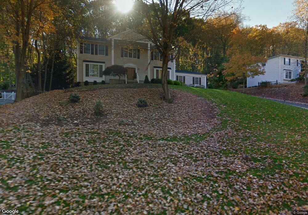
47 Forrest Rd Randolph, NJ 07869
Estimated Value: $870,000 - $906,000
4
Beds
3
Baths
2,713
Sq Ft
$329/Sq Ft
Est. Value
About This Home
This home is located at 47 Forrest Rd, Randolph, NJ 07869 and is currently estimated at $891,514, approximately $328 per square foot. 47 Forrest Rd is a home located in Morris County with nearby schools including Randolph High School, Randolph Middle School, and The Red Oaks School.
Ownership History
Date
Name
Owned For
Owner Type
Purchase Details
Closed on
Apr 15, 2024
Sold by
Caldari Julius and Caldari Patricia
Bought by
Caldari Family Irrevocable Trust and Stroh
Current Estimated Value
Purchase Details
Closed on
Mar 9, 2018
Sold by
Bowkley Charles W and Bowkley Nancy
Bought by
Caldari Julius and Caldari Patricia
Purchase Details
Closed on
Feb 26, 1998
Sold by
Bowkley Charles W and Bowkley Mary E
Bought by
Bowkley Charles W
Create a Home Valuation Report for This Property
The Home Valuation Report is an in-depth analysis detailing your home's value as well as a comparison with similar homes in the area
Home Values in the Area
Average Home Value in this Area
Purchase History
| Date | Buyer | Sale Price | Title Company |
|---|---|---|---|
| Caldari Family Irrevocable Trust | -- | None Listed On Document | |
| Caldari Family Irrevocable Trust | -- | None Listed On Document | |
| Caldari Julius | $545,000 | None Available | |
| Bowkley Charles W | -- | -- |
Source: Public Records
Tax History Compared to Growth
Tax History
| Year | Tax Paid | Tax Assessment Tax Assessment Total Assessment is a certain percentage of the fair market value that is determined by local assessors to be the total taxable value of land and additions on the property. | Land | Improvement |
|---|---|---|---|---|
| 2025 | $14,778 | $522,000 | $221,300 | $300,700 |
| 2024 | $14,407 | $522,000 | $221,300 | $300,700 |
| 2023 | $14,407 | $522,000 | $221,300 | $300,700 |
| 2022 | $13,843 | $522,000 | $221,300 | $300,700 |
| 2021 | $13,843 | $522,000 | $221,300 | $300,700 |
| 2020 | $13,703 | $522,000 | $221,300 | $300,700 |
| 2019 | $13,507 | $520,500 | $221,300 | $299,200 |
| 2018 | $13,335 | $520,500 | $221,300 | $299,200 |
| 2017 | $13,169 | $520,500 | $221,300 | $299,200 |
| 2016 | $12,803 | $349,800 | $152,100 | $197,700 |
| 2015 | $12,649 | $349,800 | $152,100 | $197,700 |
| 2014 | $12,453 | $349,800 | $152,100 | $197,700 |
Source: Public Records
Map
Nearby Homes
- 3 Springhill Rd
- 13 Holly Dr
- 6 Quarry Ct
- 7 Holly Dr
- 10 Campo Rd
- 20 Longhill Rd
- 267 Washington Valley Rd
- 6 Alpine Dr
- 114 Shady Ln
- 119 Woodmont Dr Unit 59
- 5 Kensington Ct
- 36 Ridgewood Dr Unit 154
- 25 N Star Dr
- 15 Raynor Rd
- 5 Albert Ct
- 3 Woodmont Dr
- 160 W Hanover Ave
- 56 Albert Ct
- 6 Raleigh Ct
- 2 Bickford Dr
- 45 Forrest Rd
- 49 Forrest Rd
- 40 Springhill Rd
- 9 Echo Ridge Rd
- 38 Springhill Rd
- 43 Forrest Rd
- 42 Springhill Rd
- 51 Forrest Rd
- 44 Springhill Rd
- 56 Forrest Rd
- 8 Echo Ridge Rd
- 7 Echo Ridge Rd
- 36 Springhill Rd
- 41 Forrest Rd
- 31 Springhill Rd
- 7 Tanglewood Ct
- 52 Forrest Rd
- 33 Springhill Rd
- 46 Springhill Rd
- 5 Echo Ridge Rd