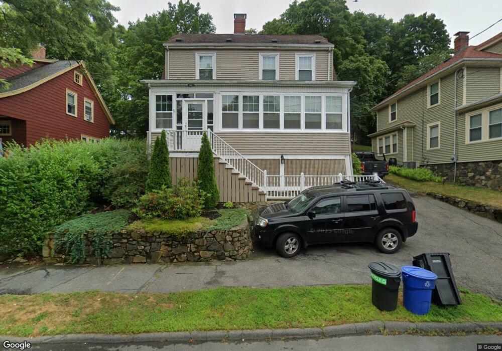
47 Franklin Ave Swampscott, MA 01907
Estimated Value: $714,000 - $895,000
4
Beds
2
Baths
1,825
Sq Ft
$451/Sq Ft
Est. Value
About This Home
This home is located at 47 Franklin Ave, Swampscott, MA 01907 and is currently estimated at $822,488, approximately $450 per square foot. 47 Franklin Ave is a home located in Essex County with nearby schools including Swampscott Middle School and Swampscott High School.
Ownership History
Date
Name
Owned For
Owner Type
Purchase Details
Closed on
Sep 17, 2002
Sold by
Moyles Linda M and Styrman Linda M
Bought by
Santerre Jeanne M
Current Estimated Value
Home Financials for this Owner
Home Financials are based on the most recent Mortgage that was taken out on this home.
Original Mortgage
$250,000
Interest Rate
6.48%
Mortgage Type
Purchase Money Mortgage
Purchase Details
Closed on
Sep 15, 1992
Sold by
Carter Barbara D and Shea Barbara
Bought by
Styrman Linda M
Create a Home Valuation Report for This Property
The Home Valuation Report is an in-depth analysis detailing your home's value as well as a comparison with similar homes in the area
Home Values in the Area
Average Home Value in this Area
Purchase History
| Date | Buyer | Sale Price | Title Company |
|---|---|---|---|
| Santerre Jeanne M | $370,000 | -- | |
| Santerre Jeanne M | $370,000 | -- | |
| Styrman Linda M | $142,000 | -- | |
| Styrman Linda M | $142,000 | -- |
Source: Public Records
Mortgage History
| Date | Status | Borrower | Loan Amount |
|---|---|---|---|
| Open | Styrman Linda M | $20,000 | |
| Open | Styrman Linda M | $270,000 | |
| Closed | Styrman Linda M | $250,000 |
Source: Public Records
Tax History
| Year | Tax Paid | Tax Assessment Tax Assessment Total Assessment is a certain percentage of the fair market value that is determined by local assessors to be the total taxable value of land and additions on the property. | Land | Improvement |
|---|---|---|---|---|
| 2025 | $7,856 | $684,900 | $287,500 | $397,400 |
| 2024 | $7,675 | $668,000 | $275,200 | $392,800 |
| 2023 | $7,463 | $635,700 | $262,900 | $372,800 |
| 2022 | $7,452 | $580,800 | $230,000 | $350,800 |
| 2021 | $7,358 | $533,200 | $213,600 | $319,600 |
| 2020 | $6,469 | $452,400 | $184,800 | $267,600 |
| 2019 | $6,191 | $407,300 | $139,700 | $267,600 |
| 2018 | $6,218 | $388,600 | $131,400 | $257,200 |
| 2017 | $6,348 | $363,800 | $123,200 | $240,600 |
| 2016 | $6,124 | $353,400 | $123,200 | $230,200 |
| 2015 | $5,920 | $345,200 | $115,000 | $230,200 |
| 2014 | $5,343 | $285,700 | $86,300 | $199,400 |
Source: Public Records
Map
Nearby Homes
- 64 Stetson Ave
- 46 Stetson Ave
- 106 Norfolk Ave
- 80 Norfolk Ave Unit 1
- 169 Walker Rd Unit 2
- 167-169 Walker Rd
- 8 Summit View Dr
- 48 Mountwood Rd
- 50 Mountwood Rd
- 4 Valley Rd Unit 4
- 143 Burrill St Unit 301
- 3 Didio Dr
- 146 Burrill St
- 96 Burpee Rd Unit 1
- 133 Elmwood Rd Unit 2
- 11 Boynton St Unit 104
- 11 Boynton St Unit 101
- 11 Boynton St Unit 103
- 11 Boynton St Unit 201
- 100 Burrill St Unit 6
- 43 Franklin Ave
- 51 Franklin Ave
- 37 Franklin Ave
- 55 Franklin Ave
- 48 Franklin Ave
- 50 Franklin Ave
- 35 Franklin Ave
- 59 Franklin Ave
- 36 Franklin Ave
- 46 Franklin Ave
- 56 Franklin Ave
- 63 Suffolk Ave
- 59 Suffolk Ave
- 63 Franklin Ave
- 60 Franklin Ave Unit 62
- 60-62 Franklin Ave
- 34 Franklin Ave
- 64 Franklin Ave
- 29 Franklin Ave
- 67 Franklin Ave
Your Personal Tour Guide
Ask me questions while you tour the home.