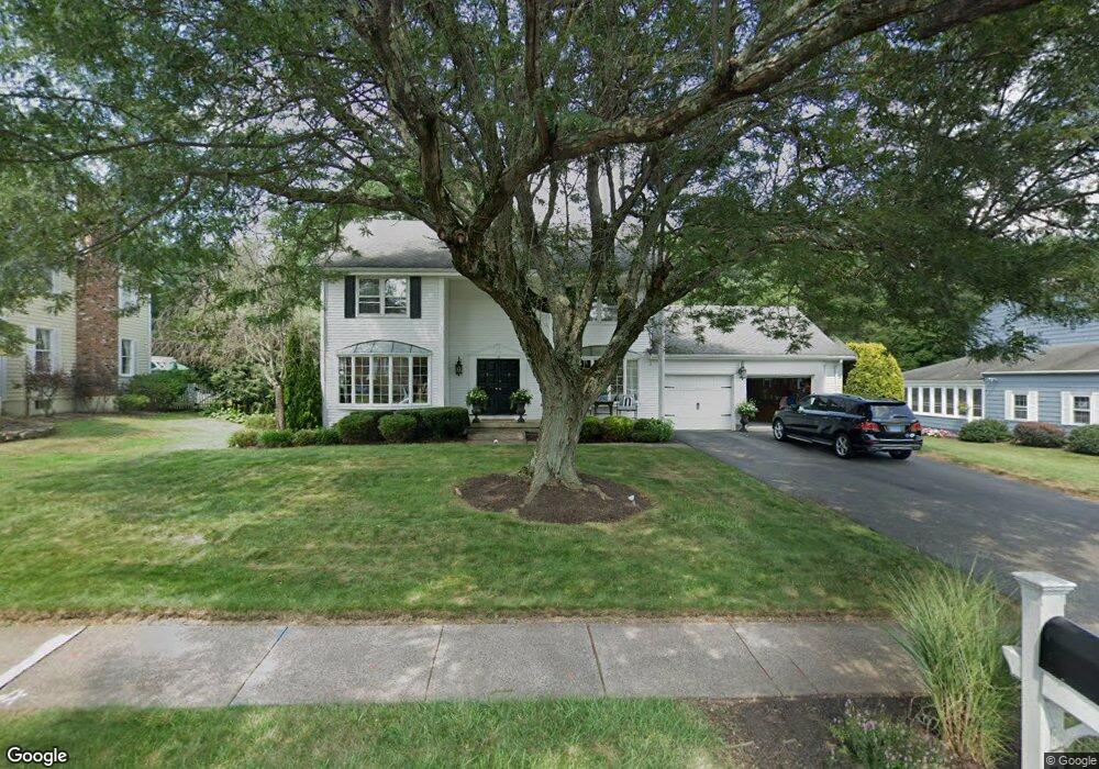
47 Goff Brook Cir Wethersfield, CT 06109
Estimated Value: $534,435 - $550,000
4
Beds
3
Baths
2,096
Sq Ft
$259/Sq Ft
Est. Value
About This Home
This home is located at 47 Goff Brook Cir, Wethersfield, CT 06109 and is currently estimated at $541,859, approximately $258 per square foot. 47 Goff Brook Cir is a home located in Hartford County with nearby schools including Highcrest School, Silas Deane Middle School, and Wethersfield High School.
Ownership History
Date
Name
Owned For
Owner Type
Purchase Details
Closed on
Nov 2, 2000
Sold by
Stone Eric D and Daprilestone Cherylann
Bought by
Emmanuel Michael N and Emmanuel Anne H
Current Estimated Value
Purchase Details
Closed on
Jul 27, 1998
Sold by
Wallace Frances C Est
Bought by
Stone Eric D and Dapilo-Stone Cherylann
Create a Home Valuation Report for This Property
The Home Valuation Report is an in-depth analysis detailing your home's value as well as a comparison with similar homes in the area
Home Values in the Area
Average Home Value in this Area
Purchase History
| Date | Buyer | Sale Price | Title Company |
|---|---|---|---|
| Emmanuel Michael N | $282,000 | -- | |
| Stone Eric D | $215,000 | -- |
Source: Public Records
Mortgage History
| Date | Status | Borrower | Loan Amount |
|---|---|---|---|
| Open | Stone Eric D | $35,000 | |
| Open | Stone Eric D | $284,800 | |
| Closed | Stone Eric D | $71,200 | |
| Closed | Stone Eric D | $275,200 |
Source: Public Records
Tax History
| Year | Tax Paid | Tax Assessment Tax Assessment Total Assessment is a certain percentage of the fair market value that is determined by local assessors to be the total taxable value of land and additions on the property. | Land | Improvement |
|---|---|---|---|---|
| 2025 | $14,028 | $340,330 | $115,010 | $225,320 |
| 2024 | $9,842 | $227,730 | $89,600 | $138,130 |
| 2023 | $9,515 | $227,730 | $89,600 | $138,130 |
| 2022 | $9,355 | $227,730 | $89,600 | $138,130 |
| 2021 | $9,262 | $227,730 | $89,600 | $138,130 |
| 2020 | $9,266 | $227,730 | $89,600 | $138,130 |
| 2019 | $9,278 | $227,730 | $89,600 | $138,130 |
| 2018 | $8,776 | $215,200 | $88,800 | $126,400 |
| 2017 | $8,559 | $215,200 | $88,800 | $126,400 |
| 2016 | $8,294 | $215,200 | $88,800 | $126,400 |
| 2015 | $8,218 | $215,200 | $88,800 | $126,400 |
| 2014 | $7,906 | $215,200 | $88,800 | $126,400 |
Source: Public Records
Map
Nearby Homes
- 155 Old Common Rd
- 268 Fox Hill Rd
- 25 Heather Hill
- 5 Robeth Ln
- 5 Westmont Rd
- 101 Collier Rd
- 0 Collier Rd
- 6 Vinnie Dr
- 18 Stone Hill Dr
- 8 Stella Dr
- 61 Luca Ln
- 76 Luca Lane Homesite 8
- 138 Cypress Rd Unit 138
- 312 Carlton Ln Unit 312
- 229 Cottonwood Rd Unit 229
- 9 Dogwood Ct
- 378 Cypress Rd
- 803 Holly Hill Dr Unit 803
- 15 Woodsedge Dr Unit 5C
- 35 Woodsedge Dr Unit 4C
- 39 Goff Brook Cir
- 53 Goff Brook Cir
- 31 Goff Brook Cir
- 46 Goff Brook Cir
- 56 Goff Brook Cir
- 38 Goff Brook Cir
- 19 Goff Brook Cir
- 22 Quail Hill Rd
- 69 Goff Brook Cir
- 26 Quail Hill Rd
- 62 Goff Brook Cir
- 30 Goff Brook Cir
- 30 Quail Hill Rd
- 361 Hang Dog Ln
- 11 Goff Brook Cir
- 353 Hang Dog Ln
- 22 Goff Brook Cir
- 14 Quail Hill Rd
- 77 Goff Brook Cir
- 371 Hang Dog Ln
Your Personal Tour Guide
Ask me questions while you tour the home.