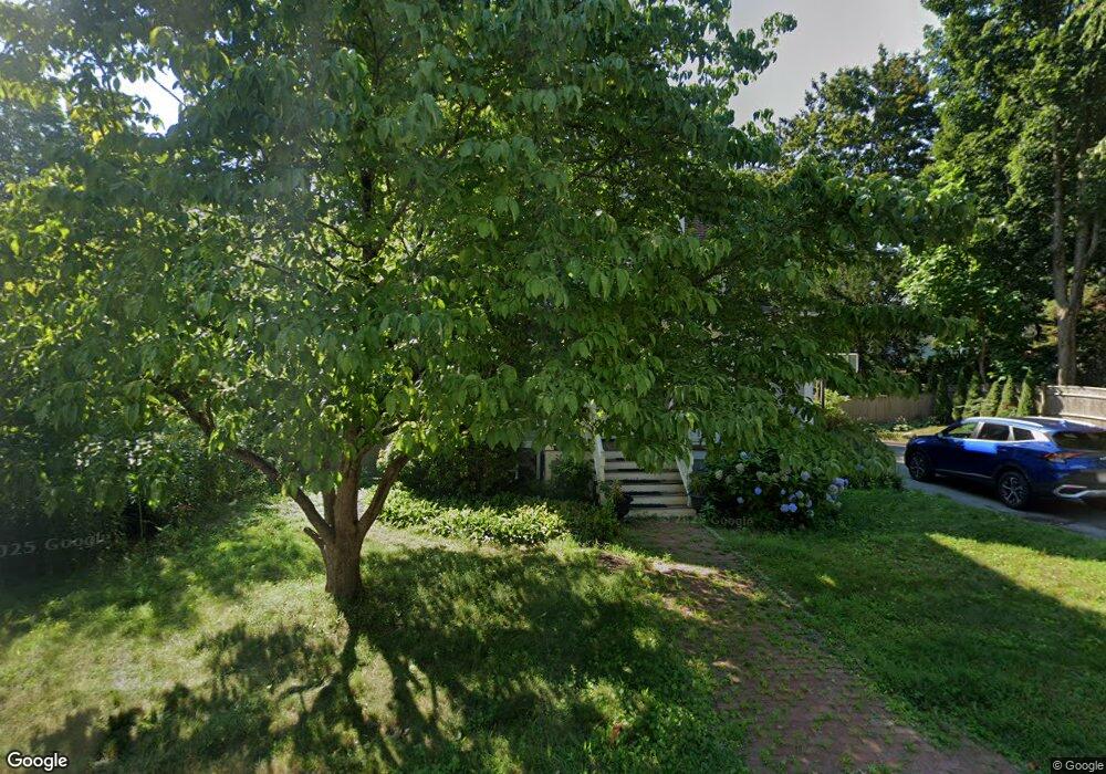
47 Grant St Lexington, MA 02420
Munroe Hill NeighborhoodEstimated Value: $1,568,571 - $1,801,000
3
Beds
3
Baths
2,096
Sq Ft
$789/Sq Ft
Est. Value
About This Home
This home is located at 47 Grant St, Lexington, MA 02420 and is currently estimated at $1,653,893, approximately $789 per square foot. 47 Grant St is a home located in Middlesex County with nearby schools including Fiske Elementary School, William Diamond Middle School, and Lexington High School.
Ownership History
Date
Name
Owned For
Owner Type
Purchase Details
Closed on
Apr 12, 2012
Sold by
Cassano Paolo and Rocha-Ruiz Teresa
Bought by
Teresa Rocha-Ruiz Ret
Current Estimated Value
Purchase Details
Closed on
Jun 24, 2011
Sold by
Kelley Jean C and Schneider Michael R
Bought by
Cassano Paolo and Rocha-Ruiz Teresa
Home Financials for this Owner
Home Financials are based on the most recent Mortgage that was taken out on this home.
Original Mortgage
$523,750
Interest Rate
4.63%
Mortgage Type
Purchase Money Mortgage
Purchase Details
Closed on
Mar 15, 2002
Sold by
Crowe Ira W and Crowe Joanne
Bought by
Schneider Michael R and Kelley Jean C
Purchase Details
Closed on
Jan 5, 1989
Sold by
Kean Victor A
Bought by
Crowe Ira W
Create a Home Valuation Report for This Property
The Home Valuation Report is an in-depth analysis detailing your home's value as well as a comparison with similar homes in the area
Home Values in the Area
Average Home Value in this Area
Purchase History
| Date | Buyer | Sale Price | Title Company |
|---|---|---|---|
| Teresa Rocha-Ruiz Ret | -- | -- | |
| Cassano Paolo | $795,000 | -- | |
| Schneider Michael R | $672,000 | -- | |
| Crowe Ira W | $250,000 | -- |
Source: Public Records
Mortgage History
| Date | Status | Borrower | Loan Amount |
|---|---|---|---|
| Previous Owner | Crowe Ira W | $465,750 | |
| Previous Owner | Crowe Ira W | $57,000 | |
| Previous Owner | Cassano Paolo | $523,750 | |
| Previous Owner | Crowe Ira W | $150,000 |
Source: Public Records
Tax History Compared to Growth
Tax History
| Year | Tax Paid | Tax Assessment Tax Assessment Total Assessment is a certain percentage of the fair market value that is determined by local assessors to be the total taxable value of land and additions on the property. | Land | Improvement |
|---|---|---|---|---|
| 2025 | $15,642 | $1,279,000 | $614,000 | $665,000 |
| 2024 | $15,839 | $1,293,000 | $584,000 | $709,000 |
| 2023 | $15,535 | $1,195,000 | $531,000 | $664,000 |
| 2022 | $14,890 | $1,079,000 | $483,000 | $596,000 |
| 2021 | $14,764 | $1,026,000 | $460,000 | $566,000 |
| 2020 | $14,191 | $1,010,000 | $460,000 | $550,000 |
| 2019 | $13,640 | $966,000 | $438,000 | $528,000 |
| 2018 | $13,199 | $923,000 | $417,000 | $506,000 |
| 2017 | $13,012 | $898,000 | $385,000 | $513,000 |
| 2016 | $12,454 | $853,000 | $366,000 | $487,000 |
| 2015 | $11,412 | $768,000 | $333,000 | $435,000 |
| 2014 | $11,307 | $729,000 | $296,000 | $433,000 |
Source: Public Records
Map
Nearby Homes
- 49 Fletcher Ave
- 30 Meriam St Unit 30
- 71 Woburn St
- 1894 Massachusetts Ave
- 1900 Massachusetts Ave
- 45 Hancock St
- 32 Forest St
- 42 Winthrop Rd
- 14 Utica St
- 14 Percy Rd
- 2 Percy Rd
- 48 Sherburne Rd
- 12 Coolidge Ave
- 93 Bedford St Unit 210
- 93 Bedford St Unit 308
- 93 Bedford St Unit 101
- 10 Eliot Rd
- 36 Adams St
- 1 Beech Tree Ln
- 7 Lothrop Cir