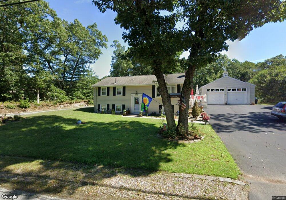
47 Hawes St Wrentham, MA 02093
Estimated Value: $488,000 - $613,000
2
Beds
2
Baths
960
Sq Ft
$563/Sq Ft
Est. Value
About This Home
This home is located at 47 Hawes St, Wrentham, MA 02093 and is currently estimated at $540,539, approximately $563 per square foot. 47 Hawes St is a home located in Norfolk County with nearby schools including Delaney Elementary School, Charles E Roderick, and The Sage School.
Ownership History
Date
Name
Owned For
Owner Type
Purchase Details
Closed on
Nov 29, 2021
Sold by
Welling Ro J and Welling Charles
Bought by
Welling Ft and Welling
Current Estimated Value
Purchase Details
Closed on
Oct 14, 2004
Sold by
Welling Charles and Welling Ro J
Bought by
Welling Ro J
Purchase Details
Closed on
Jul 9, 1986
Bought by
Welling Ro J
Create a Home Valuation Report for This Property
The Home Valuation Report is an in-depth analysis detailing your home's value as well as a comparison with similar homes in the area
Home Values in the Area
Average Home Value in this Area
Purchase History
| Date | Buyer | Sale Price | Title Company |
|---|---|---|---|
| Welling Ft | -- | None Available | |
| Welling Ft | -- | None Available | |
| Welling Ro J | -- | -- | |
| Welling Charles | -- | -- | |
| Welling Ro J | $15,000 | -- | |
| Welling Charles | -- | -- |
Source: Public Records
Mortgage History
| Date | Status | Borrower | Loan Amount |
|---|---|---|---|
| Previous Owner | Welling Ro J | $70,000 | |
| Previous Owner | Welling Ro J | $620,000 |
Source: Public Records
Tax History Compared to Growth
Tax History
| Year | Tax Paid | Tax Assessment Tax Assessment Total Assessment is a certain percentage of the fair market value that is determined by local assessors to be the total taxable value of land and additions on the property. | Land | Improvement |
|---|---|---|---|---|
| 2025 | $5,743 | $495,500 | $256,600 | $238,900 |
| 2024 | $5,360 | $446,700 | $256,600 | $190,100 |
| 2023 | $5,081 | $402,600 | $233,300 | $169,300 |
| 2022 | $5,122 | $374,700 | $226,900 | $147,800 |
| 2021 | $4,608 | $327,500 | $212,000 | $115,500 |
| 2020 | $4,590 | $322,100 | $161,900 | $160,200 |
| 2019 | $4,422 | $313,200 | $161,900 | $151,300 |
| 2018 | $4,461 | $313,300 | $162,100 | $151,200 |
| 2017 | $4,214 | $295,700 | $158,900 | $136,800 |
| 2016 | $4,140 | $289,900 | $154,300 | $135,600 |
| 2015 | $4,012 | $267,800 | $148,400 | $119,400 |
| 2014 | $3,953 | $258,200 | $142,700 | $115,500 |
Source: Public Records
Map
Nearby Homes
- 120 Hawes St
- 483 Thurston St
- 65 Pond St
- 362 East St
- 319 Taunton St
- 1 Lorraine Metcalf Dr
- 10 Nature View Dr
- 15 Nature View Dr
- 270 Dedham St
- 80 Mill St
- 11 Goodwin Dr
- 25 Foxboro Rd
- 9 Oak Dr
- 11 Earle Stewart Ln
- Lot 1 - Blueberry 2 Car Plan at King Philip Estates
- Lot 8 - Blueberry 2 Car Plan at King Philip Estates
- Lot 5 - Hughes 2 car Plan at King Philip Estates
- Lot 6 - Blueberry 3 Car Plan at King Philip Estates
- Lot 2 - Camden 2 Car Plan at King Philip Estates
- Lot 7 - Cedar Plan at King Philip Estates