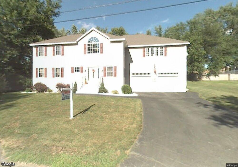
47 Hillside Rd Dracut, MA 01826
Estimated Value: $714,118 - $810,000
4
Beds
2
Baths
3,736
Sq Ft
$204/Sq Ft
Est. Value
About This Home
This home is located at 47 Hillside Rd, Dracut, MA 01826 and is currently estimated at $763,280, approximately $204 per square foot. 47 Hillside Rd is a home located in Middlesex County with nearby schools including George H. Englesby Elementary School, Richardson Middle School, and Dracut Senior High School.
Ownership History
Date
Name
Owned For
Owner Type
Purchase Details
Closed on
Jun 2, 2011
Sold by
Peffley Christopher D and Peffley Christy
Bought by
Ferreira Francis and Dubois Amanda
Current Estimated Value
Home Financials for this Owner
Home Financials are based on the most recent Mortgage that was taken out on this home.
Original Mortgage
$270,000
Outstanding Balance
$188,043
Interest Rate
4.85%
Mortgage Type
Purchase Money Mortgage
Estimated Equity
$575,237
Purchase Details
Closed on
Jan 15, 2008
Sold by
Bouchard Amanda S and Bouchard Mark J
Bought by
Peffley Christopher D and Peffley Christy
Home Financials for this Owner
Home Financials are based on the most recent Mortgage that was taken out on this home.
Original Mortgage
$414,500
Interest Rate
6.21%
Mortgage Type
Purchase Money Mortgage
Purchase Details
Closed on
Jul 26, 1993
Sold by
Welch Shirley
Bought by
Bouchard Mark J
Create a Home Valuation Report for This Property
The Home Valuation Report is an in-depth analysis detailing your home's value as well as a comparison with similar homes in the area
Home Values in the Area
Average Home Value in this Area
Purchase History
| Date | Buyer | Sale Price | Title Company |
|---|---|---|---|
| Ferreira Francis | $300,000 | -- | |
| Peffley Christopher D | $420,000 | -- | |
| Bouchard Mark J | $94,000 | -- |
Source: Public Records
Mortgage History
| Date | Status | Borrower | Loan Amount |
|---|---|---|---|
| Open | Ferreira Francis | $270,000 | |
| Previous Owner | Peffley Christopher D | $414,500 | |
| Previous Owner | Bouchard Mark J | $103,200 | |
| Previous Owner | Bouchard Mark J | $164,800 | |
| Previous Owner | Bouchard Mark J | $80,000 |
Source: Public Records
Tax History Compared to Growth
Tax History
| Year | Tax Paid | Tax Assessment Tax Assessment Total Assessment is a certain percentage of the fair market value that is determined by local assessors to be the total taxable value of land and additions on the property. | Land | Improvement |
|---|---|---|---|---|
| 2025 | $6,617 | $653,900 | $194,000 | $459,900 |
| 2024 | $6,360 | $608,600 | $184,700 | $423,900 |
| 2023 | $6,164 | $532,300 | $160,600 | $371,700 |
| 2022 | $6,124 | $498,300 | $146,000 | $352,300 |
| 2021 | $9,160 | $470,900 | $132,700 | $338,200 |
| 2020 | $5,906 | $442,400 | $128,900 | $313,500 |
| 2019 | $2,683 | $408,900 | $122,700 | $286,200 |
| 2018 | $7,951 | $396,500 | $122,700 | $273,800 |
| 2017 | $5,535 | $396,500 | $122,700 | $273,800 |
| 2016 | $5,374 | $362,100 | $118,000 | $244,100 |
| 2015 | $5,148 | $344,800 | $118,000 | $226,800 |
| 2014 | $4,761 | $328,600 | $118,000 | $210,600 |
Source: Public Records
Map
Nearby Homes
- 25 Tobey Rd Unit 57
- 51 Tobey Rd Unit 46
- 75 Sladen St
- 16 Peabody Ave
- 417 Hildreth St Unit 2
- 18 Stone St
- 306 Aiken Ave Unit 7
- 306 Aiken Ave Unit 16
- 349 Hildreth St Unit 16
- 1391 Bridge St
- 108 Billings St
- 174 Old Rd
- 1572 Bridge St
- 15 Dana St
- 195 Ludlam St
- 74 Aiken Ave
- 13 Louis Farm Rd Unit 13
- 3 Hamel Place
- 40 Arlington Ave
- 1 19th St Unit 3
- 39 Hillside Rd
- 590 Hildreth St
- 14 Burdette Rd
- 580 Hildreth St
- 600 Hildreth St
- 46 Hillside Rd
- 24 Burdette Rd
- 31 Hillside Rd
- 570 Hildreth St
- 26 Hillside Rd
- 30&38 Burdette Rd
- 568 Hildreth St
- 74 Hillside Rd
- 606 Hildreth St
- 22 Hillside Rd
- 581 Hildreth St
- 591 Hildreth St
- 21 Hillside Rd
- 599 Hildreth St
- 35 Burdette Rd