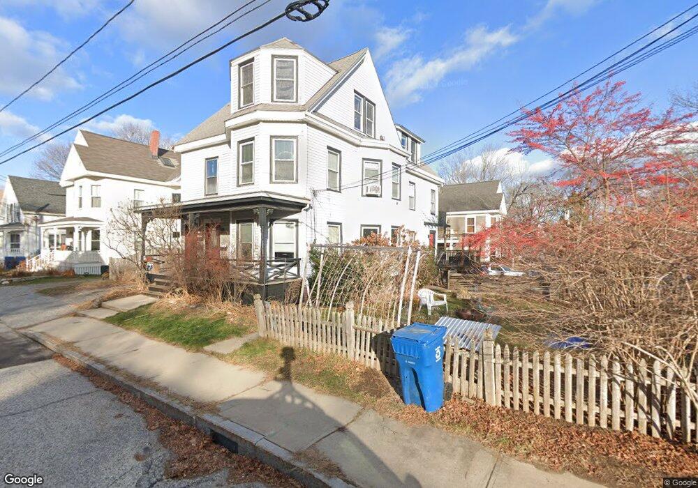
47 Irving St Portland, ME 04103
Back Cove NeighborhoodEstimated Value: $772,000 - $926,000
7
Beds
3
Baths
3,381
Sq Ft
$257/Sq Ft
Est. Value
About This Home
This home is located at 47 Irving St, Portland, ME 04103 and is currently estimated at $867,333, approximately $256 per square foot. 47 Irving St is a home located in Cumberland County with nearby schools including Ocean Avenue Elementary School, Lyman Moore Middle School, and Baxter Academy for Tech & Sciences.
Ownership History
Date
Name
Owned For
Owner Type
Purchase Details
Closed on
May 4, 2020
Sold by
Borelli Peter D and Borelli Jessica R
Bought by
Borelli Jessica R and Coggeshall Sarah J
Current Estimated Value
Purchase Details
Closed on
May 10, 2006
Sold by
Carey Marritt T
Bought by
Broelli Perter D and Brelli Jessica R
Home Financials for this Owner
Home Financials are based on the most recent Mortgage that was taken out on this home.
Original Mortgage
$291,200
Interest Rate
9%
Mortgage Type
Adjustable Rate Mortgage/ARM
Create a Home Valuation Report for This Property
The Home Valuation Report is an in-depth analysis detailing your home's value as well as a comparison with similar homes in the area
Home Values in the Area
Average Home Value in this Area
Purchase History
| Date | Buyer | Sale Price | Title Company |
|---|---|---|---|
| Borelli Jessica R | -- | None Available | |
| Borelli Jessica R | -- | None Available | |
| Broelli Perter D | -- | -- | |
| Broelli Perter D | -- | -- | |
| Broelli Perter D | -- | -- |
Source: Public Records
Mortgage History
| Date | Status | Borrower | Loan Amount |
|---|---|---|---|
| Open | Broelli Perter D | $304,000 | |
| Closed | Broelli Perter D | $291,200 |
Source: Public Records
Tax History Compared to Growth
Tax History
| Year | Tax Paid | Tax Assessment Tax Assessment Total Assessment is a certain percentage of the fair market value that is determined by local assessors to be the total taxable value of land and additions on the property. | Land | Improvement |
|---|---|---|---|---|
| 2024 | $8,286 | $552,000 | $62,600 | $489,400 |
| 2023 | $7,954 | $552,000 | $62,600 | $489,400 |
| 2022 | $7,513 | $552,000 | $62,600 | $489,400 |
| 2021 | $7,170 | $552,000 | $62,600 | $489,400 |
| 2020 | $6,981 | $299,500 | $62,600 | $236,900 |
| 2019 | $6,981 | $299,500 | $62,600 | $236,900 |
| 2018 | $6,484 | $299,500 | $62,600 | $236,900 |
| 2017 | $6,484 | $299,500 | $62,600 | $236,900 |
| 2016 | $6,322 | $299,500 | $62,600 | $236,900 |
| 2015 | $6,179 | $299,500 | $62,600 | $236,900 |
| 2014 | $5,990 | $299,500 | $62,600 | $236,900 |
Source: Public Records
Map
Nearby Homes
- 42 Sawyer St
- 736 Forest Ave
- 25 Pleasant Ave
- 33 Mayland St
- 33 Bay View Dr
- 44 Pleasant Ave
- 44 Hersey St
- 89 Clinton St
- 45 George St
- 147 Pleasant Ave Unit 2
- 37 Wellington Rd
- 930 Forest Ave
- 48 Ashmont St
- 65 Mcauley Way Unit 506
- 54 Read St
- 14 Prospect St
- 37 Tremont St
- 75 Mcauley Way Unit 307
- 75 Mcauley Way Unit 206
- 75 Mcauley Way Unit 401