47 Lasell St West Roxbury, MA 02132
West Roxbury NeighborhoodHighlights
- Property is near public transit
- Shops
- Heating System Uses Natural Gas
- No HOA
About This Home
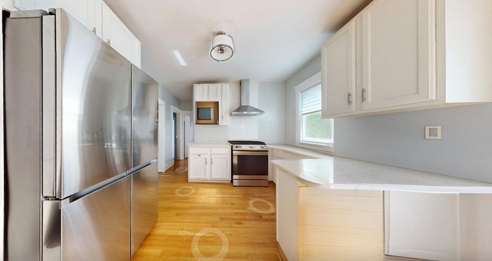
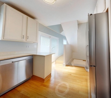
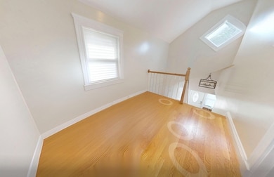
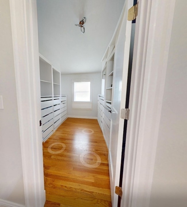
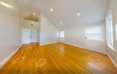
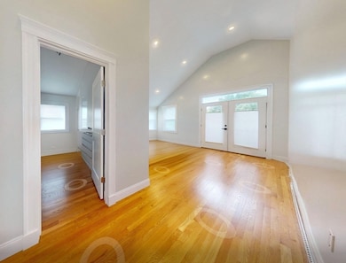
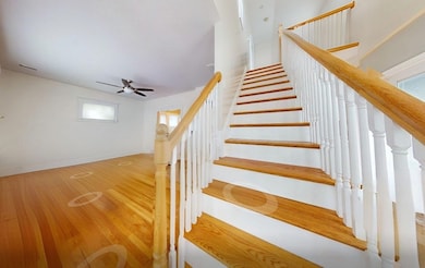
Beautifully renovated in 2022, this 3 Bed/3 Bath single-family offers 1,392 sq ft of modern living in prime West Roxbury. Enjoy an open floor plan with hardwood floors, abundant natural light, and a stylish kitchen with stainless appliances, stone countertops, and modern cabinetry flowing into dining and living areas. Three well-sized bedrooms include a primary suite with private bath, plus two additional full baths. Features include in-unit laundry, energy-efficient systems with tankless hot water, private deck and fenced yard, garage, and 2 off-street parking spaces. Excellent location near VFW Parkway, shops, restaurants, and public transit. Fee & Policy Disclosures: Pet rent $75/mo if applicable; Lease extension/sublet/roommate add $295; Renter’s insurance required (own policy or $42/mo Resident Benefit Package). No hidden fees. 1BR/1 tenant policy; $250/mo per extra approved occupant.
Home Details
Home Type
- Single Family
Est. Annual Taxes
- $8,069
Year Built
- 1940
Home Design
- 1,392 Sq Ft Home
- Entry on the 1st floor
Bedrooms and Bathrooms
- 3 Bedrooms
- 3 Full Bathrooms
Utilities
- No Cooling
- Heating System Uses Natural Gas
Additional Features
- Laundry in unit
- Property is near public transit
Listing and Financial Details
- Security Deposit $3,695
- Property Available on 1/1/26
- Rent includes occupancy only
- 12 Month Lease Term
- Assessor Parcel Number 1432824
Community Details
Pet Policy
- No Pets Allowed
Additional Features
- No Home Owners Association
- Shops
Map
Source: MLS Property Information Network (MLS PIN)
MLS Number: 73433889
APN: WROX-000000-000020-007972
Disclaimer: Certain information contained herein is derived from information provided by parties other than Homes.com. All information provided is deemed reliable, but is not guaranteed to be accurate and should be independently verified.
![]() The property listing data and information, or the Images, set forth herein were provided to MLS Property Information Network, Inc. from third party sources, including sellers, lessors and public records, and were compiled by MLS Property Information Network, Inc. The property listing data and information, and the Images, are for the personal, non-commercial use of consumers having a good faith interest in purchasing or leasing listed properties of the type displayed to them and may not be used for any purpose other than to identify prospective properties which such consumers may have a good faith interest in purchasing or leasing. MLS Property Information Network, Inc. and its subscribers disclaim any and all representations and warranties as to the accuracy of the property listing data and information, or as to the accuracy of any of the Images, set forth herein.
The property listing data and information, or the Images, set forth herein were provided to MLS Property Information Network, Inc. from third party sources, including sellers, lessors and public records, and were compiled by MLS Property Information Network, Inc. The property listing data and information, and the Images, are for the personal, non-commercial use of consumers having a good faith interest in purchasing or leasing listed properties of the type displayed to them and may not be used for any purpose other than to identify prospective properties which such consumers may have a good faith interest in purchasing or leasing. MLS Property Information Network, Inc. and its subscribers disclaim any and all representations and warranties as to the accuracy of the property listing data and information, or as to the accuracy of any of the Images, set forth herein.
- 100 Keith St
- 331 Vermont St
- 9 Carroll St
- 577 Baker St Unit 577
- 857 Vfw Pkwy
- 990 Vfw Pkwy Unit 204
- 105 Chesbrough Rd
- 183 Temple St
- 59 Chesbrough Rd
- 76 Vermont St
- 579 Baker St Unit 579
- 28 Dow Rd
- 539 Lagrange St
- 340 Baker St Unit 1
- 79 Potomac St
- 76 Potomac St
- 1 Dow Rd
- 865 Lagrange St Unit 5
- 14 Sanborn Ave
- 1216 Vfw Pkwy Unit 40
- 47 Lasell St Unit 1
- 331 Vermont St Unit 1
- 333 Vermont St Unit 2
- 80 Sanborn Ave Unit 2
- 865 Lagrange St Unit 5
- 1208D Vfw Pkwy
- 50 Gardner St Unit 32
- 50 Gardner St Unit 10
- 91 Gardner St
- 91 Gardner St
- 91 Gardner St
- 91 Gardner St
- 91 Gardner St
- 91 Gardner St
- 199 Gardner St Unit 411
- 199 Gardner St Unit 409
- 199 Gardner St Unit 407
- 199 Gardner St Unit 404
- 199 Gardner St Unit 406
- 199 Gardner St Unit 410
