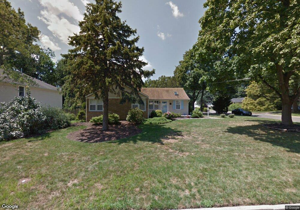
47 Laurel Dr Little Silver, NJ 07739
Estimated Value: $978,748 - $1,085,000
3
Beds
3
Baths
1,688
Sq Ft
$608/Sq Ft
Est. Value
About This Home
This home is located at 47 Laurel Dr, Little Silver, NJ 07739 and is currently estimated at $1,025,687, approximately $607 per square foot. 47 Laurel Dr is a home located in Monmouth County with nearby schools including Point Road School, Markham Place School, and Red Bank Regional High School.
Ownership History
Date
Name
Owned For
Owner Type
Purchase Details
Closed on
Jun 27, 1996
Sold by
Mizrahi Anita
Bought by
Hunt Thomas and Hunt Alice
Current Estimated Value
Home Financials for this Owner
Home Financials are based on the most recent Mortgage that was taken out on this home.
Original Mortgage
$200,000
Outstanding Balance
$14,215
Interest Rate
8.05%
Estimated Equity
$1,011,472
Purchase Details
Closed on
Aug 3, 1994
Sold by
Tauber Richard
Bought by
Mizrabi Eric and Mizrabi Anita
Home Financials for this Owner
Home Financials are based on the most recent Mortgage that was taken out on this home.
Original Mortgage
$165,000
Interest Rate
8.52%
Create a Home Valuation Report for This Property
The Home Valuation Report is an in-depth analysis detailing your home's value as well as a comparison with similar homes in the area
Home Values in the Area
Average Home Value in this Area
Purchase History
| Date | Buyer | Sale Price | Title Company |
|---|---|---|---|
| Hunt Thomas | $275,000 | -- | |
| Mizrabi Eric | $206,000 | -- |
Source: Public Records
Mortgage History
| Date | Status | Borrower | Loan Amount |
|---|---|---|---|
| Open | Hunt Thomas | $200,000 | |
| Previous Owner | Mizrabi Eric | $165,000 |
Source: Public Records
Tax History Compared to Growth
Tax History
| Year | Tax Paid | Tax Assessment Tax Assessment Total Assessment is a certain percentage of the fair market value that is determined by local assessors to be the total taxable value of land and additions on the property. | Land | Improvement |
|---|---|---|---|---|
| 2025 | $12,066 | $839,500 | $652,300 | $187,200 |
| 2024 | $11,489 | $714,800 | $437,200 | $277,600 |
| 2023 | $11,489 | $638,300 | $367,200 | $271,100 |
| 2022 | $9,694 | $575,300 | $317,200 | $258,100 |
| 2021 | $9,694 | $547,800 | $317,200 | $230,600 |
| 2020 | $10,492 | $517,600 | $292,200 | $225,400 |
| 2019 | $10,274 | $516,300 | $292,200 | $224,100 |
| 2018 | $10,108 | $505,900 | $292,200 | $213,700 |
| 2017 | $10,028 | $499,400 | $292,200 | $207,200 |
| 2016 | $9,803 | $494,100 | $292,200 | $201,900 |
| 2015 | $9,508 | $485,700 | $267,200 | $218,500 |
| 2014 | $9,526 | $454,700 | $267,200 | $187,500 |
Source: Public Records
Map
Nearby Homes
- 40 Brookside Ln
- 33 Willow Dr
- 50 Willow Dr
- 82 Little Silver Pkwy
- 36 Maple Ave
- 212 Willow Dr
- 87 Rumson Rd
- 26 Prince Place
- 55 Cheshire Square
- 32 Woodbine Ave
- 1 George St
- 199 Pinckney Rd
- 104 Garden Rd
- 30 Crest Dr
- 41 Edgewood Ave
- 35 Sunnybank Dr
- 172 Woods End Dr
- 420 Rumson Rd
- 3 Sandbar Alley
- 492 Hance Rd