Estimated Value: $588,000 - $841,000
2
Beds
2
Baths
1,343
Sq Ft
$520/Sq Ft
Est. Value
About This Home
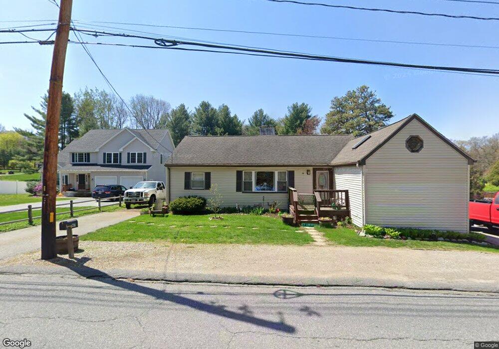
This home is located at 47 Lawsbrook Rd, Acton, MA 01720 and is currently estimated at $697,698, approximately $519 per square foot. 47 Lawsbrook Rd is a home located in Middlesex County with nearby schools including Acton-Boxborough Regional High School and Concord Academy.
Ownership History
Date
Name
Owned For
Owner Type
Purchase Details
Closed on
Apr 19, 2011
Sold by
Hathaway Michael J
Bought by
Acton Town Of
Current Estimated Value
Purchase Details
Closed on
Feb 11, 2011
Sold by
Hathaway Michael J and Hathaway Martha S
Bought by
Acton Town Of
Purchase Details
Closed on
Mar 1, 1999
Sold by
Fnma
Bought by
Hathaway Michael J and Hathaway Martha S
Home Financials for this Owner
Home Financials are based on the most recent Mortgage that was taken out on this home.
Original Mortgage
$177,000
Interest Rate
6.78%
Mortgage Type
Purchase Money Mortgage
Purchase Details
Closed on
Jul 22, 1998
Sold by
Hathaway Neal R and Robinson Marianne
Bought by
Federal National Mortgage Association
Purchase Details
Closed on
May 27, 1987
Sold by
Higgins Geoffrey S
Bought by
Hathaway Neal R
Home Financials for this Owner
Home Financials are based on the most recent Mortgage that was taken out on this home.
Original Mortgage
$136,400
Interest Rate
10.25%
Mortgage Type
Purchase Money Mortgage
Create a Home Valuation Report for This Property
The Home Valuation Report is an in-depth analysis detailing your home's value as well as a comparison with similar homes in the area
Home Values in the Area
Average Home Value in this Area
Purchase History
| Date | Buyer | Sale Price | Title Company |
|---|---|---|---|
| Acton Town Of | -- | -- | |
| Acton Town Of | $518 | -- | |
| Hathaway Michael J | $178,610 | -- | |
| Federal National Mortgage Association | $175,161 | -- | |
| Hathaway Neal R | $185,000 | -- |
Source: Public Records
Mortgage History
| Date | Status | Borrower | Loan Amount |
|---|---|---|---|
| Previous Owner | Hathaway Neal R | $177,000 | |
| Previous Owner | Hathaway Neal R | $11,630 | |
| Previous Owner | Hathaway Neal R | $136,400 |
Source: Public Records
Tax History
| Year | Tax Paid | Tax Assessment Tax Assessment Total Assessment is a certain percentage of the fair market value that is determined by local assessors to be the total taxable value of land and additions on the property. | Land | Improvement |
|---|---|---|---|---|
| 2025 | $8,693 | $506,900 | $272,400 | $234,500 |
| 2024 | $8,270 | $496,100 | $272,400 | $223,700 |
| 2023 | $7,900 | $449,900 | $247,600 | $202,300 |
| 2022 | $7,844 | $403,300 | $215,200 | $188,100 |
| 2021 | $7,625 | $376,900 | $199,300 | $177,600 |
| 2020 | $7,155 | $371,900 | $199,300 | $172,600 |
| 2019 | $6,750 | $348,500 | $199,300 | $149,200 |
| 2018 | $6,341 | $327,200 | $199,300 | $127,900 |
| 2017 | $6,236 | $327,200 | $199,300 | $127,900 |
| 2016 | $6,000 | $312,000 | $199,300 | $112,700 |
| 2015 | $5,795 | $304,200 | $199,300 | $104,900 |
| 2014 | $5,831 | $299,800 | $199,300 | $100,500 |
Source: Public Records
Map
Nearby Homes
- 60 Lawsbrook Rd
- 65 Summit St
- 303 School St
- 245 Oak Hill Cir
- 37 Water St
- 66 Old Stow Rd
- 27 Water St
- 1687 Main St
- 1828 Main St
- 1844 Main St Unit 1844
- 42 Sunnyside Ln
- 45 Millrun Ln Unit 45
- 95 Conant St Unit 320
- 100 Harrington Ave
- 22 Center Village Dr
- 62 Edgewood Rd
- 31 Drummer Rd Unit 31
- 54 Maple St
- 128 Parker St Unit 3B
- 70 McCallar Ln
- 2 Bellantoni Dr
- 51 Lawsbrook Rd
- 46 Lawsbrook Rd
- 1 Old Colony Ln
- 4 Bellantoni Dr
- 48 Lawsbrook Rd
- 54 Lawsbrook Rd
- 1 Bellantoni Dr
- 3 Old Colony Ln
- 6 Bellantoni Dr
- 42 Lawsbrook Rd
- 59 Laws Brook Rd
- 5 Old Colony Ln
- 4 Old Colony Ln
- 5 Bellantoni Dr
- 40 Lawsbrook Rd
- 2 Lisa Ln
- 4 Lisa Ln
- 52 Lawsbrook Rd
- 8 Old Colony Ln
Your Personal Tour Guide
Ask me questions while you tour the home.