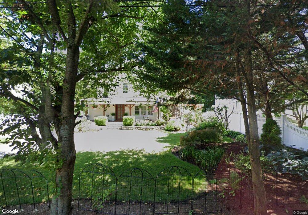
47 Lockwood Ln Riverside, CT 06878
Estimated Value: $2,493,000 - $3,368,000
4
Beds
4
Baths
3,086
Sq Ft
$968/Sq Ft
Est. Value
About This Home
This home is located at 47 Lockwood Ln, Riverside, CT 06878 and is currently estimated at $2,988,015, approximately $968 per square foot. 47 Lockwood Ln is a home located in Fairfield County with nearby schools including Riverside School, Eastern Middle School, and Greenwich High School.
Ownership History
Date
Name
Owned For
Owner Type
Purchase Details
Closed on
Sep 12, 1997
Sold by
Harbor Builders Llc
Bought by
Ricci Teresa M and Ricci John S
Current Estimated Value
Home Financials for this Owner
Home Financials are based on the most recent Mortgage that was taken out on this home.
Original Mortgage
$529,000
Outstanding Balance
$78,607
Interest Rate
7%
Mortgage Type
Unknown
Estimated Equity
$2,909,408
Create a Home Valuation Report for This Property
The Home Valuation Report is an in-depth analysis detailing your home's value as well as a comparison with similar homes in the area
Home Values in the Area
Average Home Value in this Area
Purchase History
We collect this data history from publicly available records. To have your information removed, we recommend requesting removal directly through your county’s website.
| Date | Buyer | Sale Price | Title Company |
|---|---|---|---|
| Ricci Teresa M | $662,000 | -- |
Source: Public Records
Mortgage History
We collect this data history from publicly available records. To have your information removed, we recommend requesting removal directly through your county’s website.
| Date | Status | Borrower | Loan Amount |
|---|---|---|---|
| Open | Ricci Teresa M | $529,000 |
Source: Public Records
Tax History
| Year | Tax Paid | Tax Assessment Tax Assessment Total Assessment is a certain percentage of the fair market value that is determined by local assessors to be the total taxable value of land and additions on the property. | Land | Improvement |
|---|---|---|---|---|
| 2025 | $16,609 | $1,343,860 | $902,020 | $441,840 |
| 2024 | $16,040 | $1,343,860 | $902,020 | $441,840 |
| 2023 | $15,637 | $1,343,860 | $902,020 | $441,840 |
| 2022 | $15,495 | $1,343,860 | $902,020 | $441,840 |
| 2021 | $14,333 | $1,190,420 | $703,150 | $487,270 |
| 2020 | $14,309 | $1,190,420 | $703,150 | $487,270 |
| 2019 | $14,452 | $1,190,420 | $703,150 | $487,270 |
| 2018 | $14,130 | $1,190,420 | $703,150 | $487,270 |
| 2017 | $14,308 | $1,190,420 | $703,150 | $487,270 |
| 2016 | $14,081 | $1,190,420 | $703,150 | $487,270 |
| 2015 | $13,076 | $1,096,480 | $693,980 | $402,500 |
| 2014 | $12,747 | $1,096,480 | $693,980 | $402,500 |
Source: Public Records
Map
Nearby Homes
- 14 Bradbury Place
- 73 Lockwood Rd
- 1 Bramble Ln
- 32 Winthrop Dr
- 29 Coventry Ln
- 23 Thornhill Rd
- 31 Thornhill Rd
- 115 River Rd Unit 3
- 22 Wescott St
- 56 Winthrop Dr
- 22 Carrona Dr
- 47 Owenoke Way
- 33 Sound Beach Ave
- 153 Lockwood Rd
- 64 Summit Rd
- 5 Sunshine Ave
- 21 Lake Dr
- 98 Valley Rd Unit 12
- 45 Sunshine Ave
- 30 Weston Hill Rd
- 37 Lockwood Ln
- 33 Lockwood Ln
- 39 Lockwood Ln
- 43 Lockwood Ln
- 31 Lockwood Ln
- 31 Pleasant St
- 41 Lockwood Ln
- 41 Lockwood Ln
- 33 Morning View Rd
- 33 Pleasant St
- 36 Lockwood Ln
- 38 Lockwood Ln
- 34 Lockwood Ln
- 40 Lockwood Ln
- 45 Lockwood Ln
- 48 Breezemont Ave
- 46 Breezemont Ave
- 50 Breezemont Ave
- 30 Pleasant St
- 32 Lockwood Ln
Your Personal Tour Guide
Ask me questions while you tour the home.