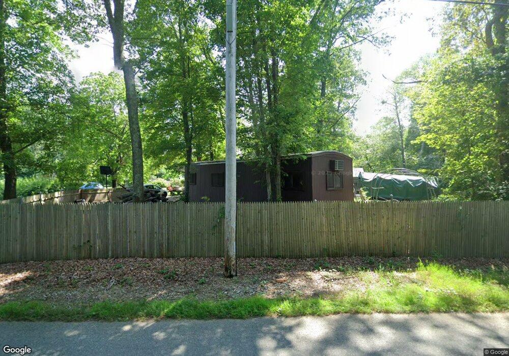
47 Martin St Rehoboth, MA 02769
Estimated Value: $409,453 - $469,000
1
Bed
2
Baths
1,104
Sq Ft
$407/Sq Ft
Est. Value
About This Home
This home is located at 47 Martin St, Rehoboth, MA 02769 and is currently estimated at $449,363, approximately $407 per square foot. 47 Martin St is a home located in Bristol County with nearby schools including Dighton-Rehoboth Regional High School.
Ownership History
Date
Name
Owned For
Owner Type
Purchase Details
Closed on
Mar 18, 2016
Sold by
Chace Isabel G
Bought by
Chace Alan D
Current Estimated Value
Purchase Details
Closed on
Sep 21, 2011
Sold by
Chace Alan D
Bought by
Chace Isabel G
Purchase Details
Closed on
Feb 25, 2011
Sold by
Chase Isabel G
Bought by
Chase Alan D
Purchase Details
Closed on
Oct 31, 1963
Bought by
Chace Alan D
Create a Home Valuation Report for This Property
The Home Valuation Report is an in-depth analysis detailing your home's value as well as a comparison with similar homes in the area
Home Values in the Area
Average Home Value in this Area
Purchase History
| Date | Buyer | Sale Price | Title Company |
|---|---|---|---|
| Chace Alan D | -- | -- | |
| Chace Isabel G | -- | -- | |
| Chase Alan D | -- | -- | |
| Chace Alan D | -- | -- | |
| Chace Alan D | -- | -- |
Source: Public Records
Mortgage History
| Date | Status | Borrower | Loan Amount |
|---|---|---|---|
| Previous Owner | Chace Alan D | $10,000 | |
| Previous Owner | Chace Alan D | $32,000 |
Source: Public Records
Tax History Compared to Growth
Tax History
| Year | Tax Paid | Tax Assessment Tax Assessment Total Assessment is a certain percentage of the fair market value that is determined by local assessors to be the total taxable value of land and additions on the property. | Land | Improvement |
|---|---|---|---|---|
| 2025 | $34 | $303,200 | $175,600 | $127,600 |
| 2024 | $3,348 | $294,700 | $175,600 | $119,100 |
| 2023 | $3,284 | $283,600 | $172,000 | $111,600 |
| 2022 | $3,355 | $264,800 | $172,000 | $92,800 |
| 2021 | $3,278 | $247,600 | $164,200 | $83,400 |
| 2020 | $3,162 | $241,000 | $164,200 | $76,800 |
| 2018 | $2,674 | $235,800 | $156,400 | $79,400 |
| 2017 | $2,736 | $217,800 | $156,400 | $61,400 |
| 2016 | $2,671 | $219,800 | $156,400 | $63,400 |
| 2015 | $2,519 | $204,600 | $149,200 | $55,400 |
| 2014 | $2,456 | $197,400 | $142,000 | $55,400 |
Source: Public Records
Map
Nearby Homes