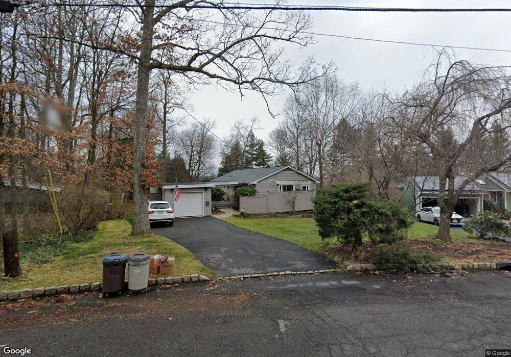
47 Martins Ln Berkeley Heights, NJ 07922
Estimated Value: $661,138 - $793,000
--
Bed
--
Bath
1,242
Sq Ft
$587/Sq Ft
Est. Value
About This Home
This home is located at 47 Martins Ln, Berkeley Heights, NJ 07922 and is currently estimated at $729,285, approximately $587 per square foot. 47 Martins Ln is a home located in Union County with nearby schools including Columbia Middle School, Governor Livingston High School, and The Academy of Our Lady of Peace.
Ownership History
Date
Name
Owned For
Owner Type
Purchase Details
Closed on
Jul 12, 2001
Sold by
Oh Mary Ann and Oh David
Bought by
Mcguire Joseph S and Mcguire Kathleen
Current Estimated Value
Home Financials for this Owner
Home Financials are based on the most recent Mortgage that was taken out on this home.
Original Mortgage
$120,000
Outstanding Balance
$46,245
Interest Rate
7.14%
Mortgage Type
Purchase Money Mortgage
Estimated Equity
$683,040
Purchase Details
Closed on
Aug 28, 1998
Sold by
Woolheater Judith A
Bought by
Laskay Mary Ann and Oh David
Home Financials for this Owner
Home Financials are based on the most recent Mortgage that was taken out on this home.
Original Mortgage
$157,500
Interest Rate
6.9%
Create a Home Valuation Report for This Property
The Home Valuation Report is an in-depth analysis detailing your home's value as well as a comparison with similar homes in the area
Home Values in the Area
Average Home Value in this Area
Purchase History
| Date | Buyer | Sale Price | Title Company |
|---|---|---|---|
| Mcguire Joseph S | $343,000 | -- | |
| Laskay Mary Ann | $197,500 | Chicago Title Insurance Co |
Source: Public Records
Mortgage History
| Date | Status | Borrower | Loan Amount |
|---|---|---|---|
| Open | Mcguire Joseph S | $120,000 | |
| Previous Owner | Laskay Mary Ann | $157,500 |
Source: Public Records
Tax History Compared to Growth
Tax History
| Year | Tax Paid | Tax Assessment Tax Assessment Total Assessment is a certain percentage of the fair market value that is determined by local assessors to be the total taxable value of land and additions on the property. | Land | Improvement |
|---|---|---|---|---|
| 2025 | $9,367 | $218,500 | $149,300 | $69,200 |
| 2024 | $9,232 | $218,500 | $149,300 | $69,200 |
| 2023 | $9,232 | $218,500 | $149,300 | $69,200 |
| 2022 | $9,175 | $218,500 | $149,300 | $69,200 |
| 2021 | $9,125 | $218,500 | $149,300 | $69,200 |
| 2020 | $9,173 | $218,500 | $149,300 | $69,200 |
| 2019 | $9,127 | $218,500 | $149,300 | $69,200 |
| 2018 | $8,937 | $218,500 | $149,300 | $69,200 |
| 2017 | $8,827 | $218,500 | $149,300 | $69,200 |
| 2016 | $8,672 | $218,500 | $149,300 | $69,200 |
| 2015 | $8,624 | $218,500 | $149,300 | $69,200 |
| 2014 | $8,399 | $218,500 | $149,300 | $69,200 |
Source: Public Records
Map
Nearby Homes
- 33 Bristol Ct
- 25 Oechsner Ct
- 5 Berkeley Square Unit 5
- 62 Springholm Dr Unit 62
- 86 Orion Rd
- 78 Twin Falls Rd
- 41 Meadowview Ln
- 132 Fairview Ave
- 34 Meadowview Ln
- 56 Valley Rd
- 45 Wilson Dr
- 28 Peacock Ln Unit 28
- 30 Robbins Ave
- 19 Guenevere Way Ondo
- 78 Spring Ridge Dr
- 12 Park Edge
- 25 Murray Hill Square
- 126 Snyder Ave
- 37 Oak Ridge Rd
- 11 Earl Place
- 53 Martins Ln
- 41 Martins Ln
- 39 Timothy Field Rd
- 41 Timothy Field Rd
- 37 Timothy Field Rd
- 57 Martins Ln
- 46 Martins Ln
- 33 Martins Ln
- 35 Timothy Field Rd
- 58 Martins Ln
- 17 Barnstable Rd
- 63 Martins Ln
- 32 Martins Ln
- 43 Timothy Field Rd
- 38 Timothy Field Rd
- 19 Barnstable Rd
- 67 Martins Ln
- 40 Timothy Field Rd
- 23 Timothy Field Rd
- 66 Martins Ln