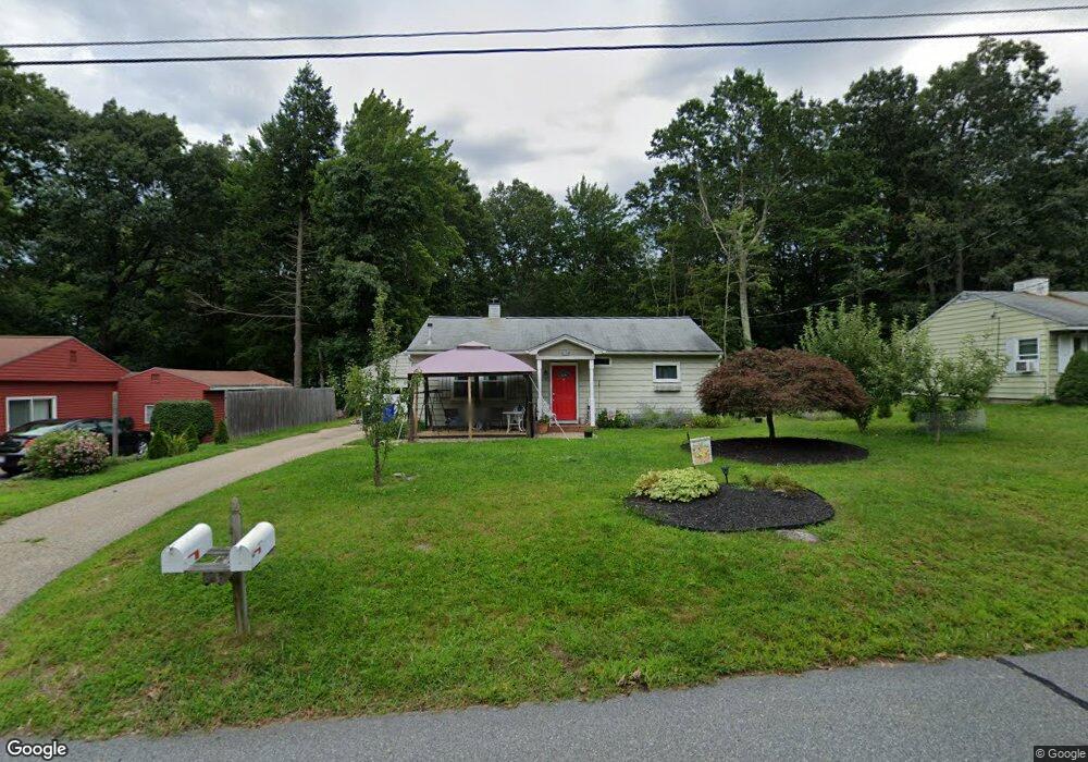
47 Mayflower Cir Holden, MA 01520
Estimated Value: $354,000 - $419,000
3
Beds
1
Bath
896
Sq Ft
$448/Sq Ft
Est. Value
About This Home
This home is located at 47 Mayflower Cir, Holden, MA 01520 and is currently estimated at $401,761, approximately $448 per square foot. 47 Mayflower Cir is a home located in Worcester County with nearby schools including Wachusett Regional High School, Abby Kelley Foster Charter Public School, and Bancroft School.
Ownership History
Date
Name
Owned For
Owner Type
Purchase Details
Closed on
Nov 25, 2009
Sold by
Sprague-Cloutier Caryl W
Bought by
Sampson Lorrie and Sampson Frederick G
Current Estimated Value
Home Financials for this Owner
Home Financials are based on the most recent Mortgage that was taken out on this home.
Original Mortgage
$203,898
Outstanding Balance
$133,130
Interest Rate
4.92%
Mortgage Type
Purchase Money Mortgage
Estimated Equity
$268,631
Purchase Details
Closed on
Jul 30, 2004
Sold by
Hall Susan R
Bought by
Sprague Caryl W
Home Financials for this Owner
Home Financials are based on the most recent Mortgage that was taken out on this home.
Original Mortgage
$168,300
Interest Rate
6.33%
Mortgage Type
Purchase Money Mortgage
Purchase Details
Closed on
Jan 27, 1998
Sold by
Oberg Paul J and Oberg Michaela
Bought by
Sprague Caryl W and Oberg Michaela
Create a Home Valuation Report for This Property
The Home Valuation Report is an in-depth analysis detailing your home's value as well as a comparison with similar homes in the area
Home Values in the Area
Average Home Value in this Area
Purchase History
| Date | Buyer | Sale Price | Title Company |
|---|---|---|---|
| Sampson Lorrie | $199,900 | -- | |
| Sprague Caryl W | $187,000 | -- | |
| Sprague Caryl W | $2,500 | -- |
Source: Public Records
Mortgage History
| Date | Status | Borrower | Loan Amount |
|---|---|---|---|
| Open | Sampson Lorrie | $203,898 | |
| Previous Owner | Sprague Caryl W | $168,300 |
Source: Public Records
Tax History Compared to Growth
Tax History
| Year | Tax Paid | Tax Assessment Tax Assessment Total Assessment is a certain percentage of the fair market value that is determined by local assessors to be the total taxable value of land and additions on the property. | Land | Improvement |
|---|---|---|---|---|
| 2025 | $5,015 | $361,800 | $158,300 | $203,500 |
| 2024 | $4,507 | $318,500 | $153,700 | $164,800 |
| 2023 | $4,325 | $288,500 | $133,600 | $154,900 |
| 2022 | $4,132 | $249,500 | $104,400 | $145,100 |
| 2021 | $4,012 | $230,600 | $99,300 | $131,300 |
| 2020 | $3,708 | $218,100 | $94,700 | $123,400 |
| 2019 | $3,668 | $210,200 | $94,700 | $115,500 |
| 2018 | $3,334 | $189,300 | $90,200 | $99,100 |
| 2017 | $3,256 | $185,100 | $90,200 | $94,900 |
| 2016 | $3,058 | $177,300 | $85,900 | $91,400 |
| 2015 | $3,082 | $170,100 | $85,900 | $84,200 |
| 2014 | $3,019 | $170,100 | $85,900 | $84,200 |
Source: Public Records
Map
Nearby Homes
- 27 Mayflower Cir
- 18 Edgewood Dr
- 314 Main St
- 23 Gail Dr
- 122 Holden St
- 189 Holden St
- 160 Shrewsbury St
- 9 Birchwood Dr
- 250 Shrewsbury St
- 47 Chapel St
- 27 Tea Party Cir Unit 27
- 8 Indian Cir Unit 8
- 2 Explorers Way Unit 2
- 11 Brentwood Dr
- 156 Newell Rd
- 308 Holden St
- 36 Wilde Willow Dr
- 47 Banbury Ln
- 9 Emily St
- 15 Lowell Ave
- 41 Mayflower Cir
- 51 Mayflower Cir
- 57 Mayflower Cir
- 37 Mayflower Cir
- 46 Mayflower Cir
- 54 Mayflower Cir
- 2 Edgewood Dr
- 40 Mayflower Cir
- 31 Mayflower Cir
- 34 Colonial Dr
- 34 Mayflower Cir
- 8 Edgewood Dr
- 30 Colonial Dr
- 5 Edgewood Dr
- 10 Mayflower Cir
- 29 Mayflower Cir
- 16 Mayflower Cir
- 22 Mayflower Cir
- 35 Colonial Dr
- 4 Mayflower Cir