Estimated Value: $428,284 - $461,000
2
Beds
1
Bath
1,125
Sq Ft
$392/Sq Ft
Est. Value
About This Home
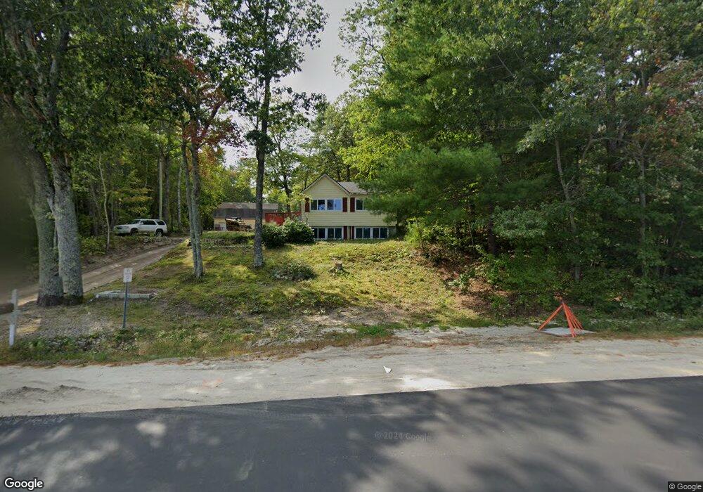
This home is located at 47 N Raymond Rd, Gray, ME 04039 and is currently estimated at $441,321, approximately $392 per square foot. 47 N Raymond Rd is a home located in Cumberland County with nearby schools including Gray-New Gloucester High School and Fiddlehead School of Arts & Science.
Ownership History
Date
Name
Owned For
Owner Type
Purchase Details
Closed on
Mar 29, 2022
Sold by
Manchester Cathleen
Bought by
Wallace Dana
Current Estimated Value
Purchase Details
Closed on
Oct 20, 2005
Sold by
Sullivan Daniel and Plummer Vincent
Bought by
Manchester Cathy
Create a Home Valuation Report for This Property
The Home Valuation Report is an in-depth analysis detailing your home's value as well as a comparison with similar homes in the area
Home Values in the Area
Average Home Value in this Area
Purchase History
| Date | Buyer | Sale Price | Title Company |
|---|---|---|---|
| Wallace Dana | $239,600 | None Available | |
| Manchester Cathy | -- | -- |
Source: Public Records
Tax History Compared to Growth
Tax History
| Year | Tax Paid | Tax Assessment Tax Assessment Total Assessment is a certain percentage of the fair market value that is determined by local assessors to be the total taxable value of land and additions on the property. | Land | Improvement |
|---|---|---|---|---|
| 2024 | $4,031 | $415,600 | $142,800 | $272,800 |
| 2023 | $3,674 | $242,000 | $62,700 | $179,300 |
| 2022 | $3,376 | $242,000 | $62,700 | $179,300 |
| 2021 | $3,270 | $223,800 | $62,700 | $161,100 |
| 2020 | $3,301 | $223,800 | $62,700 | $161,100 |
| 2019 | $3,301 | $223,800 | $62,700 | $161,100 |
| 2018 | $3,133 | $223,800 | $62,700 | $161,100 |
| 2017 | $2,780 | $146,300 | $56,200 | $90,100 |
| 2016 | $2,677 | $146,300 | $56,200 | $90,100 |
| 2015 | $2,617 | $143,800 | $56,200 | $87,600 |
| 2014 | $2,617 | $143,800 | $56,200 | $87,600 |
| 2012 | $2,279 | $143,755 | $56,167 | $87,588 |
Source: Public Records
Map
Nearby Homes
- 167 Weymouth Rd
- 74 May Meadow Dr
- 153 Shaker Rd
- 4 Wanda Ln
- 65 Blueberry Ln
- 00 N Shore Rd
- 150 Birchwood Rd
- 127 Shaker Rd Unit 61
- 127 Shaker Rd Unit 37
- 11-007 Westwood Rd
- M011-006 Westwood Rd
- 28 Oak Dr
- Lot 3-12B Johnson Rd
- 2 Dr
- 17 Callaway Dr Unit 17
- 10 Notched Pond Rd
- 27 Callaway Dr Unit 27B
- 27 Callaway Dr Unit 27A
- 263 Mayall Rd
- 27 Boulder Dr
- 45 N Raymond Rd
- 49 N Raymond Rd
- 41 N Raymond Rd
- 0 Mayberry
- 51 N Raymond Rd
- 38 N Raymond Rd
- 53 N Raymond Rd
- 39 N Raymond Rd
- 35 N Raymond Rd
- 12 Mayberry
- 36 N Raymond Rd
- 8 Mayberry Rd
- 33 N Raymond Rd
- 34 N Raymond Rd
- 34 N Raymond Rd
- 10 Mayberry Rd
- 29 N Raymond Rd
- 14 Mayberry Rd
- 16 Mayberry Rd
- 32 N Raymond Rd