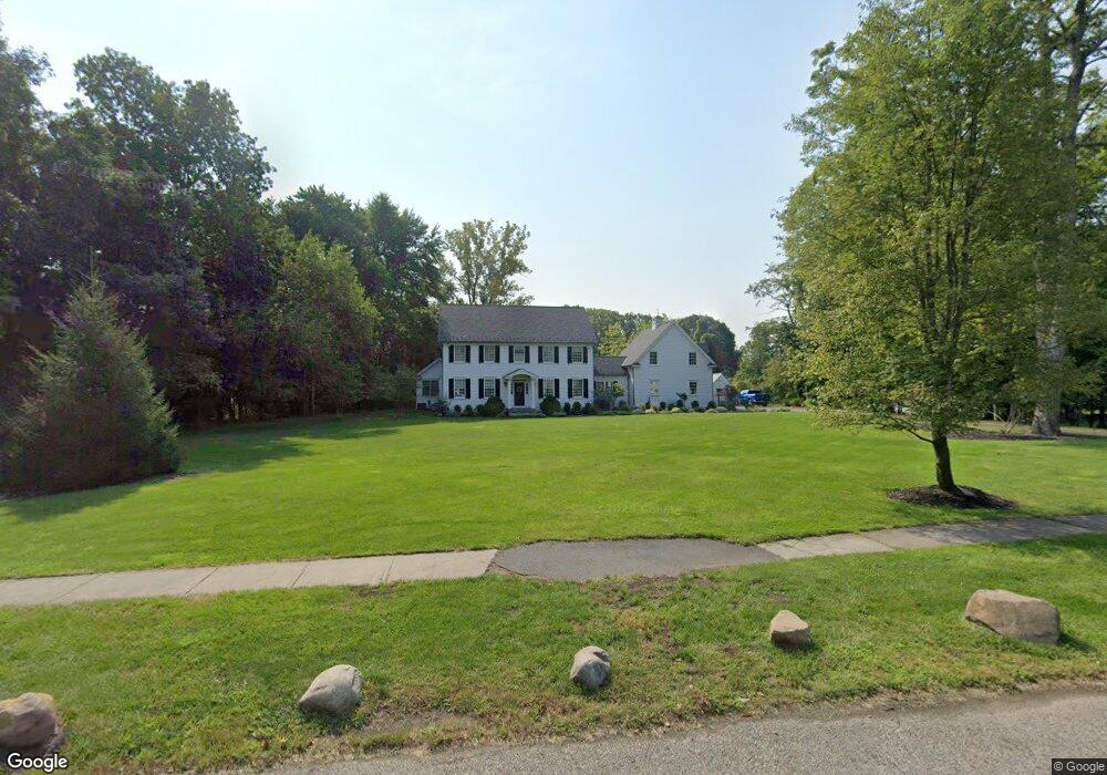
47 Old Tappan Rd Old Tappan, NJ 07675
Estimated Value: $1,244,000 - $2,203,000
--
Bed
--
Bath
3,414
Sq Ft
$511/Sq Ft
Est. Value
About This Home
This home is located at 47 Old Tappan Rd, Old Tappan, NJ 07675 and is currently estimated at $1,743,253, approximately $510 per square foot. 47 Old Tappan Rd is a home with nearby schools including T. Baldwin Demarest Elementary School, Charles DeWolf Middle School, and Northern Valley Regional High School at Old Tappan.
Ownership History
Date
Name
Owned For
Owner Type
Purchase Details
Closed on
Dec 15, 2016
Sold by
Gigante Teresa
Bought by
Brunnquell Stephen and Brunnquell Donna
Current Estimated Value
Purchase Details
Closed on
May 11, 2005
Sold by
Pollina Raymond
Bought by
Gigante Teresa
Home Financials for this Owner
Home Financials are based on the most recent Mortgage that was taken out on this home.
Original Mortgage
$644,000
Interest Rate
5.73%
Create a Home Valuation Report for This Property
The Home Valuation Report is an in-depth analysis detailing your home's value as well as a comparison with similar homes in the area
Home Values in the Area
Average Home Value in this Area
Purchase History
| Date | Buyer | Sale Price | Title Company |
|---|---|---|---|
| Brunnquell Stephen | $742,500 | First Jersey Title Services | |
| Gigante Teresa | $920,000 | -- |
Source: Public Records
Mortgage History
| Date | Status | Borrower | Loan Amount |
|---|---|---|---|
| Previous Owner | Gigante Teresa | $644,000 |
Source: Public Records
Tax History Compared to Growth
Tax History
| Year | Tax Paid | Tax Assessment Tax Assessment Total Assessment is a certain percentage of the fair market value that is determined by local assessors to be the total taxable value of land and additions on the property. | Land | Improvement |
|---|---|---|---|---|
| 2025 | $25,825 | $1,172,800 | $560,600 | $612,200 |
| 2024 | $25,262 | $1,172,800 | $560,600 | $612,200 |
| 2023 | $24,957 | $1,172,800 | $560,600 | $612,200 |
| 2022 | $24,957 | $1,172,800 | $560,600 | $612,200 |
| 2021 | $24,899 | $1,172,800 | $560,600 | $612,200 |
| 2020 | $24,535 | $1,172,800 | $560,600 | $612,200 |
| 2019 | $24,121 | $1,169,200 | $560,600 | $608,600 |
| 2018 | $11,330 | $560,600 | $560,600 | $0 |
| 2017 | $11,240 | $560,600 | $560,600 | $0 |
| 2016 | $10,949 | $560,600 | $560,600 | $0 |
| 2015 | $10,775 | $560,600 | $560,600 | $0 |
| 2014 | $10,489 | $560,600 | $560,600 | $0 |
Source: Public Records
Map
Nearby Homes
- 43 Old Tappan Rd
- 1 Woods Edge Rd
- 407 Semino Rd
- 7 Orchard Ln
- 32 Moeser Place
- 28 Woods Edge Rd
- 407 Overbrook Rd
- 26 Summit Ave
- 12 Hickory Hill Ln Unit 33
- 13 Central Ave
- 192 White Ave
- 35 Andre Ave
- 415 Briarwood Ln
- 11 Oconnors Ln
- 11 Oconners Ln
- 9 Ross Place
- 121 Constitution Dr
- 121 Winding Creek
- 125 Constitution Dr
- 78 Main St