Estimated Value: $347,493 - $366,000
2
Beds
2
Baths
1,134
Sq Ft
$315/Sq Ft
Est. Value
About This Home
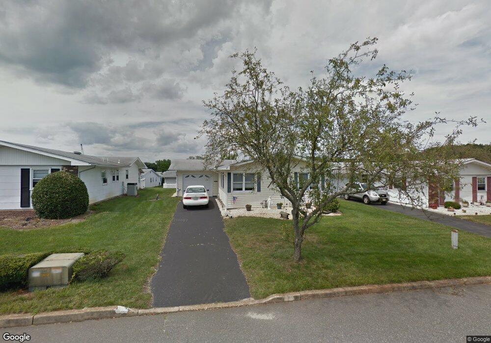
This home is located at 47 Patmore Rd, Brick, NJ 08724 and is currently estimated at $356,873, approximately $314 per square foot. 47 Patmore Rd is a home located in Ocean County with nearby schools including Lanes Mill Elementary School, Veterans Memorial Middle School, and Brick Township Memorial High School.
Ownership History
Date
Name
Owned For
Owner Type
Purchase Details
Closed on
Aug 6, 2004
Sold by
Sweetman James R and Sweetman Susan H
Bought by
Destasio Lucille
Current Estimated Value
Home Financials for this Owner
Home Financials are based on the most recent Mortgage that was taken out on this home.
Original Mortgage
$140,800
Interest Rate
5.81%
Mortgage Type
Fannie Mae Freddie Mac
Purchase Details
Closed on
Aug 1, 2002
Sold by
Kern Lorraine E
Bought by
Sweetman James and Sweetman Susan
Home Financials for this Owner
Home Financials are based on the most recent Mortgage that was taken out on this home.
Original Mortgage
$90,000
Interest Rate
6.48%
Purchase Details
Closed on
Aug 3, 1995
Sold by
Milani E O Mario
Bought by
Kern Lorraine E
Home Financials for this Owner
Home Financials are based on the most recent Mortgage that was taken out on this home.
Original Mortgage
$55,000
Interest Rate
7.48%
Create a Home Valuation Report for This Property
The Home Valuation Report is an in-depth analysis detailing your home's value as well as a comparison with similar homes in the area
Home Values in the Area
Average Home Value in this Area
Purchase History
| Date | Buyer | Sale Price | Title Company |
|---|---|---|---|
| Destasio Lucille | $176,000 | -- | |
| Sweetman James | $130,000 | -- | |
| Kern Lorraine E | $69,000 | -- |
Source: Public Records
Mortgage History
| Date | Status | Borrower | Loan Amount |
|---|---|---|---|
| Previous Owner | Destasio Lucille | $140,800 | |
| Previous Owner | Sweetman James | $90,000 | |
| Previous Owner | Kern Lorraine E | $55,000 |
Source: Public Records
Tax History
| Year | Tax Paid | Tax Assessment Tax Assessment Total Assessment is a certain percentage of the fair market value that is determined by local assessors to be the total taxable value of land and additions on the property. | Land | Improvement |
|---|---|---|---|---|
| 2025 | $2,884 | $110,500 | $40,000 | $70,500 |
| 2024 | $2,237 | $110,500 | $40,000 | $70,500 |
Source: Public Records
Map
Nearby Homes
Your Personal Tour Guide
Ask me questions while you tour the home.