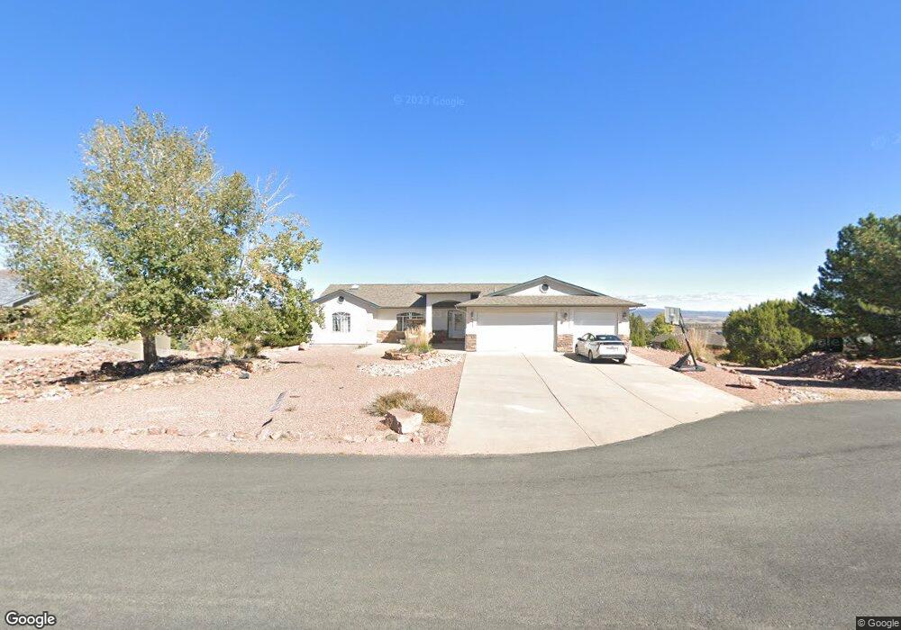
47 Primrose Ct Cañon City, CO 81212
Estimated Value: $595,858 - $631,000
4
Beds
3
Baths
3,349
Sq Ft
$183/Sq Ft
Est. Value
About This Home
This home is located at 47 Primrose Ct, Cañon City, CO 81212 and is currently estimated at $614,215, approximately $183 per square foot. 47 Primrose Ct is a home located in Fremont County with nearby schools including Lincoln School of Science & Technology, Canon City Middle School, and Canon City High School.
Ownership History
Date
Name
Owned For
Owner Type
Purchase Details
Closed on
May 4, 2023
Sold by
Dealejandro Ruben
Bought by
Hockaday Brently Shane and Hockaday Amanda Suzanne
Current Estimated Value
Home Financials for this Owner
Home Financials are based on the most recent Mortgage that was taken out on this home.
Original Mortgage
$549,000
Outstanding Balance
$533,818
Interest Rate
6.42%
Mortgage Type
New Conventional
Estimated Equity
$80,397
Purchase Details
Closed on
Feb 21, 2023
Sold by
Dealejandro Ruben
Bought by
Dealejandro Ruben and Grinnals Malissa
Create a Home Valuation Report for This Property
The Home Valuation Report is an in-depth analysis detailing your home's value as well as a comparison with similar homes in the area
Home Values in the Area
Average Home Value in this Area
Purchase History
| Date | Buyer | Sale Price | Title Company |
|---|---|---|---|
| Hockaday Brently Shane | $599,000 | None Listed On Document | |
| Dealejandro Ruben | -- | Fidelity National Title |
Source: Public Records
Mortgage History
| Date | Status | Borrower | Loan Amount |
|---|---|---|---|
| Open | Hockaday Brently Shane | $549,000 |
Source: Public Records
Tax History Compared to Growth
Tax History
| Year | Tax Paid | Tax Assessment Tax Assessment Total Assessment is a certain percentage of the fair market value that is determined by local assessors to be the total taxable value of land and additions on the property. | Land | Improvement |
|---|---|---|---|---|
| 2024 | $2,974 | $37,072 | $0 | $0 |
| 2023 | $2,974 | $26,329 | $0 | $0 |
| 2022 | $1,680 | $26,194 | $0 | $0 |
| 2021 | $1,684 | $26,948 | $0 | $0 |
| 2020 | $1,283 | $22,332 | $0 | $0 |
| 2019 | $1,267 | $22,332 | $0 | $0 |
| 2018 | $1,088 | $19,913 | $0 | $0 |
| 2017 | $1,013 | $19,913 | $0 | $0 |
| 2016 | $942 | $20,740 | $0 | $0 |
| 2015 | $1,526 | $20,740 | $0 | $0 |
| 2012 | $1,503 | $21,585 | $3,582 | $18,003 |
Source: Public Records
Map
Nearby Homes
- 159 Blue Grouse Dr
- 68 Wild Rose Ct
- 137 Wild Rose Dr
- 135 Wild Rose Dr
- 131 Wild Rose Dr
- 133 Blue Grouse Dr
- 140 N Osprey Ct
- 204 Storm Ridge Dr
- 123 Wild Rose Dr
- 87 Eagle Crest Loop
- 85 Eagle Crest Loop
- 154 S Osprey Ct
- 156 Osprey Ct
- 156 S Osprey Ct
- 131 Eagle Crest Loop
- 28 Eagle Crest Dr
- 29 Kyndra Ct
- TBD Wild Rose Dr
- 410/414 Storm Ridge Dr
- 105 Bobwhite Loop
- 45 Primrose Ct
- 49 Primrose Ct
- 48 Silverado Ct
- 50 Silverado Ct
- 46 Silverado Ct
- 48 Primrose Ct
- 48 Primrose Ct Unit 60
- 46 Primrose Ct
- 50 Primrose Ct
- 000 Silver Bear Trail
- 153 Mourning Dove Dr
- 44 Silverado Ct
- 149 Mourning Dove Dr
- TBD Silverado Ct
- 47 Silverado Ct
- 155 Mourning Dove Dr
- 47 Oak Leaf Ct
- 158 Mourning Dove Dr
- 45 Silverado Ct
- 146 Mourning Dove Dr