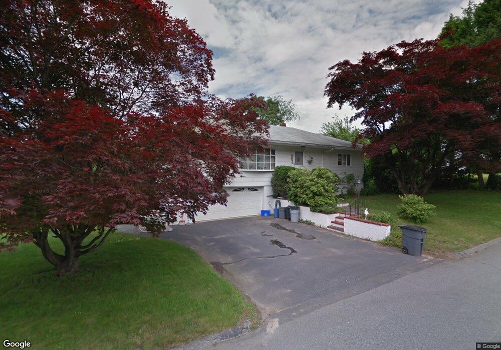
47 Ridge Rd Methuen, MA 01844
The East End NeighborhoodEstimated Value: $502,000 - $626,000
2
Beds
3
Baths
2,019
Sq Ft
$280/Sq Ft
Est. Value
About This Home
This home is located at 47 Ridge Rd, Methuen, MA 01844 and is currently estimated at $565,633, approximately $280 per square foot. 47 Ridge Rd is a home located in Essex County with nearby schools including Timony Grammar School, Methuen High School, and Community Day Charter Public School - Gateway.
Ownership History
Date
Name
Owned For
Owner Type
Purchase Details
Closed on
Aug 8, 2019
Sold by
Saffie Albert R and Saffie Mildred H
Bought by
Saffie Joanne E
Current Estimated Value
Purchase Details
Closed on
Feb 28, 1995
Sold by
Andersen Frederick P
Bought by
Saffie Albert R
Purchase Details
Closed on
May 1, 1989
Sold by
Moschetto Thomas
Bought by
Andersen Frederick
Home Financials for this Owner
Home Financials are based on the most recent Mortgage that was taken out on this home.
Original Mortgage
$120,000
Interest Rate
10.9%
Mortgage Type
Purchase Money Mortgage
Create a Home Valuation Report for This Property
The Home Valuation Report is an in-depth analysis detailing your home's value as well as a comparison with similar homes in the area
Home Values in the Area
Average Home Value in this Area
Purchase History
| Date | Buyer | Sale Price | Title Company |
|---|---|---|---|
| Saffie Joanne E | -- | -- | |
| Saffie Joanne E | -- | -- | |
| Saffie Joanne E | -- | -- | |
| Saffie Albert R | $125,000 | -- | |
| Saffie Albert R | $125,000 | -- | |
| Andersen Frederick | $160,000 | -- |
Source: Public Records
Mortgage History
| Date | Status | Borrower | Loan Amount |
|---|---|---|---|
| Previous Owner | Andersen Frederick | $121,000 | |
| Previous Owner | Andersen Frederick | $120,000 |
Source: Public Records
Tax History
| Year | Tax Paid | Tax Assessment Tax Assessment Total Assessment is a certain percentage of the fair market value that is determined by local assessors to be the total taxable value of land and additions on the property. | Land | Improvement |
|---|---|---|---|---|
| 2025 | $4,917 | $464,700 | $207,200 | $257,500 |
| 2024 | $4,849 | $446,500 | $189,000 | $257,500 |
| 2023 | $4,569 | $390,500 | $168,000 | $222,500 |
| 2022 | $4,390 | $336,400 | $140,000 | $196,400 |
| 2021 | $4,121 | $312,400 | $133,000 | $179,400 |
| 2020 | $4,110 | $305,800 | $133,000 | $172,800 |
| 2019 | $3,840 | $270,600 | $119,000 | $151,600 |
| 2018 | $3,752 | $262,900 | $119,000 | $143,900 |
| 2017 | $3,639 | $248,400 | $119,000 | $129,400 |
| 2016 | $3,477 | $234,800 | $112,000 | $122,800 |
| 2015 | $3,370 | $230,800 | $112,000 | $118,800 |
Source: Public Records
Map
Nearby Homes
- 18 Erhardt Terrace
- 7 Erhardt Terrace
- 32 Josephine Ave
- 106 Leroy Ave
- 39 Swan Ave
- 264 E Haverhill St Unit 2
- 12 Annette St
- 14 Court St
- 68 Ashford St
- 109 Ferry St
- 2 Leslie St
- 1 Riverview Blvd Unit 8-203
- 65 Arthur St
- 25-27 Bicknell Ave
- 5 Kendrick St
- 37 Albion St
- 192 Union St
- 27 Woodland Ct
- 173 Jackson St
- 80-82 Haverhill St
- 26 Erhardt Terrace
- 43 Ridge Rd
- 22 Erhardt Terrace
- 42 Ridge Rd
- 46 Ridge Rd
- 38 Ridge Rd
- 50 Lorenzo Cir
- 27 Erhardt Terrace
- 45 Meadowbrook Rd
- 75 Lorenzo Cir
- 37 Ridge Rd
- 46 Lorenzo Cir
- 23 Erhardt Terrace
- 43 Meadowbrook Rd
- 44 Linwood Ave
- 30 Ridge Rd
- 37 Meadowbrook Rd
- 38 Linwood Ave
- 41 Weisner Pkwy
- 71 Lorenzo Cir
Your Personal Tour Guide
Ask me questions while you tour the home.