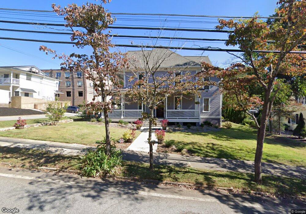
47 S Park St Dahlonega, GA 30533
Estimated Value: $83,970
--
Bed
--
Bath
2,704
Sq Ft
$31/Sq Ft
Est. Value
About This Home
This home is located at 47 S Park St, Dahlonega, GA 30533 and is currently priced at $83,970, approximately $31 per square foot. 47 S Park St is a home located in Lumpkin County with nearby schools including Clay County Middle School and Lumpkin County High School.
Ownership History
Date
Name
Owned For
Owner Type
Purchase Details
Closed on
Jul 15, 2021
Sold by
City Of Dahlonega Georgia
Bought by
Downtown Dev Authority Of City Of Dahlon
Current Estimated Value
Purchase Details
Closed on
Oct 30, 2018
Sold by
Thomas & Tommye Scanlin Charitable Remai
Bought by
City Of Dahlonega
Purchase Details
Closed on
Oct 9, 2003
Sold by
Mcghee Carroll
Bought by
Scanlin Thomas E
Purchase Details
Closed on
May 15, 1990
Bought by
Mcghee Carroll
Purchase Details
Closed on
Feb 1, 1976
Bought by
Elder Ernest
Create a Home Valuation Report for This Property
The Home Valuation Report is an in-depth analysis detailing your home's value as well as a comparison with similar homes in the area
Home Values in the Area
Average Home Value in this Area
Purchase History
| Date | Buyer | Sale Price | Title Company |
|---|---|---|---|
| Downtown Dev Authority Of City Of Dahlon | -- | -- | |
| City Of Dahlonega | $47,500 | -- | |
| City Of Dahlonega | $475,000 | -- | |
| City Of Dahlonega | $475,000 | -- | |
| Scanlin Thomas E | $350,000 | -- | |
| Mcghee Carroll | $70,000 | -- | |
| Elder Ernest | -- | -- |
Source: Public Records
Tax History Compared to Growth
Tax History
| Year | Tax Paid | Tax Assessment Tax Assessment Total Assessment is a certain percentage of the fair market value that is determined by local assessors to be the total taxable value of land and additions on the property. | Land | Improvement |
|---|---|---|---|---|
| 2024 | -- | $209,357 | $57,333 | $152,024 |
| 2023 | $0 | $64,013 | $28,666 | $35,347 |
| 2022 | $3,766 | $123,277 | $28,666 | $94,611 |
| 2021 | $4,237 | $116,414 | $28,666 | $87,748 |
| 2020 | $4,237 | $116,414 | $28,666 | $87,748 |
| 2019 | $4,237 | $116,414 | $28,666 | $87,748 |
| 2018 | $4,237 | $116,414 | $28,666 | $87,748 |
| 2017 | $4,309 | $116,414 | $28,666 | $87,748 |
| 2016 | $4,404 | $116,414 | $28,666 | $87,748 |
| 2015 | $3,877 | $116,414 | $28,666 | $87,748 |
| 2014 | $3,877 | $119,787 | $28,666 | $91,120 |
| 2013 | -- | $123,159 | $28,666 | $94,492 |
Source: Public Records
Map
Nearby Homes
- 0 S Chestatee St Unit 10619536
- 0 Highway 19 N Unit 10594984
- 1392 S Chestatee St
- 315 Church St
- 95 Jones St
- 168 W Main St
- 120 Riley Rd
- 329 Morrison Moore Pkwy E
- 399 N Chestatee St
- 6480A Highway 52
- 0 Highway 60 Unit 7241582
- 0 Highway 9 S Unit 10487179
- 0 Highway 9 S Unit 7548614
- 0 Calhoun Rd Unit 7643314
- 0 Calhoun Rd Unit 10598012
- 00 Calhoun Rd
- 502 Wimpy Mill Rd
- 0 Alicia Ln
- 94 Mountain View Dr
- 0 Crown Mountain Unit 7682225
- 65 S Park St
- 199 Choice Ave
- 83 S Park St
- 27 S Park St
- 40 Public Square S
- 107 S Park St
- 85 S Chestatee St
- 6.05 Ac S Chestatee St
- 184 Maple St
- 00 S Chestatee St
- 0 S Chestatee St
- 0 S Chestatee St Unit 7578343
- 0 S Chestatee St Unit 10520838
- 0 S Chestatee St Unit 7542481
- 0 S Chestatee St Unit 10410921
- 0 S Chestatee St Unit 7498320
- 0 S Chestatee St Unit 7041783
- 0 S Chestatee St Unit 7418619
- 0 S Chestatee St Unit 10335471
- 0 S Chestatee St Unit 8347022