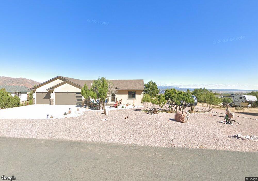
47 Silverado Ct Canon City, CO 81212
Estimated Value: $505,000 - $543,000
3
Beds
2
Baths
1,780
Sq Ft
$294/Sq Ft
Est. Value
About This Home
This home is located at 47 Silverado Ct, Canon City, CO 81212 and is currently estimated at $523,461, approximately $294 per square foot. 47 Silverado Ct is a home located in Fremont County with nearby schools including Lincoln School of Science & Technology, Canon City Middle School, and Canon City High School.
Ownership History
Date
Name
Owned For
Owner Type
Purchase Details
Closed on
Jul 27, 2022
Sold by
Carder Mark L and Carder Tanya G
Bought by
Carder Mark L and Carder Tanya G
Current Estimated Value
Purchase Details
Closed on
Dec 2, 2019
Sold by
Charlene K Southern & Mark A Kelemen Jlt
Bought by
Wetters Lynn E and Bellantoni Angela M
Purchase Details
Closed on
Dec 11, 2013
Sold by
Southern Charlene and Kelemen Mark A
Bought by
The Charlene K Southern & Mark A Kelemen
Create a Home Valuation Report for This Property
The Home Valuation Report is an in-depth analysis detailing your home's value as well as a comparison with similar homes in the area
Home Values in the Area
Average Home Value in this Area
Purchase History
| Date | Buyer | Sale Price | Title Company |
|---|---|---|---|
| Carder Mark L | -- | None Listed On Document | |
| Wetters Lynn E | $31,960 | None Available | |
| The Charlene K Southern & Mark A Kelemen | -- | None Available |
Source: Public Records
Tax History Compared to Growth
Tax History
| Year | Tax Paid | Tax Assessment Tax Assessment Total Assessment is a certain percentage of the fair market value that is determined by local assessors to be the total taxable value of land and additions on the property. | Land | Improvement |
|---|---|---|---|---|
| 2024 | $2,559 | $32,408 | $0 | $0 |
| 2023 | $2,559 | $31,708 | $0 | $0 |
| 2022 | $633 | $7,250 | $7,250 | $0 |
| 2021 | $617 | $7,250 | $7,250 | $0 |
| 2020 | $613 | $7,250 | $7,250 | $0 |
| 2019 | $605 | $7,250 | $7,250 | $0 |
| 2018 | $620 | $7,250 | $0 | $0 |
| 2017 | $578 | $7,250 | $0 | $0 |
| 2016 | $534 | $7,250 | $0 | $0 |
| 2015 | $533 | $7,250 | $0 | $0 |
| 2012 | $200 | $2,871 | $2,871 | $0 |
Source: Public Records
Map
Nearby Homes
- 159 Blue Grouse Dr
- 137 Wild Rose Dr
- 135 Wild Rose Dr
- 133 Blue Grouse Dr
- 131 Wild Rose Dr
- 123 Wild Rose Dr
- 68 Wild Rose Ct
- 29 Kyndra Ct
- 140 N Osprey Ct
- 142 N Osprey Ct
- 154 S Osprey Ct
- 204 Storm Ridge Dr
- 87 Eagle Crest Loop
- 85 Eagle Crest Loop
- 156 Osprey Ct
- 156 S Osprey Ct
- 131 Eagle Crest Loop
- 28 Eagle Crest Dr
- TBD Wild Rose Dr
- 105 Bobwhite Loop
- 48 Cougar Loop
- 146 Mourning Dove Dr
- 45 Silverado Ct
- 144 Mourning Dove Dr
- 48 Silverado Ct
- TBD Silverado Ct
- 50 Silverado Ct
- 000 Silver Bear Trail
- 44 Cougar Loop
- 46 Silverado Ct
- 44 Silverado Ct
- 140 Mourning Dove Dr
- 145 Mourning Dove Dr
- 143 Mourning Dove Dr
- 47 Primrose Ct
- 149 Mourning Dove Dr
- 49 Primrose Ct
- 45 Primrose Ct
- 42 Cougar Loop
- 159 Mourning Dove Dr