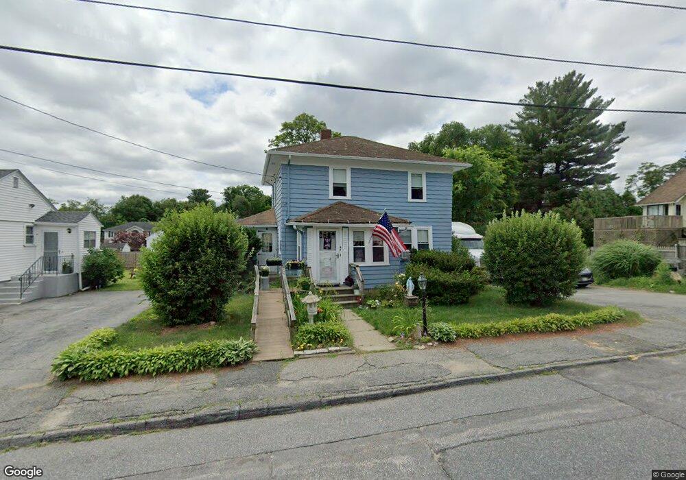
47 Spofford Rd Worcester, MA 01607
South Quinsigamond Village NeighborhoodEstimated Value: $386,000 - $487,000
4
Beds
1
Bath
1,353
Sq Ft
$312/Sq Ft
Est. Value
About This Home
This home is located at 47 Spofford Rd, Worcester, MA 01607 and is currently estimated at $422,189, approximately $312 per square foot. 47 Spofford Rd is a home located in Worcester County with nearby schools including Quinsigamond School, Jacob Hiatt Magnet School, and Chandler Magnet.
Create a Home Valuation Report for This Property
The Home Valuation Report is an in-depth analysis detailing your home's value as well as a comparison with similar homes in the area
Home Values in the Area
Average Home Value in this Area
Tax History
| Year | Tax Paid | Tax Assessment Tax Assessment Total Assessment is a certain percentage of the fair market value that is determined by local assessors to be the total taxable value of land and additions on the property. | Land | Improvement |
|---|---|---|---|---|
| 2025 | $4,660 | $353,300 | $117,700 | $235,600 |
| 2024 | $4,598 | $334,400 | $117,700 | $216,700 |
| 2023 | $4,407 | $307,300 | $102,400 | $204,900 |
| 2022 | $4,057 | $266,700 | $81,900 | $184,800 |
| 2021 | $3,865 | $237,400 | $65,500 | $171,900 |
| 2020 | $3,781 | $222,400 | $65,500 | $156,900 |
| 2019 | $3,654 | $203,000 | $58,900 | $144,100 |
| 2018 | $3,653 | $193,200 | $58,900 | $134,300 |
| 2017 | $3,540 | $184,200 | $58,900 | $125,300 |
| 2016 | $3,460 | $167,900 | $42,900 | $125,000 |
| 2015 | $3,370 | $167,900 | $42,900 | $125,000 |
| 2014 | $3,281 | $167,900 | $42,900 | $125,000 |
Source: Public Records
Map
Nearby Homes
- 29 Steele St
- 557 SW Cutoff Unit 17
- 557 SW Cutoff Unit 55
- 557 SW Cutoff Unit 60
- 22 Bittersweet Blvd
- 50 Sophia Dr
- 4 Stockholm St
- 73 Sophia Dr
- 30 Ekman St
- 6 Beckman St
- 50 Whipple St
- 154 Pakachoag St
- 6 Epworth St
- 204-212 Hampton St
- 457 Granite St
- 47 Gibbs St
- 38 Garnet St
- 1034 Southbridge St
- 464-466 Granite St
- 460-462 Granite St
Your Personal Tour Guide
Ask me questions while you tour the home.