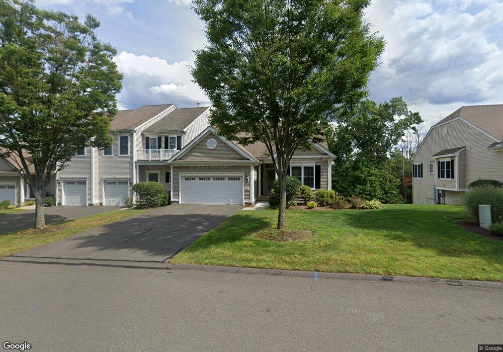
47 Sterling Dr Newington, CT 06111
Estimated Value: $444,756 - $498,000
2
Beds
2
Baths
1,592
Sq Ft
$296/Sq Ft
Est. Value
About This Home
This home is located at 47 Sterling Dr, Newington, CT 06111 and is currently estimated at $470,439, approximately $295 per square foot. 47 Sterling Dr is a home located in Hartford County with nearby schools including Anna Reynolds School, Martin Kellogg Middle School, and Newington High School.
Ownership History
Date
Name
Owned For
Owner Type
Purchase Details
Closed on
May 5, 2016
Sold by
Weinbaum Kenneth B and Weinbaum Myra N
Bought by
Brown Maurice
Current Estimated Value
Home Financials for this Owner
Home Financials are based on the most recent Mortgage that was taken out on this home.
Original Mortgage
$186,000
Outstanding Balance
$147,911
Interest Rate
3.71%
Mortgage Type
Purchase Money Mortgage
Estimated Equity
$322,528
Purchase Details
Closed on
Aug 27, 2008
Sold by
Fnma
Bought by
Weinbaum Kenneth B and Weinbaum Myra N
Purchase Details
Closed on
Jun 2, 2006
Sold by
Pulte Homes New Eng Ll
Bought by
Amouyal Ilan M and Amouyal Kinerey
Home Financials for this Owner
Home Financials are based on the most recent Mortgage that was taken out on this home.
Original Mortgage
$321,655
Interest Rate
6.55%
Create a Home Valuation Report for This Property
The Home Valuation Report is an in-depth analysis detailing your home's value as well as a comparison with similar homes in the area
Home Values in the Area
Average Home Value in this Area
Purchase History
| Date | Buyer | Sale Price | Title Company |
|---|---|---|---|
| Brown Maurice | $281,000 | -- | |
| Weinbaum Kenneth B | $275,000 | -- | |
| Amouyal Ilan M | $338,585 | -- |
Source: Public Records
Mortgage History
| Date | Status | Borrower | Loan Amount |
|---|---|---|---|
| Open | Brown Maurice | $186,000 | |
| Previous Owner | Amouyal Ilan M | $321,655 |
Source: Public Records
Tax History Compared to Growth
Tax History
| Year | Tax Paid | Tax Assessment Tax Assessment Total Assessment is a certain percentage of the fair market value that is determined by local assessors to be the total taxable value of land and additions on the property. | Land | Improvement |
|---|---|---|---|---|
| 2025 | $7,623 | $190,670 | $0 | $190,670 |
| 2024 | $7,564 | $190,670 | $0 | $190,670 |
| 2023 | $7,314 | $190,670 | $0 | $190,670 |
| 2022 | $7,339 | $190,670 | $0 | $190,670 |
| 2021 | $7,400 | $190,670 | $0 | $190,670 |
| 2020 | $7,644 | $194,600 | $0 | $194,600 |
| 2019 | $7,677 | $194,600 | $0 | $194,600 |
| 2018 | $7,492 | $194,600 | $0 | $194,600 |
| 2017 | $7,120 | $194,600 | $0 | $194,600 |
| 2016 | $6,957 | $194,600 | $0 | $194,600 |
| 2014 | $6,473 | $186,160 | $0 | $186,160 |
Source: Public Records
Map
Nearby Homes
- 236 Sterling Dr Unit 236
- 218 Sterling Dr Unit 218
- 228 Reservoir Rd
- 31 Dacosta Dr
- 16 Thornton Dr
- 305 Hampton Ct
- 20 Surrey Dr Unit B16 aka B4
- 140 Camp Ave
- 54 Red Top Dr
- 105 Gilbert Rd
- 9 Old Farm Dr
- 7 Old Farm Dr
- 135 Village Square Dr Unit 1
- 25 Fowler Dr
- 35 Harding Ave
- 47 Francis Dr
- 27 Harding Ave
- 760 Willard Ave
- 84 Barbour Rd
- 164 Brittany Farms Rd Unit A
- 47 Sterling Dr Unit 47
- 53 Sterling Dr
- 41 Sterling Dr
- 59 Sterling Dr
- 35 Sterling Dr
- 35 Sterling Dr Unit 35
- 65 Sterling Dr
- 29 Sterling Dr
- 71 Sterling Dr
- 68 Sterling Dr
- 68 Sterling Dr Unit 68
- 50 Sterling Dr
- 77 Sterling Dr
- 77 Sterling Dr Unit 77
- 56 Sterling Dr
- 56 Sterling Dr
- 74 Sterling Dr
- 74 Sterling Dr Unit 74
- 23 Sterling Dr
- 89 Sterling Dr