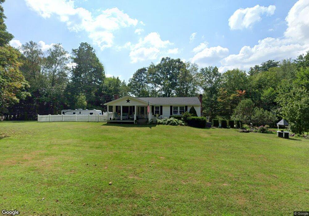
47 T Hall Rd Charlton, MA 01507
Estimated Value: $387,000 - $476,000
3
Beds
1
Bath
1,464
Sq Ft
$297/Sq Ft
Est. Value
About This Home
This home is located at 47 T Hall Rd, Charlton, MA 01507 and is currently estimated at $435,124, approximately $297 per square foot. 47 T Hall Rd is a home located in Worcester County with nearby schools including Shepherd Hill Regional High School.
Ownership History
Date
Name
Owned For
Owner Type
Purchase Details
Closed on
Feb 21, 2020
Sold by
Francesco Jon A and Francesco Norma J
Bought by
Jon A Francesco Lt and Francesco
Current Estimated Value
Purchase Details
Closed on
Oct 19, 2010
Sold by
Francesco Jon A
Bought by
Francesco Jon A and Francesco Norma J
Purchase Details
Closed on
Dec 9, 1994
Sold by
Demers Earl J
Bought by
Francesco Jon A
Home Financials for this Owner
Home Financials are based on the most recent Mortgage that was taken out on this home.
Original Mortgage
$64,800
Interest Rate
9%
Mortgage Type
Purchase Money Mortgage
Create a Home Valuation Report for This Property
The Home Valuation Report is an in-depth analysis detailing your home's value as well as a comparison with similar homes in the area
Home Values in the Area
Average Home Value in this Area
Purchase History
| Date | Buyer | Sale Price | Title Company |
|---|---|---|---|
| Jon A Francesco Lt | -- | None Available | |
| Jon A Francesco Lt | -- | None Available | |
| Francesco Jon A | -- | -- | |
| Francesco Jon A | -- | -- | |
| Francesco Jon A | $81,000 | -- | |
| Francesco Jon A | $81,000 | -- |
Source: Public Records
Mortgage History
| Date | Status | Borrower | Loan Amount |
|---|---|---|---|
| Previous Owner | Francesco Jon A | $79,000 | |
| Previous Owner | Francesco Jon A | $64,800 |
Source: Public Records
Tax History Compared to Growth
Tax History
| Year | Tax Paid | Tax Assessment Tax Assessment Total Assessment is a certain percentage of the fair market value that is determined by local assessors to be the total taxable value of land and additions on the property. | Land | Improvement |
|---|---|---|---|---|
| 2025 | $3,730 | $335,100 | $96,400 | $238,700 |
| 2024 | $3,617 | $319,000 | $96,100 | $222,900 |
| 2023 | $3,556 | $292,200 | $91,300 | $200,900 |
| 2022 | $3,438 | $258,700 | $82,900 | $175,800 |
| 2021 | $3,359 | $223,800 | $78,700 | $145,100 |
| 2020 | $3,299 | $220,800 | $75,700 | $145,100 |
| 2019 | $3,261 | $220,800 | $75,700 | $145,100 |
| 2018 | $2,981 | $220,800 | $75,700 | $145,100 |
| 2017 | $2,828 | $200,600 | $69,700 | $130,900 |
| 2016 | $2,764 | $200,600 | $69,700 | $130,900 |
| 2015 | $2,692 | $200,600 | $69,700 | $130,900 |
| 2014 | $2,346 | $185,300 | $71,300 | $114,000 |
Source: Public Records
Map
Nearby Homes
- 91 Burlingame Rd
- 10 Harrington Rd
- 0 Blood Rd
- 57 Carpenter Hill Rd
- Lot 7 Harrington Rd
- 86 Berry Corner Rd
- 28 Southbridge Rd Unit 402
- 5 Carpenter Hill Rd
- 0 Worcester Rd
- 7 L Stevens Rd Unit A
- 7 L Stevens Rd Unit B
- 0 Trolley Crossing Rd
- 0 Freeman Rd Unit 73369281
- 68 - 74 Sturbridge Rd
- 6 S Sullivan Rd
- 876 Worcester St
- 25 N Main St Unit A
- 102 Worcester Rd
- 149 Berry Corner Rd
- 796 Charlton St