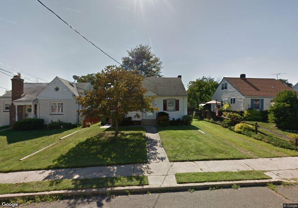
47 Vineyard Ave South Amboy, NJ 08879
Estimated Value: $419,000 - $468,000
3
Beds
1
Bath
787
Sq Ft
$571/Sq Ft
Est. Value
About This Home
This home is located at 47 Vineyard Ave, South Amboy, NJ 08879 and is currently estimated at $449,367, approximately $570 per square foot. 47 Vineyard Ave is a home located in Middlesex County with nearby schools including Sayreville War Memorial High School, St. Mary Elementary School, and Cardinal Mccarrick High School.
Ownership History
Date
Name
Owned For
Owner Type
Purchase Details
Closed on
Dec 26, 2019
Sold by
Kuzinski Joseph and Estate Of Helen Kuzinski
Bought by
Maskuli Dik and Maskuli Ahmed
Current Estimated Value
Home Financials for this Owner
Home Financials are based on the most recent Mortgage that was taken out on this home.
Original Mortgage
$208,000
Outstanding Balance
$183,776
Interest Rate
3.6%
Mortgage Type
New Conventional
Estimated Equity
$265,591
Create a Home Valuation Report for This Property
The Home Valuation Report is an in-depth analysis detailing your home's value as well as a comparison with similar homes in the area
Home Values in the Area
Average Home Value in this Area
Purchase History
| Date | Buyer | Sale Price | Title Company |
|---|---|---|---|
| Maskuli Dik | $260,000 | Quality Ttl & Abstract Agcy |
Source: Public Records
Mortgage History
| Date | Status | Borrower | Loan Amount |
|---|---|---|---|
| Open | Maskuli Dik | $208,000 |
Source: Public Records
Tax History Compared to Growth
Tax History
| Year | Tax Paid | Tax Assessment Tax Assessment Total Assessment is a certain percentage of the fair market value that is determined by local assessors to be the total taxable value of land and additions on the property. | Land | Improvement |
|---|---|---|---|---|
| 2025 | $6,789 | $111,200 | $55,300 | $55,900 |
| 2024 | $6,601 | $111,200 | $55,300 | $55,900 |
| 2023 | $6,601 | $111,200 | $55,300 | $55,900 |
| 2022 | $6,166 | $111,200 | $55,300 | $55,900 |
| 2021 | $6,098 | $111,200 | $55,300 | $55,900 |
| 2020 | $5,944 | $111,200 | $55,300 | $55,900 |
| 2019 | $5,569 | $111,200 | $55,300 | $55,900 |
| 2018 | $5,465 | $111,200 | $55,300 | $55,900 |
| 2017 | $5,332 | $111,200 | $55,300 | $55,900 |
| 2016 | $5,433 | $111,200 | $55,300 | $55,900 |
| 2015 | $5,060 | $111,200 | $55,300 | $55,900 |
| 2014 | $4,917 | $111,200 | $55,300 | $55,900 |
Source: Public Records
Map
Nearby Homes
- 333 Midland Ave
- 179 Gabriel Terrace
- 21 Luke St
- 158 Liberty St
- 158 Liberty St St
- 164 Liberty St
- 10 Dolan Ave
- 37 Hoffman Ave
- 21 Gordon Ave
- 1200 Ernston Rd
- 434 S Pine Ave
- 415 Brook Ave
- 3014 Lighthouse Ln
- 3015 Lighthouse Ln
- 1511 Pebble Place
- 503 Woodland Ave
- 99 Morgan Ave
- 191 Wessco St
- 60 Wlodarczyk Place
- 156 Grabowski Dr
- 45 Vineyard Ave
- 49 Vineyard Ave
- 43 Vineyard Ave
- 280 Vineyard Ave
- 22 Norton St
- 36 Norton St
- 40 Norton St
- 293 Stevens Ave
- 289 Stevens Ave
- 31 Vineyard Ave
- 285 Stevens Ave
- 123 Norton St
- 301 Vineyard Ave
- 281 Stevens Ave
- 27 Vineyard Ave
- 32 Vineyard Ave
- 287 Vineyard Ave
- 127 Norton St
- 285 Vineyard Ave
- 277 Stevens Ave