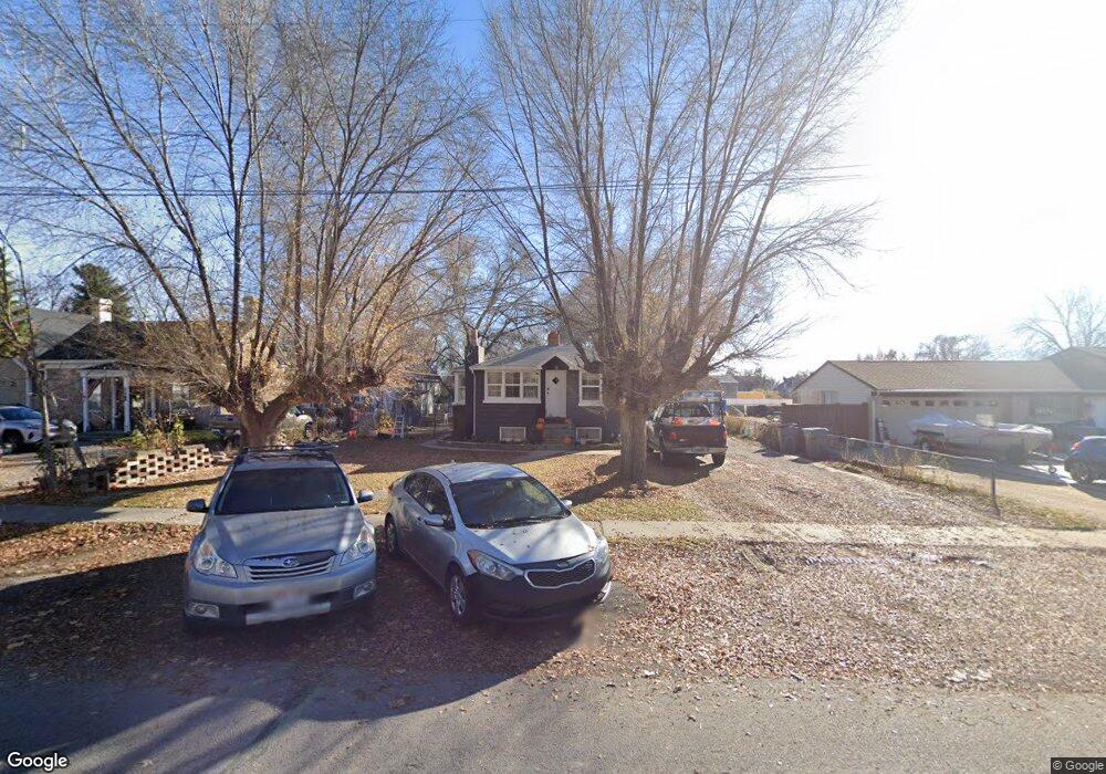
47 W 200 N American Fork, UT 84003
Estimated Value: $372,000 - $465,000
3
Beds
1
Bath
1,363
Sq Ft
$310/Sq Ft
Est. Value
About This Home
This home is located at 47 W 200 N, American Fork, UT 84003 and is currently estimated at $422,458, approximately $309 per square foot. 47 W 200 N is a home located in Utah County with nearby schools including Shelley Elementary School, American Fork Junior High School, and American Fork High School.
Ownership History
Date
Name
Owned For
Owner Type
Purchase Details
Closed on
Jan 12, 2023
Sold by
Turner Cory L
Bought by
Walters Zane and Stanton Marlayna L
Current Estimated Value
Home Financials for this Owner
Home Financials are based on the most recent Mortgage that was taken out on this home.
Original Mortgage
$325,544
Outstanding Balance
$314,972
Interest Rate
6.33%
Mortgage Type
FHA
Estimated Equity
$107,486
Purchase Details
Closed on
Nov 6, 2018
Sold by
Aa Rocky Mountain Bail Bonds Inc
Bought by
Turner Cory L
Home Financials for this Owner
Home Financials are based on the most recent Mortgage that was taken out on this home.
Original Mortgage
$179,193
Interest Rate
4.7%
Mortgage Type
FHA
Create a Home Valuation Report for This Property
The Home Valuation Report is an in-depth analysis detailing your home's value as well as a comparison with similar homes in the area
Home Values in the Area
Average Home Value in this Area
Purchase History
| Date | Buyer | Sale Price | Title Company |
|---|---|---|---|
| Walters Zane | -- | Gateway Title | |
| Turner Cory L | -- | Vanguard Title Ins Agcy Llc |
Source: Public Records
Mortgage History
| Date | Status | Borrower | Loan Amount |
|---|---|---|---|
| Open | Walters Zane | $325,544 | |
| Previous Owner | Turner Cory L | $179,193 |
Source: Public Records
Tax History Compared to Growth
Tax History
| Year | Tax Paid | Tax Assessment Tax Assessment Total Assessment is a certain percentage of the fair market value that is determined by local assessors to be the total taxable value of land and additions on the property. | Land | Improvement |
|---|---|---|---|---|
| 2025 | $1,608 | $195,085 | $201,400 | $153,300 |
| 2024 | $1,608 | $178,695 | $0 | $0 |
| 2023 | $1,497 | $176,330 | $0 | $0 |
| 2022 | $1,699 | $197,505 | $0 | $0 |
| 2021 | $1,445 | $262,400 | $144,500 | $117,900 |
| 2020 | $1,347 | $237,200 | $129,000 | $108,200 |
| 2019 | $1,199 | $218,400 | $110,600 | $107,800 |
| 2018 | $1,109 | $193,200 | $99,500 | $93,700 |
| 2017 | $1,037 | $97,515 | $0 | $0 |
| 2016 | $1,011 | $88,275 | $0 | $0 |
| 2015 | -- | $83,710 | $0 | $0 |
| 2014 | $952 | $77,825 | $0 | $0 |
Source: Public Records
Map
Nearby Homes
- 105 N 100 W
- 129 W Pacific Dr
- 148 N 100 E
- 365 N 100 W
- 161 N Grant Ave
- 374 N Center St
- 146 N Grant Ave
- 396 N 100 E
- 414 N 100 E
- 55 S 200 W
- 370 W Pacific Dr Unit 1
- 120 N 350 W Unit 127
- 120 N 350 W Unit 133
- 120 N 350 W Unit 130
- 317 E 100 N
- 195 S Center St
- 351 Washington Ave
- 51 N 370 E
- 540 N 300 W
- 217 W Main St