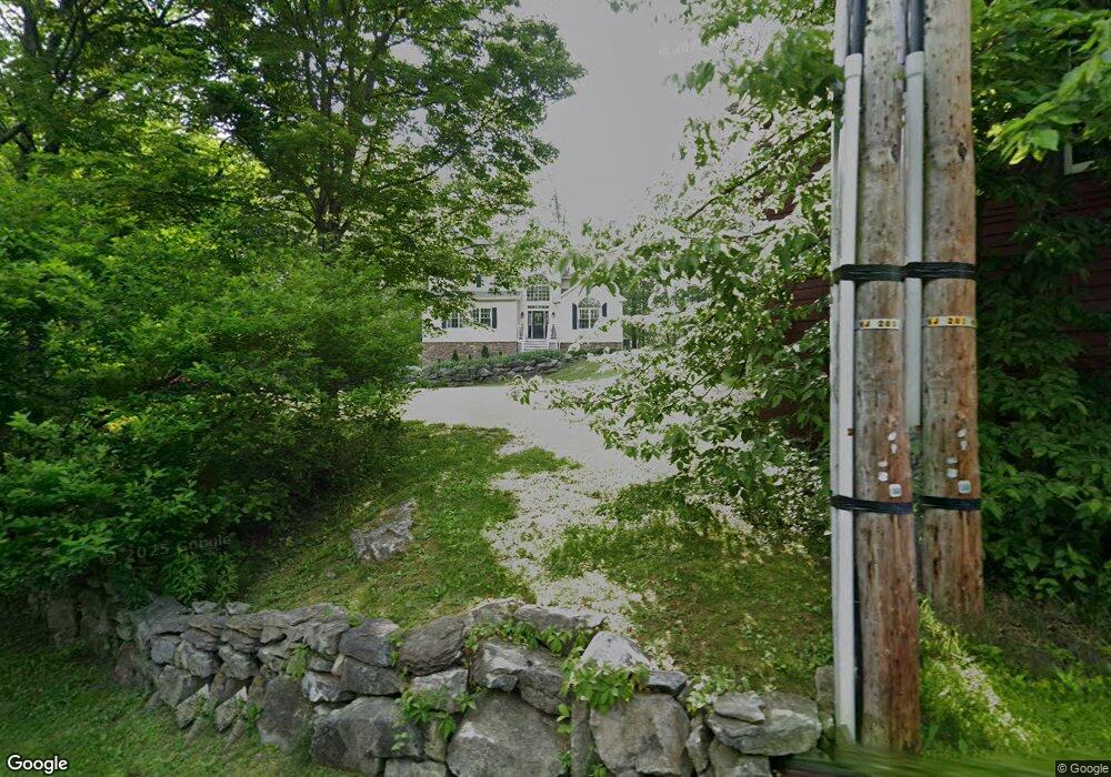
47 Ward Rd Hardwick, NJ 07825
Estimated Value: $600,036 - $647,000
--
Bed
--
Bath
2,792
Sq Ft
$223/Sq Ft
Est. Value
About This Home
This home is located at 47 Ward Rd, Hardwick, NJ 07825 and is currently estimated at $624,009, approximately $223 per square foot. 47 Ward Rd is a home located in Warren County with nearby schools including Blairstown Elementary School, North Warren Regional School, and Ridge & Valley Charter School.
Ownership History
Date
Name
Owned For
Owner Type
Purchase Details
Closed on
Jul 23, 2010
Sold by
The Last Frontier Inc
Bought by
Andrasek Steven and Andrasek Anna C
Current Estimated Value
Home Financials for this Owner
Home Financials are based on the most recent Mortgage that was taken out on this home.
Original Mortgage
$370,017
Outstanding Balance
$247,718
Interest Rate
4.87%
Mortgage Type
FHA
Estimated Equity
$376,291
Purchase Details
Closed on
Oct 30, 2007
Sold by
Matzal Stefan
Bought by
The Last Frontier Inc
Home Financials for this Owner
Home Financials are based on the most recent Mortgage that was taken out on this home.
Original Mortgage
$63,700
Interest Rate
6.47%
Mortgage Type
Purchase Money Mortgage
Purchase Details
Closed on
Sep 1, 1996
Sold by
Matzal Edmund O
Bought by
Matzal Carolyn L
Create a Home Valuation Report for This Property
The Home Valuation Report is an in-depth analysis detailing your home's value as well as a comparison with similar homes in the area
Home Values in the Area
Average Home Value in this Area
Purchase History
| Date | Buyer | Sale Price | Title Company |
|---|---|---|---|
| Andrasek Steven | $375,000 | Lawyers Title | |
| The Last Frontier Inc | $98,000 | None Available | |
| Matzal Carolyn L | -- | -- |
Source: Public Records
Mortgage History
| Date | Status | Borrower | Loan Amount |
|---|---|---|---|
| Open | Andrasek Steven | $370,017 | |
| Previous Owner | The Last Frontier Inc | $63,700 |
Source: Public Records
Tax History Compared to Growth
Tax History
| Year | Tax Paid | Tax Assessment Tax Assessment Total Assessment is a certain percentage of the fair market value that is determined by local assessors to be the total taxable value of land and additions on the property. | Land | Improvement |
|---|---|---|---|---|
| 2025 | $11,432 | $313,800 | $62,000 | $251,800 |
| 2024 | $11,005 | $313,800 | $62,000 | $251,800 |
| 2023 | $11,190 | $313,800 | $62,000 | $251,800 |
| 2022 | $11,190 | $313,800 | $62,000 | $251,800 |
| 2021 | $9,901 | $313,800 | $62,000 | $251,800 |
| 2020 | $9,846 | $303,900 | $62,000 | $241,900 |
| 2019 | $9,640 | $303,900 | $62,000 | $241,900 |
| 2018 | $9,640 | $303,900 | $62,000 | $241,900 |
| 2017 | $9,694 | $303,900 | $62,000 | $241,900 |
| 2016 | $9,403 | $303,900 | $62,000 | $241,900 |
| 2015 | $9,284 | $303,900 | $62,000 | $241,900 |
| 2014 | $9,023 | $303,900 | $62,000 | $241,900 |
Source: Public Records
Map
Nearby Homes
- 82 Spring Valley Rd
- 5 Ward Rd
- 39 Stillwater Rd
- 18 New Jersey 94
- 1054 Route94
- 42C Spring Valley Rd
- 229 Spring Valley Rd
- 16 Stillwater Rd
- 17 High St
- 12 Jones Ln
- 150 Silver Lake Rd
- 49 Spring Valley Rd
- 32 High St
- 6 Main St
- 720 New Jersey 94
- 76 Hope Rd
- 89 Millbrook Rd
- 30 Lanning Rd
- 910 New Jersey 94
- 910 State Route 94