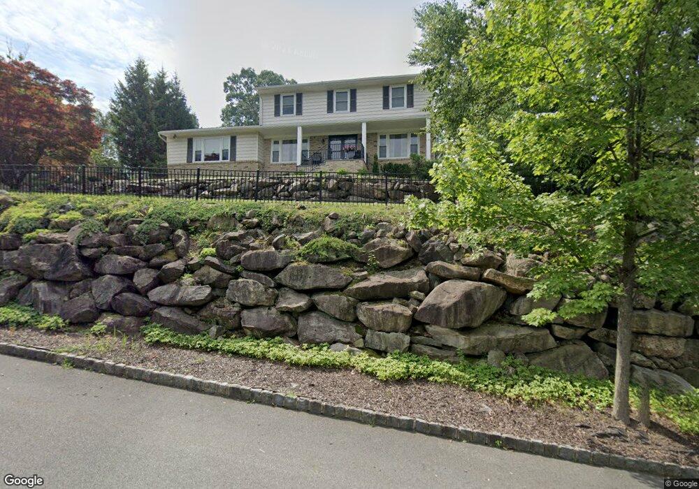
47 Whitewood Dr Morris Plains, NJ 07950
Estimated Value: $889,175 - $921,000
--
Bed
--
Bath
2,657
Sq Ft
$341/Sq Ft
Est. Value
About This Home
This home is located at 47 Whitewood Dr, Morris Plains, NJ 07950 and is currently estimated at $905,044, approximately $340 per square foot. 47 Whitewood Dr is a home located in Morris County with nearby schools including Mount Tabor School, Brooklawn Middle School, and Parsippany Hills High School.
Ownership History
Date
Name
Owned For
Owner Type
Purchase Details
Closed on
Aug 30, 2011
Sold by
Arney F Todd and Riemenschneider Arney Julie A
Bought by
Gonzalez Anthony and Gonzalez Kathy
Current Estimated Value
Home Financials for this Owner
Home Financials are based on the most recent Mortgage that was taken out on this home.
Original Mortgage
$487,800
Outstanding Balance
$339,104
Interest Rate
4.58%
Mortgage Type
Stand Alone First
Estimated Equity
$565,940
Purchase Details
Closed on
Jul 29, 2004
Sold by
Grossman Bruce
Bought by
Arney F Todd and Arney Julie
Purchase Details
Closed on
Nov 16, 2001
Sold by
Kasthuri Chitra
Bought by
Grossman Bruce and Grossman Ellen
Home Financials for this Owner
Home Financials are based on the most recent Mortgage that was taken out on this home.
Original Mortgage
$344,000
Interest Rate
6.6%
Create a Home Valuation Report for This Property
The Home Valuation Report is an in-depth analysis detailing your home's value as well as a comparison with similar homes in the area
Home Values in the Area
Average Home Value in this Area
Purchase History
| Date | Buyer | Sale Price | Title Company |
|---|---|---|---|
| Gonzalez Anthony | $542,000 | Fidelity Natl Title Ins Co | |
| Arney F Todd | $570,000 | -- | |
| Grossman Bruce | $430,000 | -- |
Source: Public Records
Mortgage History
| Date | Status | Borrower | Loan Amount |
|---|---|---|---|
| Open | Gonzalez Anthony | $487,800 | |
| Previous Owner | Grossman Bruce | $344,000 |
Source: Public Records
Tax History Compared to Growth
Tax History
| Year | Tax Paid | Tax Assessment Tax Assessment Total Assessment is a certain percentage of the fair market value that is determined by local assessors to be the total taxable value of land and additions on the property. | Land | Improvement |
|---|---|---|---|---|
| 2025 | $15,136 | $435,700 | $198,200 | $237,500 |
| 2024 | $14,849 | $435,700 | $198,200 | $237,500 |
| 2023 | $14,849 | $435,700 | $198,200 | $237,500 |
| 2022 | $13,816 | $435,700 | $198,200 | $237,500 |
| 2021 | $13,816 | $435,700 | $198,200 | $237,500 |
| 2020 | $13,437 | $435,700 | $198,200 | $237,500 |
| 2019 | $13,075 | $435,700 | $198,200 | $237,500 |
| 2018 | $12,705 | $435,700 | $198,200 | $237,500 |
| 2017 | $12,417 | $435,700 | $198,200 | $237,500 |
| 2016 | $12,204 | $435,700 | $198,200 | $237,500 |
| 2015 | $11,895 | $435,700 | $198,200 | $237,500 |
| 2014 | $11,720 | $435,700 | $198,200 | $237,500 |
Source: Public Records
Map
Nearby Homes
- 20 Whitewood Dr
- 711 Park Rd
- 1 Ironwood Dr
- 78 North Place
- 29 Whitfield Place
- 32 Fletcher Place
- 15 Force Place
- 26 Wesley Place
- 35 Oakdale Rd
- 1466 Tabor Rd
- 2 Castaby Way
- 21 Holly Dr
- 31 Station Rd
- 62 Brookstone Cir
- 20 Dogwood Dr
- 17 Freeman Ave
- 62 Fernview Rd
- 189 Park Rd
- 42 Flintlock Rd
- 2350 State Route 10 Unit D11
- 49 Whitewood Dr
- 45 Whitewood Dr
- 46 Whitewood Dr
- 53 Whitewood Dr
- 48 Whitewood Dr
- 43 Whitewood Dr
- 44 Whitewood Dr
- 50 Whitewood Dr
- 42 Whitewood Dr
- 55 Whitewood Dr
- 52 Whitewood Dr
- 39 Whitewood Dr
- 40 Whitewood Dr
- 57 Whitewood Dr
- 54 Whitewood Dr
- 37 Whitewood Dr
- 38 Whitewood Dr
- 4 Timberlane Ct
- 4A Timberlane Ct
- 8 Timberlane Ct