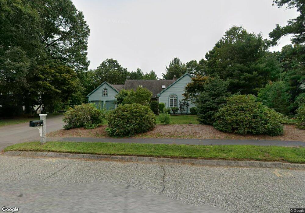
47 York Rd Mansfield, MA 02048
Estimated Value: $1,029,309 - $1,353,000
4
Beds
4
Baths
3,741
Sq Ft
$311/Sq Ft
Est. Value
About This Home
This home is located at 47 York Rd, Mansfield, MA 02048 and is currently estimated at $1,162,077, approximately $310 per square foot. 47 York Rd is a home located in Bristol County with nearby schools including Everett W. Robinson Elementary School, Jordan/Jackson Elementary School, and Harold L. Qualters Middle School.
Ownership History
Date
Name
Owned For
Owner Type
Purchase Details
Closed on
Sep 20, 2021
Sold by
Okorn Frank M and Okorn Susan R
Bought by
Okorn Ft
Current Estimated Value
Purchase Details
Closed on
Sep 15, 1994
Sold by
Fredette Joseph B and Fredette Brigitte M
Bought by
Okorn Frank M and Okorn Susan R
Home Financials for this Owner
Home Financials are based on the most recent Mortgage that was taken out on this home.
Original Mortgage
$44,336
Interest Rate
8.78%
Purchase Details
Closed on
Jun 14, 1989
Sold by
The Broderick Corp
Bought by
Fredette Joseph B
Home Financials for this Owner
Home Financials are based on the most recent Mortgage that was taken out on this home.
Original Mortgage
$125,000
Interest Rate
10.87%
Mortgage Type
Purchase Money Mortgage
Create a Home Valuation Report for This Property
The Home Valuation Report is an in-depth analysis detailing your home's value as well as a comparison with similar homes in the area
Home Values in the Area
Average Home Value in this Area
Purchase History
| Date | Buyer | Sale Price | Title Company |
|---|---|---|---|
| Okorn Ft | -- | None Available | |
| Okorn Frank M | $312,000 | -- | |
| Fredette Joseph B | $80,500 | -- |
Source: Public Records
Mortgage History
| Date | Status | Borrower | Loan Amount |
|---|---|---|---|
| Previous Owner | Fredette Joseph B | $44,336 | |
| Previous Owner | Fredette Joseph B | $112,000 | |
| Previous Owner | Fredette Joseph B | $125,000 |
Source: Public Records
Tax History
| Year | Tax Paid | Tax Assessment Tax Assessment Total Assessment is a certain percentage of the fair market value that is determined by local assessors to be the total taxable value of land and additions on the property. | Land | Improvement |
|---|---|---|---|---|
| 2025 | $12,228 | $928,500 | $302,400 | $626,100 |
| 2024 | $12,154 | $900,300 | $266,100 | $634,200 |
| 2023 | $11,827 | $839,400 | $266,100 | $573,300 |
| 2022 | $11,303 | $745,100 | $246,300 | $498,800 |
| 2021 | $11,383 | $741,100 | $224,000 | $517,100 |
| 2020 | $10,781 | $701,900 | $224,000 | $477,900 |
| 2019 | $10,417 | $684,400 | $202,100 | $482,300 |
| 2018 | $9,438 | $661,900 | $192,700 | $469,200 |
| 2017 | $9,206 | $612,900 | $187,300 | $425,600 |
| 2016 | $8,742 | $567,300 | $185,200 | $382,100 |
| 2015 | $8,661 | $558,800 | $185,200 | $373,600 |
Source: Public Records
Map
Nearby Homes
- 85 Jewell St
- 78 Old Farm Rd
- 150 Gilbert St
- 24 Maverick Dr
- 14 Claire Ave
- 25 Munroe Dr
- 52 White Oak Way
- 49 Pheasant Hill Rd
- 115 Westfield Dr
- 451R Gilbert St
- 84 Messenger St
- 2 Oak St Unit 2A
- 2 Oak St Unit 2B
- 9 Coach Rd
- 57 Vine St
- 37 Oakleaf Dr
- 16 Treasure Island Rd
- Lot 5 Jeffrey Dr
- Lot 2 Jeffrey Dr
- 71 Richardson Ave
Your Personal Tour Guide
Ask me questions while you tour the home.