Estimated Value: $225,000 - $281,000
2
Beds
2
Baths
1,166
Sq Ft
$210/Sq Ft
Est. Value
About This Home
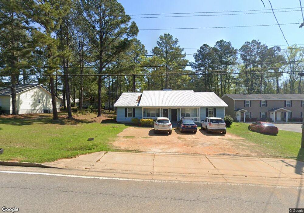
This home is located at 470 20th St NE Unit A & B, Cairo, GA 39828 and is currently estimated at $244,963, approximately $210 per square foot. 470 20th St NE Unit A & B is a home located in Grady County with nearby schools including Cairo High School.
Ownership History
Date
Name
Owned For
Owner Type
Purchase Details
Closed on
Aug 1, 2022
Sold by
Southern Georgia Home Rentals Llc
Bought by
Wiregrass Rentals Llc
Current Estimated Value
Purchase Details
Closed on
Dec 5, 2006
Sold by
Kelso Carol
Bought by
Kelso William R and Cbk Holding Llc
Purchase Details
Closed on
Oct 1, 2004
Bought by
Cbk Holdings Llc
Purchase Details
Closed on
Jan 26, 1994
Bought by
Thomas Charles A
Create a Home Valuation Report for This Property
The Home Valuation Report is an in-depth analysis detailing your home's value as well as a comparison with similar homes in the area
Home Values in the Area
Average Home Value in this Area
Purchase History
| Date | Buyer | Sale Price | Title Company |
|---|---|---|---|
| Wiregrass Rentals Llc | -- | -- | |
| Kelso William R | -- | -- | |
| Cbk Holdings Llc | -- | -- | |
| Thomas Charles A | -- | -- |
Source: Public Records
Tax History Compared to Growth
Tax History
| Year | Tax Paid | Tax Assessment Tax Assessment Total Assessment is a certain percentage of the fair market value that is determined by local assessors to be the total taxable value of land and additions on the property. | Land | Improvement |
|---|---|---|---|---|
| 2024 | $3,198 | $81,048 | $6,000 | $75,048 |
| 2023 | $1,620 | $43,771 | $2,400 | $41,371 |
| 2022 | $1,685 | $43,771 | $2,400 | $41,371 |
| 2021 | $1,690 | $43,771 | $2,400 | $41,371 |
| 2020 | $1,694 | $43,771 | $2,400 | $41,371 |
| 2019 | $1,694 | $43,771 | $2,400 | $41,371 |
| 2018 | $1,610 | $43,771 | $2,400 | $41,371 |
| 2017 | $1,549 | $43,771 | $2,400 | $41,371 |
| 2016 | $1,328 | $36,720 | $2,400 | $34,320 |
| 2015 | $1,315 | $36,720 | $2,400 | $34,320 |
| 2014 | $1,316 | $36,720 | $2,400 | $34,320 |
| 2013 | -- | $32,703 | $2,400 | $30,303 |
Source: Public Records
Map
Nearby Homes
- 0 20th St NE
- 00 20th St NE
- 00 NW 9th Ave
- 66 22nd St NE
- 2600 U S 84
- 00 State Route 188
- 0 State Route 188
- 711 2nd Ave NE
- 78.6 Ac Strickland Rd
- 21 24th St NE
- 0 NE Airport Rd Unit 145784
- 2975 U S 84
- 4761 Hadley Ferry Rd
- 471 4th St SE
- 481 4th St SE
- 309 3rd St SE
- 530 6th Ave SE
- 125 6th Ave NW
- 602 4th St SE
- X 1st St
- 472 20th St NE Unit A & B
- 470 20th St NE
- 480 20th St NE
- 469 Pebblebrook Dr
- 473 Pebblebrook Dr
- 483 Pebble Brook Dr Unit A&B
- 483 Pebble Brook Dr
- 467 Pebblebrook Dr
- 403 20th St NE
- 483 Pebblebrook Dr
- 483 Pebblebrook Dr Unit A&B
- 465 Pebble Brook Dr
- 465 Pebblebrook Dr
- 1990 Oak Dr
- 484 Pebblebrook Dr
- 474 Pebblebrook Dr
- 466 Pebblebrook Dr
- 462 Pebblebrook Dr
- 1991 Oak Dr
- 1980 Oak Dr