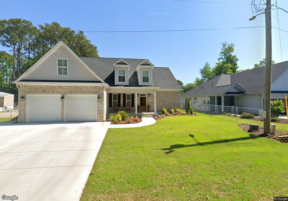
470 Boundary Ave Murrells Inlet, SC 29576
Estimated Value: $812,000 - $913,742
4
Beds
3
Baths
2,491
Sq Ft
$341/Sq Ft
Est. Value
About This Home
This home is located at 470 Boundary Ave, Murrells Inlet, SC 29576 and is currently estimated at $849,186, approximately $340 per square foot. 470 Boundary Ave is a home with nearby schools including Seaside Elementary, St. James Middle School, and St. James Intermediate.
Ownership History
Date
Name
Owned For
Owner Type
Purchase Details
Closed on
Aug 27, 2020
Sold by
Mowry Theresa
Bought by
Poston Angela H and Poston Reamer J
Current Estimated Value
Purchase Details
Closed on
Dec 15, 2017
Sold by
Bagwell Curtis E
Bought by
Mowry Theresa
Purchase Details
Closed on
May 21, 2016
Sold by
Bagwell Jimmie D
Bought by
Bagwell Curtis E
Purchase Details
Closed on
May 6, 2003
Sold by
Davis Charles H
Bought by
Bagwell Jimmie
Purchase Details
Closed on
Mar 14, 2000
Sold by
Bagwell Jimmie and Davis Charles
Bought by
Bagwell Jimmie and Davis Charles H
Create a Home Valuation Report for This Property
The Home Valuation Report is an in-depth analysis detailing your home's value as well as a comparison with similar homes in the area
Home Values in the Area
Average Home Value in this Area
Purchase History
| Date | Buyer | Sale Price | Title Company |
|---|---|---|---|
| Poston Angela H | $126,000 | -- | |
| Mowry Theresa | $80,000 | -- | |
| Bagwell Curtis E | -- | -- | |
| Bagwell Jimmie | -- | -- | |
| Bagwell Jimmie | -- | -- |
Source: Public Records
Tax History Compared to Growth
Tax History
| Year | Tax Paid | Tax Assessment Tax Assessment Total Assessment is a certain percentage of the fair market value that is determined by local assessors to be the total taxable value of land and additions on the property. | Land | Improvement |
|---|---|---|---|---|
| 2024 | $2,475 | $30,979 | $14,883 | $16,096 |
| 2023 | $2,475 | $7,780 | $5,040 | $2,740 |
| 2021 | $839 | $20,422 | $13,229 | $7,193 |
| 2020 | $1,400 | $14,102 | $14,102 | $0 |
| 2019 | $1,400 | $14,102 | $14,102 | $0 |
| 2018 | $1,263 | $10,673 | $10,673 | $0 |
| 2017 | $1,260 | $6,099 | $6,099 | $0 |
| 2016 | -- | $3,812 | $3,812 | $0 |
| 2015 | $555 | $6,671 | $6,671 | $0 |
| 2014 | $523 | $3,812 | $3,812 | $0 |
Source: Public Records
Map
Nearby Homes
- 390 Boundary Ave
- 520 & 526 Boundary Ave
- 513 1st St
- Lot 4 Seacrest Dr
- 449 Delton Dr
- 425 Delton Dr
- 435 Delton Dr
- 495 Clubhouse Rd
- 724 1st St
- 1508 Sunnydale Ln
- 316 Cypress Ave
- 494 Clubhouse Rd
- 310 Clam Shell Cir
- 382 W Canal
- 441 Delton Dr
- 315 Inlet Rd
- 326 Tunnoch Rd
- 806 Marlin Ct
- 420 Delton Dr
- 324 Yucca Cir
- 460 Boundary Ave Unit B
- 460 Boundary Ave Unit B
- 460 Boundary Ave Unit A
- 460 Boundary Ave Unit A
- 429 Yaupon Ave Unit 2
- 429 Yaupon Ave
- 6 Boundary Ave
- 429 Yaupon Ave
- 402 2nd St
- 451 Boundary Ave
- 450 Boundary Ave
- 439 Yaupon Ave
- 0 Boundary Ave
- Lot 1B BL 1 Boundary Ave
- Lot 11 Yaupon Ave
- Lot 4 Yaupon Ave
- Lot 9 Boundary Ave
- 425 Belle Dr
- 406 Boundary Ave
- 403 2nd St