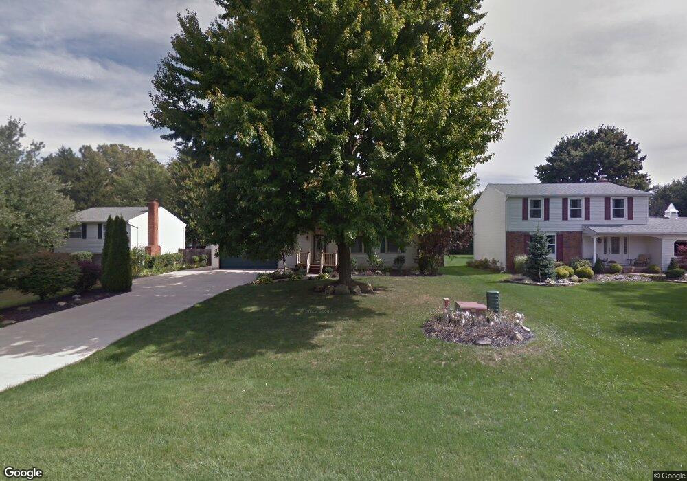
470 Manhattan Pkwy Painesville, OH 44077
Estimated Value: $267,000 - $293,000
4
Beds
3
Baths
960
Sq Ft
$296/Sq Ft
Est. Value
About This Home
This home is located at 470 Manhattan Pkwy, Painesville, OH 44077 and is currently estimated at $284,250, approximately $296 per square foot. 470 Manhattan Pkwy is a home located in Lake County with nearby schools including Henry F. Lamuth Middle School, Riverside Junior/Senior High School, and Summit Academy Community School - Painesville.
Ownership History
Date
Name
Owned For
Owner Type
Purchase Details
Closed on
Feb 14, 1997
Sold by
Vilcheck Lesa M
Bought by
Vilcheck Ronald J
Current Estimated Value
Home Financials for this Owner
Home Financials are based on the most recent Mortgage that was taken out on this home.
Original Mortgage
$104,000
Outstanding Balance
$11,651
Interest Rate
7.46%
Estimated Equity
$272,599
Purchase Details
Closed on
May 27, 1994
Bought by
Vilcheck Ronald J
Create a Home Valuation Report for This Property
The Home Valuation Report is an in-depth analysis detailing your home's value as well as a comparison with similar homes in the area
Home Values in the Area
Average Home Value in this Area
Purchase History
| Date | Buyer | Sale Price | Title Company |
|---|---|---|---|
| Vilcheck Ronald J | -- | U S Title Agency Inc | |
| Vilcheck Ronald J | $116,500 | -- |
Source: Public Records
Mortgage History
| Date | Status | Borrower | Loan Amount |
|---|---|---|---|
| Open | Vilcheck Ronald J | $104,000 |
Source: Public Records
Tax History Compared to Growth
Tax History
| Year | Tax Paid | Tax Assessment Tax Assessment Total Assessment is a certain percentage of the fair market value that is determined by local assessors to be the total taxable value of land and additions on the property. | Land | Improvement |
|---|---|---|---|---|
| 2024 | -- | $91,990 | $17,750 | $74,240 |
| 2023 | $4,202 | $70,070 | $14,270 | $55,800 |
| 2022 | $4,101 | $70,070 | $14,270 | $55,800 |
| 2021 | $4,115 | $70,070 | $14,270 | $55,800 |
| 2020 | $4,054 | $60,930 | $12,410 | $48,520 |
| 2019 | $4,084 | $60,930 | $12,410 | $48,520 |
| 2018 | $3,944 | $54,690 | $10,440 | $44,250 |
| 2017 | $3,791 | $54,690 | $10,440 | $44,250 |
| 2016 | $3,338 | $54,690 | $10,440 | $44,250 |
| 2015 | $3,133 | $54,690 | $10,440 | $44,250 |
| 2014 | $3,185 | $54,690 | $10,440 | $44,250 |
| 2013 | $3,112 | $54,690 | $10,440 | $44,250 |
Source: Public Records
Map
Nearby Homes
- 525 Morgan Dr
- 500 Park Rd
- V/L Morgan Dr
- 396 Park Rd
- 43 Bristol Ave
- 269 Hale Rd
- 108 Birch Dr
- 4505 Lane Rd
- 1787 Muirfield Ln
- 0 N Ridge Rd Unit 5110949
- 67 Tanners Farm Dr
- 65 Tanners Farm Dr
- 1182 Dalton Dr
- 1172 Dalton Dr
- 808 N Creek Dr
- 634 N Creek Dr
- 5406 Pebble Creek Ln
- 1865 Marsh Ln Unit 1865
- 389 Sand Trap Cir
- 1598 Bogie Ln
- 460 Manhattan Pkwy
- 478 Manhattan Pkwy
- 1586 Westchester Ct
- 454 Manhattan Pkwy
- 1589 Statten Ct
- 1596 Westchester Ct
- 475 Manhattan Pkwy
- 481 Manhattan Pkwy
- 1595 Statten Ct
- 459 Manhattan Pkwy
- 491 Manhattan Pkwy
- 1595 Westchester Ct
- 498 Manhattan Pkwy
- 495 Manhattan Pkwy
- 553 Morgan Dr
- 1589 Westchester Ct
- 438 Manhattan Pkwy
- 1596 Statten Ct
- 443 Manhattan Pkwy
- 501 Manhattan Pkwy