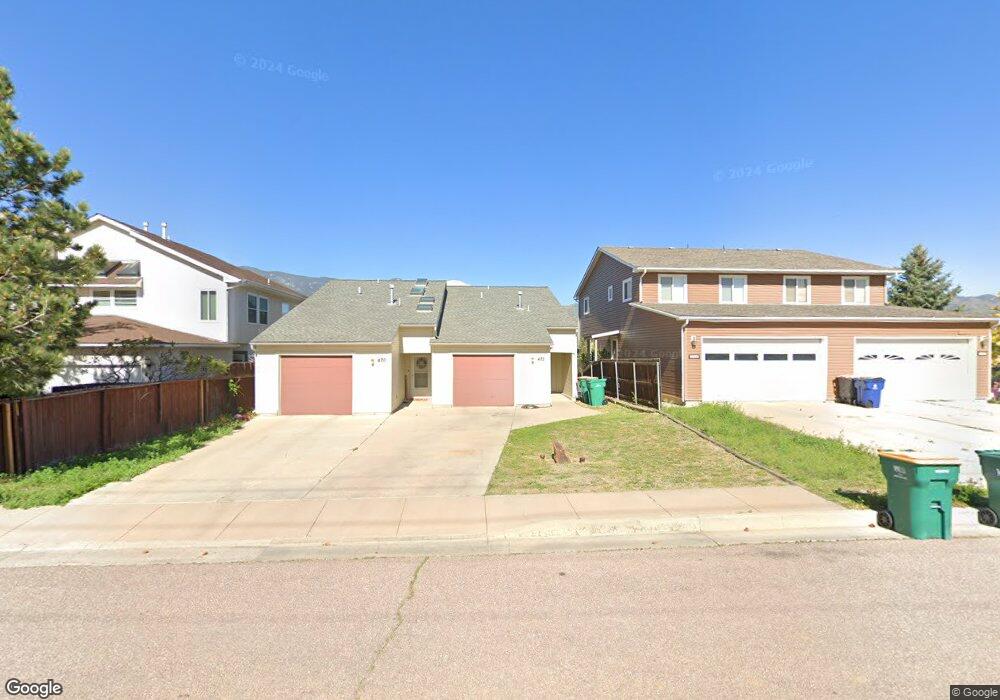
470 N Limit St Colorado Springs, CO 80904
Westside NeighborhoodEstimated Value: $679,232 - $825,000
4
Beds
6
Baths
2,575
Sq Ft
$291/Sq Ft
Est. Value
About This Home
This home is located at 470 N Limit St, Colorado Springs, CO 80904 and is currently estimated at $750,558, approximately $291 per square foot. 470 N Limit St is a home located in El Paso County with nearby schools including Bristol Elementary, School of the Arts and STEM, Holmes Middle School, and Coronado High School.
Ownership History
Date
Name
Owned For
Owner Type
Purchase Details
Closed on
Nov 30, 2015
Sold by
515 W Tyler St Land Trust
Bought by
Liu Xiaoyang and Tang Diana Xiaochun
Current Estimated Value
Home Financials for this Owner
Home Financials are based on the most recent Mortgage that was taken out on this home.
Original Mortgage
$245,000
Outstanding Balance
$193,624
Interest Rate
3.85%
Mortgage Type
Commercial
Estimated Equity
$556,934
Purchase Details
Closed on
Aug 11, 2007
Sold by
Blomquist Dennis
Bought by
470 N Limit Land Trust
Purchase Details
Closed on
Oct 13, 2003
Sold by
Fincham Ronald L and Fincham Stephen A
Bought by
Blomquist Dennis
Home Financials for this Owner
Home Financials are based on the most recent Mortgage that was taken out on this home.
Original Mortgage
$51,500
Interest Rate
3%
Mortgage Type
Commercial
Create a Home Valuation Report for This Property
The Home Valuation Report is an in-depth analysis detailing your home's value as well as a comparison with similar homes in the area
Home Values in the Area
Average Home Value in this Area
Purchase History
| Date | Buyer | Sale Price | Title Company |
|---|---|---|---|
| Liu Xiaoyang | $350,000 | Capstone Title Services Llc | |
| 515 W Tyler St Land Trust | -- | None Available | |
| 470 N Limit Land Trust | $257,343 | None Available | |
| Blomquist Dennis | $50,000 | -- |
Source: Public Records
Mortgage History
| Date | Status | Borrower | Loan Amount |
|---|---|---|---|
| Open | Liu Xiaoyang | $245,000 | |
| Previous Owner | Blomquist Dennis | $51,500 |
Source: Public Records
Tax History Compared to Growth
Tax History
| Year | Tax Paid | Tax Assessment Tax Assessment Total Assessment is a certain percentage of the fair market value that is determined by local assessors to be the total taxable value of land and additions on the property. | Land | Improvement |
|---|---|---|---|---|
| 2025 | $2,058 | $41,310 | -- | -- |
| 2024 | $1,937 | $41,500 | $8,600 | $32,900 |
| 2022 | $1,698 | $30,350 | $5,810 | $24,540 |
| 2021 | $1,884 | $31,920 | $6,110 | $25,810 |
| 2020 | $1,843 | $27,150 | $5,210 | $21,940 |
| 2019 | $1,833 | $27,150 | $5,210 | $21,940 |
| 2018 | $1,825 | $24,870 | $4,800 | $20,070 |
| 2017 | $1,728 | $24,870 | $4,800 | $20,070 |
| 2016 | $1,187 | $20,480 | $5,300 | $15,180 |
| 2015 | $1,183 | $20,480 | $5,300 | $15,180 |
| 2014 | $1,152 | $19,140 | $4,780 | $14,360 |
Source: Public Records
Map
Nearby Homes
- 1345 Talley Cir
- 1355 Talley Cir
- 1375 Talley Cir
- 1365 Talley Cir
- 585 Observatory Dr Unit 2F
- 1502 Manitou Blvd
- 660 Pony Ln
- 1522 Manitou Blvd
- 321 Graceland Grove
- 135 Helena Ln
- 23 N 15th St
- 1509 W Platte Ave
- 119 Helena Ln
- 549 W Dale St Unit 569
- 708 Cooper Ave
- 546 W Saint Vrain St
- 1531 W Bijou St
- 1315 W Kiowa St
- 427 N Chestnut St
- 1411 W Kiowa St
- 462 N Limit St
- 480 N Limit St
- 460 N Limit St
- 575 Observatory Dr Unit A
- 583 Observatory Dr
- 581 Observatory Dr Unit 2D
- 1320 Talley Cir
- 806 Manitou Blvd
- 579 Observatory Dr Unit 2C
- 1310 Talley Cir
- 1322 Talley Cir
- 589 Observatory Dr Unit 1B
- 591 Observatory Dr
- 577 Observatory Dr
- 587 Observatory Dr Unit A
- 1330 Talley Cir
- 800 Manitou Blvd
- 1340 Talley Cir
- 812 Manitou Blvd
- 597 Observatory Dr Unit 1F