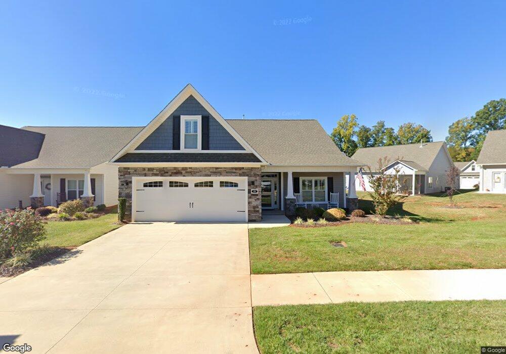
470 Pepperstone Dr Salisbury, NC 28146
Estimated Value: $407,104 - $451,000
Studio
--
Bath
2,378
Sq Ft
$182/Sq Ft
Est. Value
About This Home
This home is located at 470 Pepperstone Dr, Salisbury, NC 28146 and is currently estimated at $432,776, approximately $181 per square foot. 470 Pepperstone Dr is a home with nearby schools including Granite Quarry Elementary School, Charles C Erwin Middle School, and East Rowan High School.
Ownership History
Date
Name
Owned For
Owner Type
Purchase Details
Closed on
Dec 9, 2022
Sold by
Devlin Hugh B and Devlin Teresa L
Bought by
Brown Steven Philip and Brown Debra Fisher
Current Estimated Value
Home Financials for this Owner
Home Financials are based on the most recent Mortgage that was taken out on this home.
Original Mortgage
$140,000
Outstanding Balance
$134,554
Interest Rate
5.5%
Mortgage Type
New Conventional
Estimated Equity
$298,222
Purchase Details
Closed on
Jun 4, 2019
Sold by
Spencer Lane Construction Llc
Bought by
Devlin Hugh B and Devlin Teresa L
Home Financials for this Owner
Home Financials are based on the most recent Mortgage that was taken out on this home.
Original Mortgage
$100,000
Interest Rate
4.1%
Mortgage Type
New Conventional
Create a Home Valuation Report for This Property
The Home Valuation Report is an in-depth analysis detailing your home's value as well as a comparison with similar homes in the area
Purchase History
| Date | Buyer | Sale Price | Title Company |
|---|---|---|---|
| Brown Steven Philip | $430,000 | -- | |
| Brown Steven Philip | $430,000 | None Listed On Document | |
| Devlin Hugh B | $288,000 | United Shore Fincl Svcs Llc |
Source: Public Records
Mortgage History
| Date | Status | Borrower | Loan Amount |
|---|---|---|---|
| Open | Brown Steven Philip | $140,000 | |
| Closed | Brown Steven Philip | $140,000 | |
| Previous Owner | Devlin Hugh B | $100,000 |
Source: Public Records
Tax History
| Year | Tax Paid | Tax Assessment Tax Assessment Total Assessment is a certain percentage of the fair market value that is determined by local assessors to be the total taxable value of land and additions on the property. | Land | Improvement |
|---|---|---|---|---|
| 2025 | $5,096 | $426,076 | $34,000 | $392,076 |
| 2024 | $5,096 | $426,076 | $34,000 | $392,076 |
| 2023 | $5,096 | $426,076 | $34,000 | $392,076 |
| 2022 | $3,639 | $264,269 | $34,000 | $230,269 |
| 2021 | $3,639 | $264,269 | $34,000 | $230,269 |
| 2020 | $3,639 | $264,269 | $34,000 | $230,269 |
| 2019 | $28 | $34,000 | $34,000 | $0 |
| 2018 | $393 | $28,900 | $28,900 | $0 |
Source: Public Records
Map
Nearby Homes
- 415 Garner Dr
- 327 River Birch Dr
- 237 River Birch Dr
- 115 River Birch Dr
- 520 River Birch Dr
- 407 Oak Forest Ln
- 507 Oak Brook Dr
- 1425 Faith Rd
- 1207 Oak Haven Dr
- 0 Old Concord Rd Unit 10094451
- 208 Stone Ridge Dr
- 422 Mirror Lake Rd
- 200 N Kayla Dr
- 122 Stone Ridge Dr Unit 8
- 101 S Kayla Dr
- 508 Mulberry Ln
- 204 Morlan Park Rd
- 529 N Main Gq St
- 1211 Tower Dr
- 315 Brookwood Dr
- 476 Pepperstone Dr
- 477 Pepperstone Dr
- 405 Drake Ln
- 401 Drake Ln
- 409 Drake Ln
- 480 Pepperstone Dr
- 413 Drake Ln
- 471 Pepperstone Dr
- 483 Pepperstone Dr
- 465 Pepperstone Dr
- 459 Pepperstone Dr
- 489 Pepperstone Dr
- 417 Drake Ln
- 453 Pepperstone Dr
- 402 Spring Arbor Ave
- 406 Spring Arbor Ave
- 447 Pepperstone Dr
- 406 Drake Ln
- 402 Drake Ln
- 410 Drake Ln
Your Personal Tour Guide
Ask me questions while you tour the home.