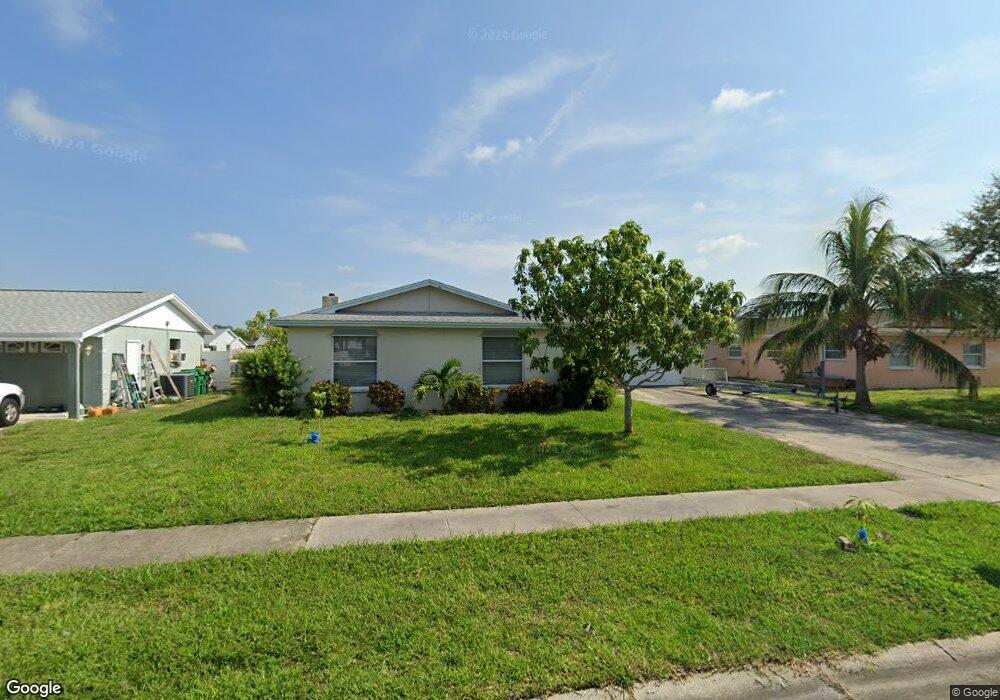
470 Sundoro Ct Merritt Island, FL 32953
Estimated Value: $601,000 - $615,000
4
Beds
2
Baths
1,629
Sq Ft
$372/Sq Ft
Est. Value
About This Home
This home is located at 470 Sundoro Ct, Merritt Island, FL 32953 and is currently estimated at $606,398, approximately $372 per square foot. 470 Sundoro Ct is a home located in Brevard County with nearby schools including Audubon Elementary School, Thomas Jefferson Middle School, and Merritt Island High School.
Ownership History
Date
Name
Owned For
Owner Type
Purchase Details
Closed on
Dec 12, 2019
Sold by
Pham Hiep Q and Pham Ha Le
Bought by
Pham Hiep Q and Pham Ha Le
Current Estimated Value
Purchase Details
Closed on
Dec 27, 2010
Sold by
Fannie Mae
Bought by
Pham Hiep Q and Pham Hale
Purchase Details
Closed on
Jan 5, 2010
Sold by
Lowenthal Glen and Lowenthal A
Bought by
Federal National Mortgage Association
Purchase Details
Closed on
Jul 28, 1993
Sold by
Lowenthal Jerome D and Lowenthal Glen
Bought by
1St Equity Mtg Corp
Home Financials for this Owner
Home Financials are based on the most recent Mortgage that was taken out on this home.
Original Mortgage
$53,600
Interest Rate
7.34%
Create a Home Valuation Report for This Property
The Home Valuation Report is an in-depth analysis detailing your home's value as well as a comparison with similar homes in the area
Home Values in the Area
Average Home Value in this Area
Purchase History
| Date | Buyer | Sale Price | Title Company |
|---|---|---|---|
| Pham Hiep Q | -- | Attorney | |
| Pham Hiep Q | $150,400 | Fidelity National Title Ins | |
| Federal National Mortgage Association | $309,000 | Attorney | |
| 1St Equity Mtg Corp | -- | -- |
Source: Public Records
Mortgage History
| Date | Status | Borrower | Loan Amount |
|---|---|---|---|
| Previous Owner | 1St Equity Mtg Corp | $53,600 |
Source: Public Records
Tax History Compared to Growth
Tax History
| Year | Tax Paid | Tax Assessment Tax Assessment Total Assessment is a certain percentage of the fair market value that is determined by local assessors to be the total taxable value of land and additions on the property. | Land | Improvement |
|---|---|---|---|---|
| 2025 | $6,179 | $466,740 | -- | -- |
| 2024 | $5,948 | $482,850 | -- | -- |
| 2023 | $5,948 | $461,520 | $0 | $0 |
| 2022 | $5,324 | $434,180 | $0 | $0 |
| 2021 | $5,070 | $354,370 | $215,000 | $139,370 |
| 2020 | $4,623 | $307,630 | $170,000 | $137,630 |
| 2019 | $4,809 | $315,760 | $175,000 | $140,760 |
| 2018 | $4,672 | $310,920 | $175,000 | $135,920 |
| 2017 | $4,549 | $298,420 | $180,000 | $118,420 |
| 2016 | $4,165 | $244,330 | $128,000 | $116,330 |
| 2015 | $3,975 | $215,350 | $117,000 | $98,350 |
| 2014 | $3,773 | $195,780 | $117,000 | $78,780 |
Source: Public Records
Map
Nearby Homes
- 410 Carrioca Ct
- 900 Richland Ave
- 955 Richland Ave
- 410 Caracas Dr
- 900 Waikiki Dr
- 875 Waikiki Dr
- 270 Oahu Dr
- 325 Wainai Dr
- 300 Richland Ave
- 455 Riverside Ave
- 1035 Molaki Dr
- 630 Paula Ave
- 495 Belair Ave
- 450 Patrick Ave
- 1125 Outrigger Dr
- 225 Richland Ave
- 240 Riverside Ave
- 755 Larkview St
- 380 Sabal Ave
- 240 Belair Ave