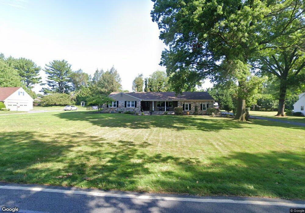
470 W MacAda Rd Bethlehem, PA 18017
Estimated Value: $534,158 - $568,000
3
Beds
3
Baths
2,306
Sq Ft
$237/Sq Ft
Est. Value
About This Home
This home is located at 470 W MacAda Rd, Bethlehem, PA 18017 and is currently estimated at $546,040, approximately $236 per square foot. 470 W MacAda Rd is a home located in Northampton County with nearby schools including Asa Packer Elementary School, Nitschmann Middle School, and Liberty High School.
Ownership History
Date
Name
Owned For
Owner Type
Purchase Details
Closed on
Jun 27, 2011
Sold by
Filaseta Albert Joseph and Filaseta Barbara L
Bought by
Filaseta Barbara L
Current Estimated Value
Home Financials for this Owner
Home Financials are based on the most recent Mortgage that was taken out on this home.
Original Mortgage
$252,000
Outstanding Balance
$173,205
Interest Rate
4.49%
Mortgage Type
New Conventional
Estimated Equity
$372,835
Purchase Details
Closed on
Feb 3, 2003
Bought by
Filaseta Albert Joseph and Filaseta Barbara L
Create a Home Valuation Report for This Property
The Home Valuation Report is an in-depth analysis detailing your home's value as well as a comparison with similar homes in the area
Home Values in the Area
Average Home Value in this Area
Purchase History
| Date | Buyer | Sale Price | Title Company |
|---|---|---|---|
| Filaseta Barbara L | -- | None Available | |
| Filaseta Albert Joseph | $245,000 | -- |
Source: Public Records
Mortgage History
| Date | Status | Borrower | Loan Amount |
|---|---|---|---|
| Open | Filaseta Barbara L | $252,000 |
Source: Public Records
Tax History
| Year | Tax Paid | Tax Assessment Tax Assessment Total Assessment is a certain percentage of the fair market value that is determined by local assessors to be the total taxable value of land and additions on the property. | Land | Improvement |
|---|---|---|---|---|
| 2025 | $1,043 | $96,600 | $51,200 | $45,400 |
| 2024 | $7,042 | $96,600 | $51,200 | $45,400 |
| 2023 | $7,066 | $96,600 | $51,200 | $45,400 |
| 2022 | $7,000 | $96,600 | $51,200 | $45,400 |
| 2021 | $6,943 | $96,600 | $51,200 | $45,400 |
| 2020 | $6,951 | $96,600 | $51,200 | $45,400 |
| 2019 | $6,923 | $96,600 | $51,200 | $45,400 |
| 2018 | $6,786 | $96,600 | $51,200 | $45,400 |
| 2017 | $6,738 | $96,600 | $51,200 | $45,400 |
| 2016 | -- | $96,600 | $51,200 | $45,400 |
| 2015 | -- | $96,600 | $51,200 | $45,400 |
| 2014 | -- | $96,600 | $51,200 | $45,400 |
Source: Public Records
Map
Nearby Homes
- 801 Yorkshire Rd
- 2616 Pioneer Rd
- 2860 Center St
- 2713 Center St
- 105 Pine Top Trail
- 386 Johnston Dr
- 1360 Stonewood Dr
- 0 Rosewood Dr Unit 766427
- 1970 Rosewood Dr Unit Lot 6
- 1305 Statten Ave
- 481 Forrest Ave
- 493 Forrest Ave
- 5602 Grace Ave
- 1440 Greenview Dr
- 3901 Post Dr
- 315 Carver Dr
- 1728 Jefferson Ave
- 1225 Brentwood Ave
- 2328 Linden St
- 329 Carver Dr Unit 329
- 430 W MacAda Rd
- 500 W MacAda Rd
- 475 Wedgewood Rd
- 556 Angelo Dr
- 546 Angelo Dr
- 425 Wedgewood Rd
- 566 Angelo Dr
- 536 Angelo Dr
- 550 W MacAda Rd
- 576 Angelo Dr
- 525 Wedgewood Rd
- 400 W MacAda Rd
- 355 Wedgewood Rd
- 295 Wedgewood Rd
- 545 Angelo Dr
- 535 Angelo Dr
- 596 Angelo Dr
- 565 Angelo Dr
- 580 W MacAda Rd
- 575 Wedgewood Rd
Your Personal Tour Guide
Ask me questions while you tour the home.