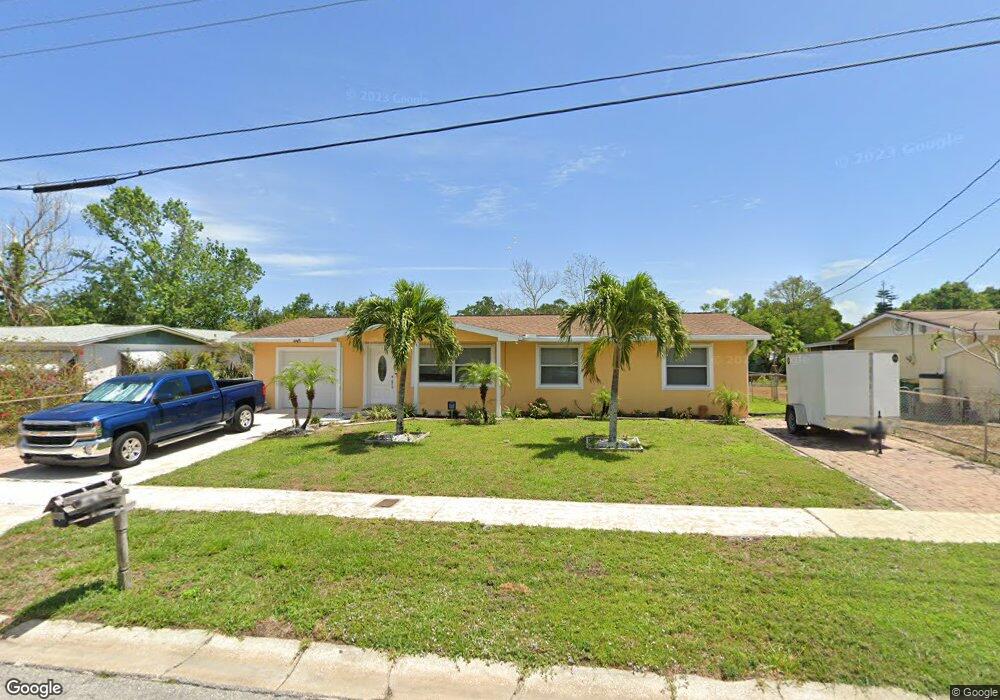
470 West Rd Merritt Island, FL 32952
Estimated Value: $305,062 - $342,000
3
Beds
1
Bath
1,534
Sq Ft
$214/Sq Ft
Est. Value
About This Home
This home is located at 470 West Rd, Merritt Island, FL 32952 and is currently estimated at $328,516, approximately $214 per square foot. 470 West Rd is a home located in Brevard County with nearby schools including Tropical Elementary School, Thomas Jefferson Middle School, and Merritt Island High School.
Ownership History
Date
Name
Owned For
Owner Type
Purchase Details
Closed on
Jan 22, 2024
Sold by
Zawadzki Maria V
Bought by
Zawadzki Maria V
Current Estimated Value
Purchase Details
Closed on
Nov 18, 1993
Sold by
Williams Michael E
Bought by
Zawadzki Stephan J
Home Financials for this Owner
Home Financials are based on the most recent Mortgage that was taken out on this home.
Original Mortgage
$74,460
Interest Rate
6.95%
Purchase Details
Closed on
Oct 7, 1993
Sold by
Williams Richard A
Bought by
Williams Michael A
Home Financials for this Owner
Home Financials are based on the most recent Mortgage that was taken out on this home.
Original Mortgage
$74,460
Interest Rate
6.95%
Purchase Details
Closed on
Jul 9, 1993
Sold by
Williams Michael E
Bought by
Williams Michael E and Williams Richard A
Create a Home Valuation Report for This Property
The Home Valuation Report is an in-depth analysis detailing your home's value as well as a comparison with similar homes in the area
Home Values in the Area
Average Home Value in this Area
Purchase History
| Date | Buyer | Sale Price | Title Company |
|---|---|---|---|
| Zawadzki Maria V | $100 | None Listed On Document | |
| Zawadzki Stephan J | $36,500 | -- | |
| Williams Michael A | $36,500 | -- | |
| Williams Michael E | -- | -- |
Source: Public Records
Mortgage History
| Date | Status | Borrower | Loan Amount |
|---|---|---|---|
| Previous Owner | Zawadzki Stephan J | $74,460 |
Source: Public Records
Tax History Compared to Growth
Tax History
| Year | Tax Paid | Tax Assessment Tax Assessment Total Assessment is a certain percentage of the fair market value that is determined by local assessors to be the total taxable value of land and additions on the property. | Land | Improvement |
|---|---|---|---|---|
| 2025 | $1,032 | $77,830 | -- | -- |
| 2024 | $987 | $75,640 | -- | -- |
| 2023 | $987 | $70,420 | $0 | $0 |
| 2022 | $983 | $68,370 | $0 | $0 |
| 2021 | $996 | $66,380 | $0 | $0 |
| 2020 | $938 | $65,470 | $0 | $0 |
| 2019 | $884 | $64,000 | $0 | $0 |
| 2018 | $883 | $62,810 | $0 | $0 |
| 2017 | $880 | $61,520 | $0 | $0 |
| 2016 | $887 | $60,260 | $18,000 | $42,260 |
| 2015 | $894 | $59,850 | $18,000 | $41,850 |
| 2014 | $899 | $59,380 | $25,000 | $34,380 |
Source: Public Records
Map
Nearby Homes
- 95 Peck Ave
- 476 Nancie Ave
- 3190 S Courtenay Pkwy
- 115 Carib Dr
- 489 Kennwood Ave
- 327 S Tropical Trail
- 270 W Lauren Ct
- 220 Bel Aire Dr S
- 225 S Tropical Trail Unit 423
- 225 S Tropical Trail Unit 414
- 225 S Tropical Trail Unit 607
- 90 S Tropical Way
- 280 Andros Dr
- 66 Moore Ave
- 230 Andros Dr
- 140 Brandy Ln
- 185 Moore Ave
- 420 Moore Park Ln Unit 203
- 180 Brandy Ln
- 0 N Courtenay Pkwy Unit 866583
- 480 West Rd
- 460 West Rd
- 65 Peck Ave
- 490 West Rd
- 485 West Rd
- 465 Allen Dr
- 455 Allen Dr
- 500 Hamilton Cir
- 475 Allen Dr
- 495 Allen Dr
- 435 Allen Dr
- 92 Hamilton Dr Unit BACK
- 90 Hamilton Dr Unit B
- 90 Hamilton Dr Unit A
- 92 Hamilton Dr
- 92 Hamilton Dr
- 88 Hamilton Dr
- 65 Hamilton Dr
- 65 Hamilton Dr Unit 65 & 67
- 440 Deb Ln