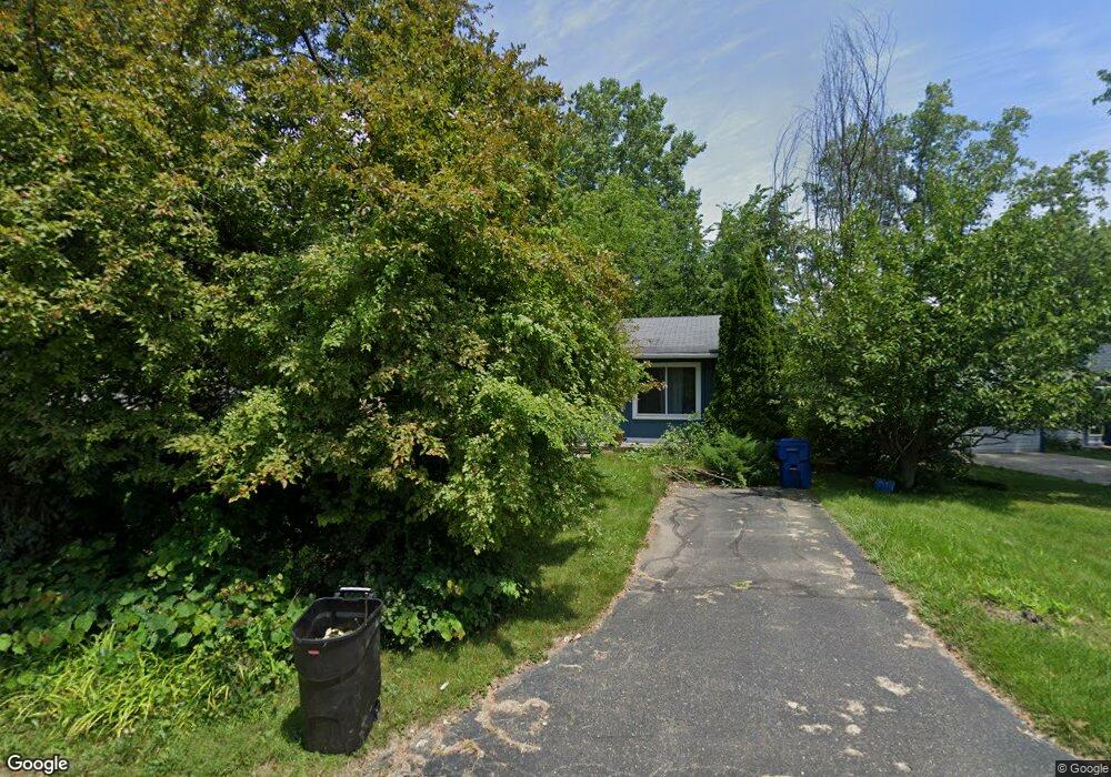
4700 Charest Ave Waterford, MI 48327
Waterford Township NeighborhoodEstimated Value: $232,633 - $266,000
3
Beds
1
Bath
954
Sq Ft
$260/Sq Ft
Est. Value
About This Home
This home is located at 4700 Charest Ave, Waterford, MI 48327 and is currently estimated at $248,158, approximately $260 per square foot. 4700 Charest Ave is a home located in Oakland County with nearby schools including Haviland Elementary School, Pierce Middle School, and Waterford Mott High School.
Ownership History
Date
Name
Owned For
Owner Type
Purchase Details
Closed on
Nov 14, 2005
Sold by
Delcore Michele P and Delcore Michael P
Bought by
Delcore Michele P
Current Estimated Value
Home Financials for this Owner
Home Financials are based on the most recent Mortgage that was taken out on this home.
Original Mortgage
$137,500
Outstanding Balance
$64,511
Interest Rate
3.75%
Mortgage Type
Adjustable Rate Mortgage/ARM
Estimated Equity
$183,647
Purchase Details
Closed on
Feb 27, 2003
Sold by
Weir Jack E and Cupp Weir Janet
Bought by
Delcore Michael P
Purchase Details
Closed on
May 8, 2001
Sold by
Mckenney Steve
Bought by
Firstar Bank Milwaukee
Purchase Details
Closed on
Jul 8, 1996
Sold by
Mckenney Steve
Bought by
Mckenney Steve
Create a Home Valuation Report for This Property
The Home Valuation Report is an in-depth analysis detailing your home's value as well as a comparison with similar homes in the area
Home Values in the Area
Average Home Value in this Area
Purchase History
| Date | Buyer | Sale Price | Title Company |
|---|---|---|---|
| Delcore Michele P | -- | None Available | |
| Delcore Michael P | $137,500 | Metropolitan Title Company | |
| Firstar Bank Milwaukee | $109,307 | -- | |
| Mckenney Steve | -- | -- |
Source: Public Records
Mortgage History
| Date | Status | Borrower | Loan Amount |
|---|---|---|---|
| Open | Delcore Michele P | $137,500 |
Source: Public Records
Tax History Compared to Growth
Tax History
| Year | Tax Paid | Tax Assessment Tax Assessment Total Assessment is a certain percentage of the fair market value that is determined by local assessors to be the total taxable value of land and additions on the property. | Land | Improvement |
|---|---|---|---|---|
| 2024 | $1,280 | $87,520 | $0 | $0 |
| 2023 | $1,221 | $84,220 | $0 | $0 |
| 2022 | $1,968 | $79,600 | $0 | $0 |
| 2021 | $1,863 | $77,510 | $0 | $0 |
| 2020 | $1,118 | $77,070 | $0 | $0 |
| 2019 | $1,817 | $67,760 | $0 | $0 |
| 2018 | $2,274 | $67,670 | $0 | $0 |
| 2017 | $2,113 | $67,670 | $0 | $0 |
| 2016 | $1,656 | $59,070 | $0 | $0 |
| 2015 | -- | $54,130 | $0 | $0 |
| 2014 | -- | $50,480 | $0 | $0 |
| 2011 | -- | $46,570 | $0 | $0 |
Source: Public Records
Map
Nearby Homes
- 1020 Charest Ave
- 4910 Chipman Dr
- 1036 Pelham Blvd
- 4616 Cass Elizabeth Rd
- 1029 Monica Place
- 00000 Muskingum
- 1522 Oregon Ct
- 4390 Cass Elizabeth Rd
- 5171 Durnham Dr
- 941 Shoshone Cir
- 1062 Forest Bay Dr
- 1079 Forest Bay Dr
- 1080 Forest Bay Ct Unit 114
- 1677 Parkview Ave
- 4275 Forest Valley Ct
- 4433 Motorway Dr
- 1385 Mill Creek Dr Unit 29
- 4405 Motorway Dr
- 549 Grixdale Ln
- 4080 Cass Elizabeth Rd
- 4692 Charest Ave
- 4708 Charest Ave
- 4686 Charest Ave
- 4681 Chipman Dr
- 4720 Charest Dr
- 4720 Charest Ave Unit Bldg-Unit
- 4720 Charest Ave
- 4693 Charest Ave
- 4699 Charest Ave
- 4703 Charest Ave
- 4685 Charest Ave
- 4671 Chipman Dr
- 4707 Charest Ave
- 4717 Charest Ave
- 4711 Charest Ave
- 4700 Chipman Dr
- 0 Charest Unit 217098282
- 0 Charest Unit R219100568
- 4721 Charest Ave
- 4694 Chipman Dr