S
Seller's Agent in 2013
Sandy Dotson
Brinkoetter REALTORS®
(217) 875-0555
334 Total Sales

Estimated Value: $183,000 - $217,000
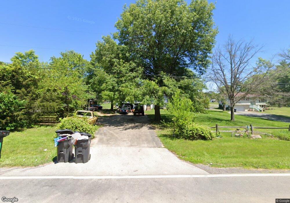
Amazing 1 acre lot lot is gorgeous! Mt. Zion Schools and close to shopping and restaurants. Super sharp bi-level with spacious master, and 3 updated baths. New carpet in family room 11, roof and furnace new in 08, windows new in 07... Updated countertops in kitchen plus a built in snack bar offers sitting for 4 or more... Arched doorway into dining area and game room. Very well maintained.
Last Agent to Sell the Property
Brinkoetter REALTORS® License #471002829 Listed on: 04/24/2013
| Date | Buyer | Sale Price | Title Company |
|---|---|---|---|
| Neill Craig O | $130,000 | None Available | |
| Drew Dennis Richard | $67,500 | -- | |
| Us Bank Na | -- | -- | |
| Fletcher Joseph K | $143,000 | None Available |
| Date | Status | Borrower | Loan Amount |
|---|---|---|---|
| Open | Neill Craig O | $127,546 | |
| Previous Owner | Fletcher Joseph K | $137,995 |
| Date | Event | Price | List to Sale | Price per Sq Ft |
|---|---|---|---|---|
| 06/28/2013 06/28/13 | Sold | $143,000 | -10.6% | $76 / Sq Ft |
| 05/09/2013 05/09/13 | Pending | -- | -- | -- |
| 04/24/2013 04/24/13 | For Sale | $159,900 | -- | $85 / Sq Ft |
| Year | Tax Paid | Tax Assessment Tax Assessment Total Assessment is a certain percentage of the fair market value that is determined by local assessors to be the total taxable value of land and additions on the property. | Land | Improvement |
|---|---|---|---|---|
| 2024 | $2,649 | $48,125 | $8,976 | $39,149 |
| 2023 | $2,555 | $44,717 | $8,340 | $36,377 |
| 2022 | $2,387 | $42,044 | $7,841 | $34,203 |
| 2021 | $2,306 | $39,860 | $7,434 | $32,426 |
| 2020 | $2,206 | $38,095 | $7,105 | $30,990 |
| 2019 | $2,206 | $38,095 | $7,105 | $30,990 |
| 2018 | $2,147 | $37,260 | $6,949 | $30,311 |
| 2017 | $2,136 | $36,800 | $6,863 | $29,937 |
| 2016 | $2,135 | $36,778 | $6,859 | $29,919 |
| 2015 | $2,062 | $36,306 | $6,771 | $29,535 |
| 2014 | $2,002 | $36,306 | $6,771 | $29,535 |
| 2013 | $1,594 | $36,306 | $6,771 | $29,535 |
S
Seller's Agent in 2013
Sandy Dotson
Brinkoetter REALTORS®
(217) 875-0555
334 Total Sales

Buyer's Agent in 2013
Linda Neisslie
Brinkoetter REALTORS®
19 Total Sales
Source: Central Illinois Board of REALTORS®
MLS Number: 5191146
APN: 09-13-29-477-014
Ask me questions while you tour the home.