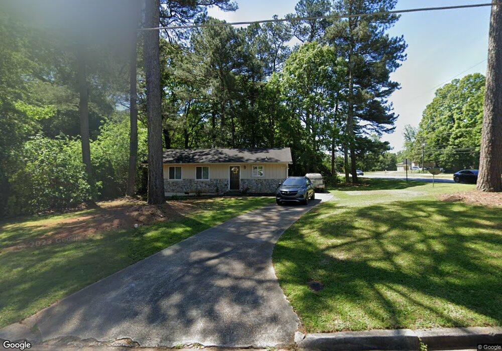
4701 Lost Colony Ct Unit 1 Stone Mountain, GA 30088
Estimated Value: $172,000 - $228,000
3
Beds
2
Baths
1,120
Sq Ft
$172/Sq Ft
Est. Value
About This Home
This home is located at 4701 Lost Colony Ct Unit 1, Stone Mountain, GA 30088 and is currently estimated at $192,955, approximately $172 per square foot. 4701 Lost Colony Ct Unit 1 is a home located in DeKalb County with nearby schools including Woodridge Elementary School, Miller Grove Middle School, and Miller Grove High School.
Ownership History
Date
Name
Owned For
Owner Type
Purchase Details
Closed on
Aug 8, 2018
Sold by
Rha 1 Llc
Bought by
Fyr Sfr Borrower Llc
Current Estimated Value
Purchase Details
Closed on
Mar 20, 2015
Sold by
Oise Esther Nneka
Bought by
Rha 1 Llc
Purchase Details
Closed on
Sep 2, 2009
Sold by
Hud-Housing Of Urban Dev
Bought by
Oise Esther N
Purchase Details
Closed on
Feb 5, 2009
Sold by
Bank Of America Na
Bought by
Hud-Housing Of Urban Dev
Purchase Details
Closed on
Feb 5, 2008
Sold by
Body Gwendolyn G
Bought by
Bank Of America Na
Purchase Details
Closed on
Sep 30, 1994
Sold by
Mchugh Charles T Vicky
Bought by
Body Gwendolyn G
Home Financials for this Owner
Home Financials are based on the most recent Mortgage that was taken out on this home.
Original Mortgage
$58,200
Interest Rate
8.53%
Mortgage Type
FHA
Create a Home Valuation Report for This Property
The Home Valuation Report is an in-depth analysis detailing your home's value as well as a comparison with similar homes in the area
Home Values in the Area
Average Home Value in this Area
Purchase History
| Date | Buyer | Sale Price | Title Company |
|---|---|---|---|
| Fyr Sfr Borrower Llc | $93,376 | -- | |
| Rha 1 Llc | $51,000 | -- | |
| Oise Esther N | -- | -- | |
| Hud-Housing Of Urban Dev | -- | -- | |
| Bank Of America Na | $79,617 | -- | |
| Body Gwendolyn G | $58,900 | -- |
Source: Public Records
Mortgage History
| Date | Status | Borrower | Loan Amount |
|---|---|---|---|
| Previous Owner | Body Gwendolyn G | $58,200 |
Source: Public Records
Tax History Compared to Growth
Tax History
| Year | Tax Paid | Tax Assessment Tax Assessment Total Assessment is a certain percentage of the fair market value that is determined by local assessors to be the total taxable value of land and additions on the property. | Land | Improvement |
|---|---|---|---|---|
| 2025 | $3,814 | $76,560 | $10,800 | $65,760 |
| 2024 | $3,579 | $71,280 | $9,000 | $62,280 |
| 2023 | $3,579 | $71,240 | $12,600 | $58,640 |
| 2022 | $2,788 | $55,440 | $7,200 | $48,240 |
| 2021 | $1,779 | $32,440 | $2,600 | $29,840 |
| 2020 | $1,596 | $28,280 | $2,600 | $25,680 |
| 2019 | $1,728 | $31,280 | $2,600 | $28,680 |
| 2018 | $1,355 | $24,440 | $2,600 | $21,840 |
| 2017 | $1,290 | $21,200 | $2,600 | $18,600 |
| 2016 | $1,260 | $20,480 | $2,600 | $17,880 |
| 2014 | $995 | $14,120 | $2,600 | $11,520 |
Source: Public Records
Map
Nearby Homes
- 4640 Elm Ridge Ct
- 1512 S Hairston Rd
- 1513 Spruce Ridge Way
- 1491 S Hairston Rd
- 4734 White Oak Trail
- 4564 Cypress Ridge Ct Unit 4
- 4605 Mercer Rd
- 1690 Briarbend Ct
- 4909 Woodhurst Way
- 4831 Oak Path
- 4550 Cypress Ridge Ct
- 4854 Terrace Green Trace Unit 11D
- 1439 Walnut Ridge Way Unit 2
- 4641 Wendover Dr Unit 1
- 4504 Cedar Ridge Trail
- 4448 Cedar Ridge Trail
- 4442 Cedar Ridge Trail
- 1406 Crooked Tree Cir
- 1764 Big Valley Way Unit 3
- 4938 Terrace Green Trace
- 4701 Lost Colony Ct
- 4701 Lost Colony Ct
- 4709 Lost Colony Ct
- 4717 Lost Colony Ct
- 1618 S Hairston Rd
- 1584 S Hairston Rd
- 1607 S Hairston Rd
- 4725 Lost Colony Ct
- 1601 S Hairston Rd
- 4722 Lost Colony Ct
- 4714 Lost Colony Ct
- 1617 S Hairston Rd
- 1634 S Hairston Rd
- 1635 S Hairston Rd
- 4701 Birch Ridge Trail
- 4733 Lost Colony Ct Unit 4733
- 4733 Lost Colony Ct
- 1560 Spruce Ridge Ct
- 1574 S Hairston Rd
- 4730 Lost Colony Ct