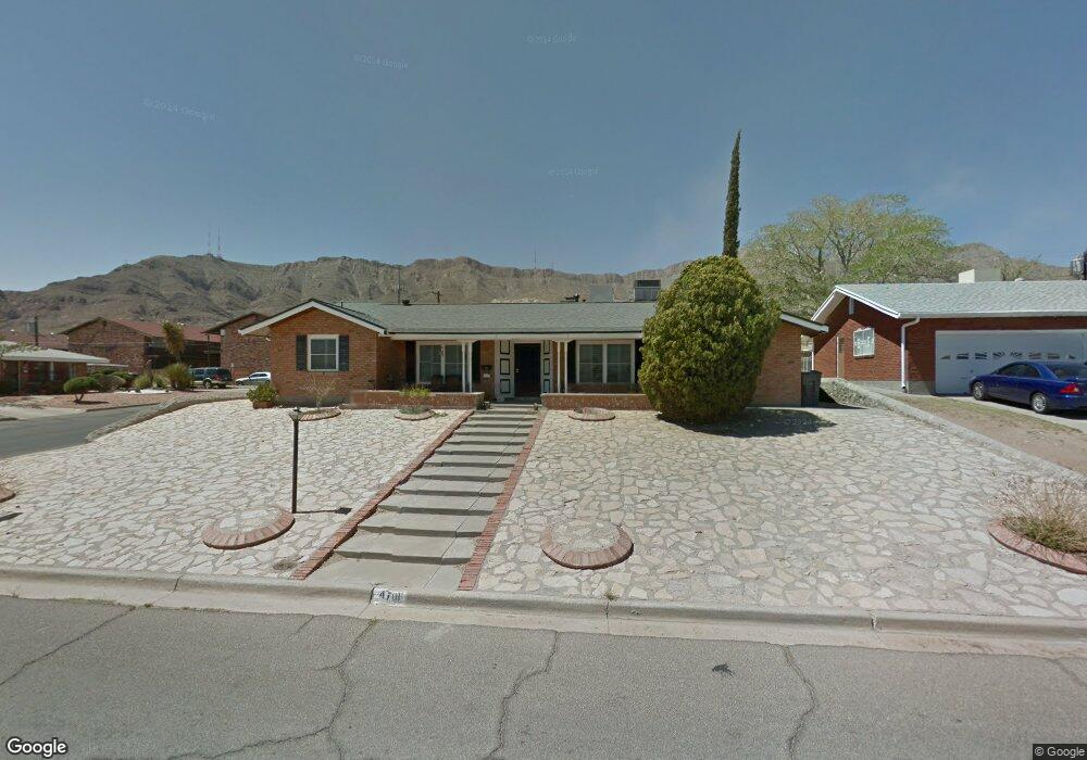
4701 Louisiana St El Paso, TX 79930
Central NeighborhoodEstimated Value: $240,000 - $300,000
3
Beds
2
Baths
2,223
Sq Ft
$125/Sq Ft
Est. Value
About This Home
This home is located at 4701 Louisiana St, El Paso, TX 79930 and is currently estimated at $277,406, approximately $124 per square foot. 4701 Louisiana St is a home located in El Paso County with nearby schools including Clendenin Elementary School, Middle School-5 NW Middle, and Austin High School.
Ownership History
Date
Name
Owned For
Owner Type
Purchase Details
Closed on
Mar 14, 2024
Sold by
Hammack Cynthia L
Bought by
Piedra Francisco Cesar
Current Estimated Value
Purchase Details
Closed on
Jul 16, 2003
Sold by
Gutsch Frank L and Gutsch Gertrude C
Bought by
Hammack Cynthia
Home Financials for this Owner
Home Financials are based on the most recent Mortgage that was taken out on this home.
Original Mortgage
$95,400
Interest Rate
5.15%
Mortgage Type
Purchase Money Mortgage
Create a Home Valuation Report for This Property
The Home Valuation Report is an in-depth analysis detailing your home's value as well as a comparison with similar homes in the area
Home Values in the Area
Average Home Value in this Area
Purchase History
| Date | Buyer | Sale Price | Title Company |
|---|---|---|---|
| Piedra Francisco Cesar | -- | None Listed On Document | |
| Hammack Cynthia L | -- | None Listed On Document | |
| Hammack Cynthia | -- | -- |
Source: Public Records
Mortgage History
| Date | Status | Borrower | Loan Amount |
|---|---|---|---|
| Previous Owner | Hammack Cynthia | $95,400 |
Source: Public Records
Tax History Compared to Growth
Tax History
| Year | Tax Paid | Tax Assessment Tax Assessment Total Assessment is a certain percentage of the fair market value that is determined by local assessors to be the total taxable value of land and additions on the property. | Land | Improvement |
|---|---|---|---|---|
| 2025 | $2,851 | $230,711 | -- | -- |
| 2024 | $2,851 | $209,737 | -- | -- |
| 2023 | $2,789 | $190,670 | $0 | $0 |
| 2022 | $5,131 | $173,336 | $0 | $0 |
| 2021 | $4,920 | $173,930 | $29,151 | $144,779 |
| 2020 | $4,403 | $143,253 | $20,822 | $122,431 |
| 2018 | $4,494 | $151,833 | $20,822 | $131,011 |
| 2017 | $4,012 | $142,439 | $20,822 | $121,617 |
| 2016 | $4,012 | $142,439 | $20,822 | $121,617 |
| 2015 | $3,683 | $142,439 | $20,822 | $121,617 |
| 2014 | $3,683 | $143,470 | $20,822 | $122,648 |
Source: Public Records
Map
Nearby Homes
- 2704 Taylor Ave
- 2801 Polk Ave
- 3010 Pierce Ave
- 3904 N Piedras St Unit A-B
- 3021 Monroe Ave
- 3104 Van Buren Ave
- 3312 Polk Ave
- 3501 Taylor Ave
- 3501 Polk Ave
- 3413 Monroe Ave
- 3027 Morehead Ave
- 3031 Fort Blvd
- PN-258825 Tbd
- 3423 Wickham Ave
- 3808 Johnson Ave
- 3737 Fred Wilson Ave
- 3125 Hamilton Ave
- 3704 Mckinley Ave
- 2816 N Piedras St
- PN-391630 Alabama St
- 4705 Louisiana St
- 2608 Pierce Ave
- 2606 Pierce Ave
- 2614 Pierce Ave
- 4700 Louisiana St
- 2610 Pierce Ave
- 2610 Pierce Ave Unit a
- 2610 Pierce Ave Unit a&b
- 4715 Louisiana St
- 4704 Louisiana St
- 4600 Alabama St
- 2616 Pierce Ave Unit 2620
- 4708 Louisiana St
- 4801 Louisiana St
- 4800 Louisiana St
- 2615 Fillmore Ave
- 2615 Fillmore Ave
- 2700 Pierce Ave
- 2611 Fillmore Ave
- 0 Alabama St Unit 526212