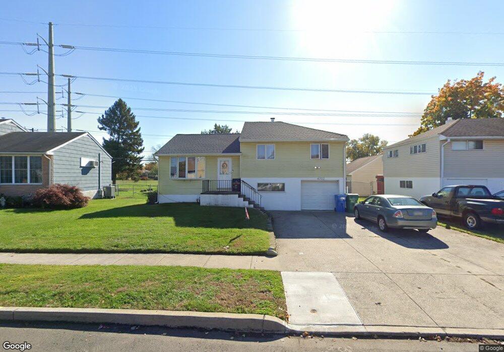
4702 Brookside Ave Bristol, PA 19007
Estimated Value: $324,000 - $378,617
3
Beds
2
Baths
1,047
Sq Ft
$332/Sq Ft
Est. Value
About This Home
This home is located at 4702 Brookside Ave, Bristol, PA 19007 and is currently estimated at $347,654, approximately $332 per square foot. 4702 Brookside Ave is a home located in Bucks County with nearby schools including Truman Senior High School, First Presbyterian Church School, and Isabet Academy.
Ownership History
Date
Name
Owned For
Owner Type
Purchase Details
Closed on
May 22, 2014
Sold by
Godwin Swatara and Godwin Andrew
Bought by
Godwin Andrew and Godwin Swatara
Current Estimated Value
Home Financials for this Owner
Home Financials are based on the most recent Mortgage that was taken out on this home.
Original Mortgage
$148,750
Outstanding Balance
$113,067
Interest Rate
4.26%
Mortgage Type
New Conventional
Estimated Equity
$234,587
Purchase Details
Closed on
Mar 31, 2005
Sold by
Ryan Edward F and Ryan Patricia Ann
Bought by
Felix Swatara and Godwin Andrew
Home Financials for this Owner
Home Financials are based on the most recent Mortgage that was taken out on this home.
Original Mortgage
$148,720
Interest Rate
5.78%
Mortgage Type
New Conventional
Create a Home Valuation Report for This Property
The Home Valuation Report is an in-depth analysis detailing your home's value as well as a comparison with similar homes in the area
Home Values in the Area
Average Home Value in this Area
Purchase History
| Date | Buyer | Sale Price | Title Company |
|---|---|---|---|
| Godwin Andrew | -- | Landguard Title Services Llc | |
| Felix Swatara | $185,900 | -- |
Source: Public Records
Mortgage History
| Date | Status | Borrower | Loan Amount |
|---|---|---|---|
| Open | Godwin Andrew | $148,750 | |
| Closed | Felix Swatara | $148,720 |
Source: Public Records
Tax History Compared to Growth
Tax History
| Year | Tax Paid | Tax Assessment Tax Assessment Total Assessment is a certain percentage of the fair market value that is determined by local assessors to be the total taxable value of land and additions on the property. | Land | Improvement |
|---|---|---|---|---|
| 2025 | $5,214 | $19,200 | $4,280 | $14,920 |
| 2024 | $5,214 | $19,200 | $4,280 | $14,920 |
| 2023 | $5,176 | $19,200 | $4,280 | $14,920 |
| 2022 | $5,176 | $19,200 | $4,280 | $14,920 |
| 2021 | $5,176 | $19,200 | $4,280 | $14,920 |
| 2020 | $5,176 | $19,200 | $4,280 | $14,920 |
| 2019 | $5,157 | $19,200 | $4,280 | $14,920 |
| 2018 | $5,074 | $19,200 | $4,280 | $14,920 |
| 2017 | $4,997 | $19,200 | $4,280 | $14,920 |
| 2016 | $4,997 | $19,200 | $4,280 | $14,920 |
| 2015 | $3,601 | $19,200 | $4,280 | $14,920 |
| 2014 | $3,601 | $19,200 | $4,280 | $14,920 |
Source: Public Records
Map
Nearby Homes
- 150 Naomi Ct Unit 811
- 3021 Bath Rd
- 246 Colette Ct
- 1515 Lakeland Ave
- 145 Mill Dr
- 23 Misty Pine Rd
- 185 Delhaas Cir
- 183 Delhaas Cir
- 187 Delhaas Cir
- 194 Delhaas Cir
- 186 Delhaas Cir
- 189 Delhaas Cir
- 192 Delhaas Cir
- 190 Delhaas Cir
- 184 Delhaas Cir
- 193 Delhaas Cir
- 188 Delhaas Cir
- 191 Delhaas Cir
- 5711 Mustang St
- 4510 Fayette Dr
- 4700 Brookside Ave
- 4704 Brookside Ave
- 4706 Brookside Ave
- 2500 Winton Dr
- 4618 Brookside Ave
- 4703 Brookside Ave
- 2501 Winton Dr
- 2502 Winton Dr
- 4708 Brookside Ave
- 2501 Laurel Dr
- 4616 Brookside Ave
- 4615 Brookside Ave
- 2503 Winton Dr
- 2504 Winton Dr
- 2503 Laurel Dr
- 4614 Brookside Ave
- 4710 Brookside Ave
- 4629 David Dr
- 4627 David Dr
- 4625 David Dr