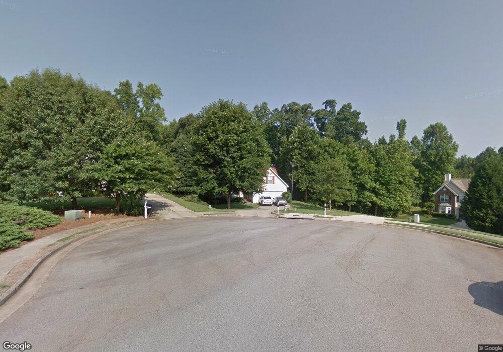
4702 Devencrest Ln Unit 1 Buford, GA 30519
Estimated Value: $360,000 - $386,821
3
Beds
2
Baths
1,685
Sq Ft
$220/Sq Ft
Est. Value
About This Home
This home is located at 4702 Devencrest Ln Unit 1, Buford, GA 30519 and is currently estimated at $371,205, approximately $220 per square foot. 4702 Devencrest Ln Unit 1 is a home located in Gwinnett County with nearby schools including Duncan Creek Elementary School, Frank N. Osborne Middle School, and Mill Creek High School.
Ownership History
Date
Name
Owned For
Owner Type
Purchase Details
Closed on
Aug 26, 2005
Sold by
Hooks Raymond
Bought by
Hooks Raymond and Hooks Melissa
Current Estimated Value
Purchase Details
Closed on
May 26, 2000
Sold by
Bowen Buildes Grp Inc
Bought by
Hooks Raymond
Home Financials for this Owner
Home Financials are based on the most recent Mortgage that was taken out on this home.
Original Mortgage
$133,050
Interest Rate
8.11%
Mortgage Type
FHA
Create a Home Valuation Report for This Property
The Home Valuation Report is an in-depth analysis detailing your home's value as well as a comparison with similar homes in the area
Home Values in the Area
Average Home Value in this Area
Purchase History
| Date | Buyer | Sale Price | Title Company |
|---|---|---|---|
| Hooks Raymond | -- | -- | |
| Hooks Raymond | $137,100 | -- |
Source: Public Records
Mortgage History
| Date | Status | Borrower | Loan Amount |
|---|---|---|---|
| Previous Owner | Hooks Raymond | $133,050 |
Source: Public Records
Tax History Compared to Growth
Tax History
| Year | Tax Paid | Tax Assessment Tax Assessment Total Assessment is a certain percentage of the fair market value that is determined by local assessors to be the total taxable value of land and additions on the property. | Land | Improvement |
|---|---|---|---|---|
| 2025 | $3,733 | $143,280 | $37,520 | $105,760 |
| 2024 | $4,095 | $153,840 | $30,560 | $123,280 |
| 2023 | $4,095 | $133,880 | $30,560 | $103,320 |
| 2022 | $3,379 | $120,960 | $28,160 | $92,800 |
| 2021 | $2,812 | $91,440 | $22,000 | $69,440 |
| 2020 | $2,703 | $85,480 | $20,160 | $65,320 |
| 2019 | $2,641 | $85,480 | $20,160 | $65,320 |
| 2018 | $2,439 | $76,160 | $20,160 | $56,000 |
| 2016 | $2,235 | $65,720 | $15,360 | $50,360 |
| 2015 | $2,047 | $56,240 | $13,360 | $42,880 |
| 2014 | -- | $56,240 | $13,360 | $42,880 |
Source: Public Records
Map
Nearby Homes
- 4693 Devencrest Ln
- 4642 Devencrest Ln Unit 1
- 5162 Morrell Rd
- 5213 Morrell Rd
- 5704 Miravista Way
- 5222 Morrell Rd
- 2264 Oak Falls Ln
- 5051 Adler Ct
- 5687 Villa Crest Dr
- 4850 Duncans Lake Dr
- 2424 Pinnae Place
- 2070 Cabela Dr
- 2732 Thompson Mill Rd
- 5378 Thompson Mill Rd
- 6096 Apple Grove Rd
- 5730 Nantucket Row
- 6071 Apple Grove Rd
- 5586 Apple Grove Rd
- 3088 Lantana Way
- 3138 Lantana Way
- 4692 Devencrest Ln
- 4692 Devencrest Ln
- 4682 Devencrest Ln Unit 83 A
- 4682 Devencrest Ln
- 4703 Devencrest Ln
- 4672 Devencrest Ln
- 5099 Weatherstone Dr
- 4673 Devencrest Ln
- 2185 Pemberton Point
- 5089 Weatherstone Dr
- 4652 Devencrest Ln
- 4663 Devencrest Ln
- 2475 Pemberton Point Unit 1
- 2470 Pemberton Point
- 5069 Weatherstone Dr
- 4653 Devencrest Ln
- 4653 Devencrest Ln
- 4653 Devencrest Ln
- 5086 Weatherstone Dr
- 2175 Pemberton Point Unit 1
