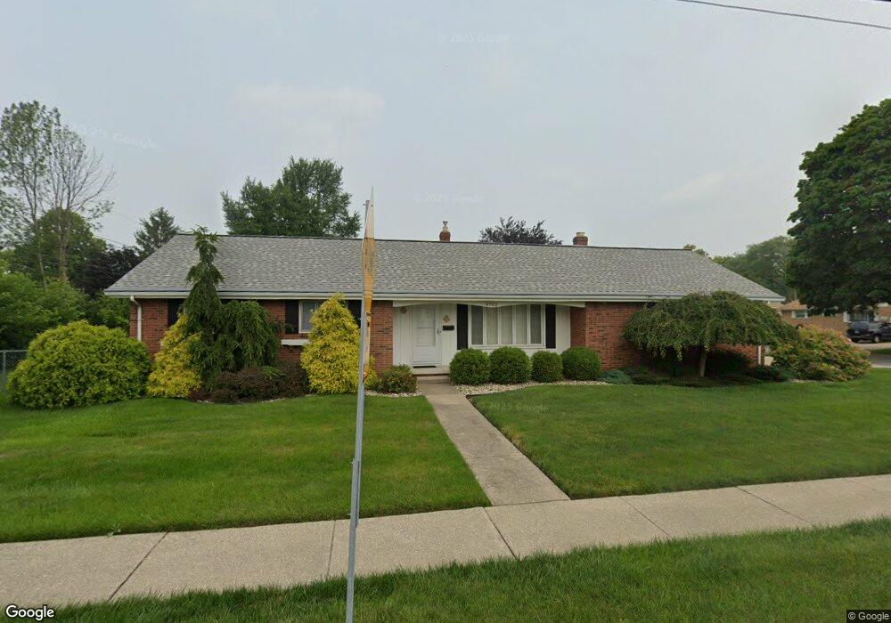
4702 Devonshire Rd Toledo, OH 43614
Beverly NeighborhoodEstimated Value: $147,000 - $210,000
3
Beds
2
Baths
1,479
Sq Ft
$124/Sq Ft
Est. Value
About This Home
This home is located at 4702 Devonshire Rd, Toledo, OH 43614 and is currently estimated at $183,930, approximately $124 per square foot. 4702 Devonshire Rd is a home located in Lucas County with nearby schools including Beverly Elementary School, Bowsher High School, and Our Lady of Perpetual Help School.
Ownership History
Date
Name
Owned For
Owner Type
Purchase Details
Closed on
Jun 28, 1999
Sold by
Thome David Paul and Thome Amy L
Bought by
Lambdin Bill and Evans Jeanne Marie
Current Estimated Value
Home Financials for this Owner
Home Financials are based on the most recent Mortgage that was taken out on this home.
Original Mortgage
$76,000
Outstanding Balance
$19,023
Interest Rate
7.15%
Estimated Equity
$164,907
Purchase Details
Closed on
Dec 22, 1994
Sold by
King Anna K
Bought by
Thome David P and Thome Amy L
Home Financials for this Owner
Home Financials are based on the most recent Mortgage that was taken out on this home.
Original Mortgage
$68,500
Interest Rate
6%
Mortgage Type
New Conventional
Purchase Details
Closed on
Apr 14, 1993
Sold by
Parker Jennifer J
Create a Home Valuation Report for This Property
The Home Valuation Report is an in-depth analysis detailing your home's value as well as a comparison with similar homes in the area
Home Values in the Area
Average Home Value in this Area
Purchase History
| Date | Buyer | Sale Price | Title Company |
|---|---|---|---|
| Lambdin Bill | $96,000 | -- | |
| Thome David P | $80,500 | -- | |
| -- | $61,000 | -- |
Source: Public Records
Mortgage History
| Date | Status | Borrower | Loan Amount |
|---|---|---|---|
| Open | Lambdin Bill | $76,000 | |
| Closed | Thome David P | $68,500 |
Source: Public Records
Tax History
| Year | Tax Paid | Tax Assessment Tax Assessment Total Assessment is a certain percentage of the fair market value that is determined by local assessors to be the total taxable value of land and additions on the property. | Land | Improvement |
|---|---|---|---|---|
| 2025 | -- | $47,110 | $10,255 | $36,855 |
| 2024 | $1,520 | $47,110 | $10,255 | $36,855 |
| 2023 | $2,965 | $44,205 | $9,450 | $34,755 |
| 2022 | $2,962 | $44,205 | $9,450 | $34,755 |
| 2021 | $3,014 | $44,205 | $9,450 | $34,755 |
| 2020 | $2,924 | $37,310 | $7,840 | $29,470 |
| 2019 | $2,835 | $37,310 | $7,840 | $29,470 |
| 2018 | $2,797 | $37,310 | $7,840 | $29,470 |
| 2017 | $2,754 | $34,265 | $7,945 | $26,320 |
| 2016 | $2,767 | $97,900 | $22,700 | $75,200 |
| 2015 | $2,745 | $97,900 | $22,700 | $75,200 |
| 2014 | $2,155 | $34,270 | $7,950 | $26,320 |
| 2013 | $2,155 | $34,270 | $7,950 | $26,320 |
Source: Public Records
Map
Nearby Homes
- 3047 March Dr
- 4347 S Detroit Ave
- 2630 7th St Unit B
- 4363 Beverly Dr
- 1047 Kirk St
- 4113 S Detroit Ave
- 2919 Lutaway Dr
- 737 Inwood Place
- 1054 Scott St
- 812 Loch Haven Blvd
- 1014 Hugo St
- 2944 Daleford Dr
- 2602 River Rd
- 2757 Medford Dr
- 1004 Birch Ave
- 327 River Bend Ln
- 329 River Bend Ln
- 115 Riverside Dr
- 659 Rd
- 99 N Masters Ct
- 3170 Escott Ave
- 3202 Escott Ave
- 3181 Astor Ave
- 3164 Escott Ave
- 3206 Escott Ave
- 4650 Devonshire Rd
- 3203 Astor Ave
- 3169 Escott Ave
- 3210 Escott Ave
- 3160 Escott Ave
- 3201 Escott Ave
- 3167 Astor Ave
- 3163 Escott Ave
- 3205 Escott Ave
- 3211 Astor Ave
- 3209 Escott Ave
- 3157 Escott Ave
- 3218 Escott Ave
- 3157 Astor Ave
- 3213 Escott Ave
Your Personal Tour Guide
Ask me questions while you tour the home.